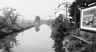
The Illinois and Michigan Canal connected the Great Lakes to the Mississippi River and the Gulf of Mexico. In Illinois, it ran 96 miles (154 km) from the Chicago River in Bridgeport, Chicago to the Illinois River at LaSalle-Peru. The canal crossed the Chicago Portage, and helped establish Chicago as the transportation hub of the United States, before the railroad era. It was opened in 1848. Its function was partially replaced by the wider and deeper Chicago Sanitary and Ship Canal in 1900, and it ceased transportation operations with the completion of the Illinois Waterway in 1933.
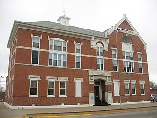
White County is a county located in the U.S. state of Illinois. According to the 2020 census, it had a population of 13,877. Its county seat is Carmi. It is located in the southern portion of Illinois known locally as "Little Egypt".
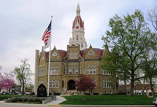
Pike County is a county in the U.S. state of Illinois. It is located between the Mississippi River and the Illinois River in western Illinois. According to the 2020 United States Census, it had a population of 14,739. Its county seat is Pittsfield.
Mason County is a county in the U.S. state of Illinois. According to the 2020 census, it had a population of 13,086. Its county seat is Havana. The county is named in honor of George Mason, a member of the Virginia legislature who campaigned for the adoption of the United States Bill of Rights.

Kane County is a county in the U.S. state of Illinois. According to the 2020 census, it has a population of 516,522, making it the fifth-most populous county in Illinois. Its county seat is Geneva, and its largest city is Aurora. Kane County is one of the collar counties of the metropolitan statistical area designated "Chicago–Naperville–Elgin, IL–IN–WI" by the US census.
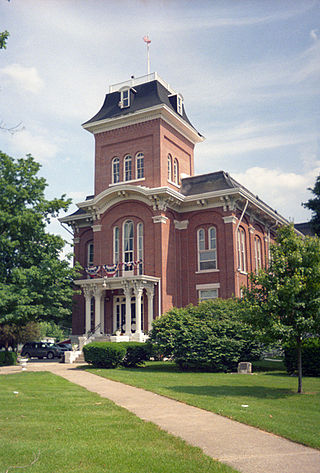
Iroquois County is a county located in the northeast part of the U.S. state of Illinois. According to the 2020 United States Census, it has a population of 27,077. It is the only county in the United States named Iroquois. The county seat is Watseka. The county is located along the border with Indiana.
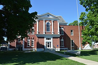
Cass County is a county located in the U.S. state of Illinois. As of the 2020 United States Census, the population was 13,042. Its county seat is Virginia. It is the home of the Jim Edgar Panther Creek State Fish and Wildlife Area.

Elgin is a city in Cook and Kane counties in the U.S. state of Illinois. It is located 35 mi (56 km) northwest of Chicago along the Fox River. As of the 2020 census, the city had a population of 114,797, making it the sixth-most populous city in the state.

Oswego is a village in Kendall and Will counties, Illinois, United States. Per the 2020 census, the population was 34,485. Oswego is the largest municipality in Kendall County. Part of the Chicago metropolitan area, it is an exurb of Chicago.

The Ozarks, also known as the Ozark Mountains, Ozark Highlands or Ozark Plateau, is a physiographic region in the U.S. states of Missouri, Arkansas, Oklahoma and the extreme southeastern corner of Kansas. The Ozarks cover a significant portion of northern Arkansas and most of the southern half of Missouri, extending from Interstate 40 in central Arkansas to Interstate 70 in central Missouri.

The Hopewell tradition, also called the Hopewell culture and Hopewellian exchange, describes a network of precontact Native American cultures that flourished in settlements along rivers in the northeastern and midwestern Eastern Woodlands from 100 BCE to 500 CE, in the Middle Woodland period. The Hopewell tradition was not a single culture or society but a widely dispersed set of populations connected by a common network of trade routes.

The Red Cedar River is a 51.1-mile-long (82.2 km) river in the U.S. state of Michigan. The river, which is a tributary of the Grand River in Michigan's Lower Peninsula, drains a watershed of approximately 461 square miles (1,190 km2) in the Lansing–East Lansing metropolitan area and suburban and rural areas to the east. The river flows through the campus of Michigan State University, and is considered a cultural symbol of the school, including being mentioned in the school's fight song.

The Illinois River is a tributary, about 56 miles (90 km) long, of the Rogue River in the U.S. state of Oregon. It drains part of the Klamath Mountains in northern California and southwestern Oregon. The river's main stem begins at the confluence of its east and west forks near Cave Junction in southern Josephine County. Its drainage basin includes Sucker Creek, which rises in the Red Buttes Wilderness, near Whiskey Peak on the California state line. The main stem flows generally northwest in a winding course past Kerby and through the Siskiyou National Forest and Kalmiopsis Wilderness. It joins the Rogue River from the south at Agness on the Curry–Josephine county line, 27 miles (43 km) from the Pacific Ocean.
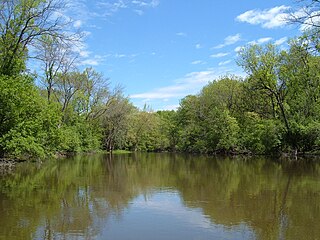
The Des Plaines River is a river that flows southward for 133 miles (214 km) through southern Wisconsin and northern Illinois in the United States Midwest, eventually meeting the Kankakee River west of Channahon to form the Illinois River, a tributary of the Mississippi River.
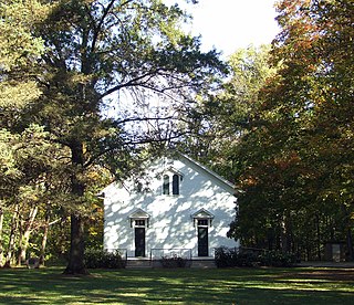
Funks Grove is a historic unincorporated community on U.S. Route 66 in McLean County, Illinois, United States, southwest of Bloomington. The grove for which the settlement is named, Funk's Grove, is a National Natural Landmark.
The 16th congressional district of Illinois is represented by Republican Darin LaHood. Prominent past representatives from the 16th district have included Everett Dirksen, who went on to become the Republican leader in the United States Senate; John B. Anderson, who became the 3rd highest ranking Republican in the House and went on to run as a major independent candidate in the 1980 Presidential election; and Lynn Martin, who later served as United States Secretary of Labor.
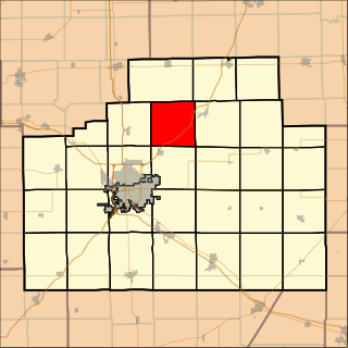
Money Creek Township is located in McLean County, Illinois. As of the 2010 census, its population was 1,085 and it contained 511 housing units.
The Steed-Kisker culture is a cultural phase that is part of the larger Central Plains Village tradition of the Plains Village period. This term applies to the prehistoric peoples who occupied the Great Plains region of the modern-day United States in prehistoric times.

Kankakee River State Park is an Illinois state park on 4,000 acres (1,619 ha) primarily in Kankakee and Will Counties, Illinois, United States. Originally, 35 acres (14 ha) of land was donated by Ethel Sturges Dummer for the creation of the state park in 1938. Another 1,715 acres (694 ha) was donated by Commonwealth Edison in 1956, which again donated more land in 1989. The islands of Smith, Hoffman, Langham, and Willow are all located inside the park on the Kankakee River.

Stillman Creek, also known during different eras as Mud Creek, Old Man's Creek, Sycamore Creek, and Stillman's Run, is part of the Rock River watershed, and located in Ogle County, Illinois, United States. The stream was named for Isaiah Stillman, who also lent his name to the village of Stillman Valley, Illinois, which lies along the creek.


