Chelan County is a county in the U.S. state of Washington. As of the 2020 census, its population was 79,074. The county seat and largest city is Wenatchee. The county was created out of Okanogan and Kittitas Counties on March 13, 1899. It derives its name from a Chelan Indian word meaning "deep water," likely a reference to 55-mile (89 km)-long Lake Chelan, which reaches a maximum depth of 1,486 feet (453 m).

Cashmere is a city in Chelan County, Washington, United States. It is part of the Wenatchee–East Wenatchee Metropolitan Statistical Area. The population was 3,248 at the 2020 census.

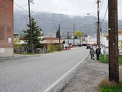
Chelan is a city in Chelan County, Washington, United States. The estimated population was 4,222 at the 2020 census. It lies on the southeast tip of Lake Chelan, where the lake flows into the Chelan River.

Sunnyslope is an unincorporated community and census-designated place (CDP) in Chelan County, Washington, United States. It is part of the Wenatchee–East Wenatchee Metropolitan Statistical Area. The population was 4,041 at the 2020 census, up from 3,252 at the 2010 census.

Wenatchee is the county seat and most populous city of Chelan County, Washington, United States. The population within the city limits in 2010 was 31,925, and has increased to 35,508 as of 2020. Located in the north-central part of the state, at the confluence of the Columbia and Wenatchee rivers near the eastern foothills of the Cascade Range, Wenatchee lies on the western side of the Columbia River, across from the city of East Wenatchee. The Columbia River forms the boundary between Chelan and Douglas County. Wenatchee is the principal city of the Wenatchee–East Wenatchee, Washington Metropolitan Statistical Area, which encompasses all of Chelan and Douglas counties. However, the "Wenatchee Valley Area" generally refers to the land between Rocky Reach and Rock Island Dam on both banks of the Columbia, which includes East Wenatchee, Rock Island, and Malaga, as well as the surrounding towns of Monitor and Cashmere to the west of Wenatchee.

The Wenatchee River is a river in the U.S. state of Washington, originating at Lake Wenatchee and flowing southeast for 53 miles (85 km), emptying into the Columbia River immediately north of Wenatchee, Washington. On its way it passes the towns of Plain, Leavenworth, Peshastin, Dryden, Cashmere, Monitor, and Wenatchee, all within Chelan County. The river attracts kayaking and river rafting enthusiasts and tourism.

The North Cascades are a section of the Cascade Range of western North America. They span the border between the Canadian province of British Columbia and the U.S. state of Washington and are officially named in the U.S. and Canada as the Cascade Mountains. The portion in Canada is known to Americans as the Canadian Cascades, a designation that also includes the mountains above the east bank of the Fraser Canyon as far north as the town of Lytton, at the confluence of the Thompson and Fraser Rivers.

U.S. Route 97 (US 97) is a major north–south route of the United States Numbered Highway System in the Pacific Northwest region. It runs for approximately 670 miles (1,078 km) through the states of California, Oregon, and Washington, primarily serving interior areas on the east side of the Cascade Mountains. The highway terminates to the south at a junction with Interstate 5 (I-5) in Weed, California, and to the north at the Canadian border near Osoyoos, British Columbia, where it becomes British Columbia Highway 97. Major cities on the US 97 corridor include Klamath Falls, Bend, and Redmond in Oregon; and Yakima, Ellensburg, and Wenatchee in Washington. A portion of the highway in California and Oregon is part of the Volcanic Legacy Scenic Byway.

Lake Chelan is a narrow, 50.5 mi (81.3 km) long lake in Chelan County, north-central Washington state, U.S. It is an overdeepened lake and resembles a fjord, with an average width of 1.3 mi (2.1 km). Near its upper end, the lake surface lies more than 6,600 ft (2,000 m) below peaks less than 3 mi (4.8 km) away. Before 1927, Lake Chelan was the largest natural lake in the state in terms of both surface area and water volume. Upon the completion of Lake Chelan Dam in 1927, the elevation of the lake was increased by 21 ft (6.4 m) to its present maximum-capacity elevation of 1,100 ft (340 m).
Stehekin is a small unincorporated community in Chelan County, Washington. The name "Stehekin" comes from a word in the Salishan language that means "the way through". Stehekin has somewhat more than 100 permanent residents, but vacationers and seasonal workers increase its population during the summer.
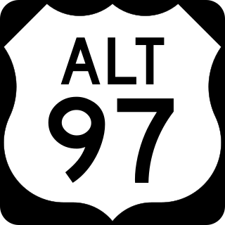
U.S. Route 97 Alternate is an alternate route of US 97 within the state of Washington. It runs for 40 miles (64 km) from Wenatchee to Chelan, following the west bank of the Columbia River opposite from US 2 and US 97. The highway travels through sparsely-populated areas along the river and passes near the Rocky Reach Dam and through the town of Entiat.
The Colville people, are a Native American people of the Pacific Northwest. The name Colville comes from association with Fort Colville, named after Andrew Colvile of the Hudson's Bay Company. Earlier, outsiders often called them Scheulpi, Chualpay, or Swhy-ayl-puh; the French traders called them Les Chaudières in reference to Kettle Falls. The neighboring Coeur d'Alene called them Sqhwiyi̱'ɫpmsh and the Spokane knew them as Sxʷyelpetkʷ. Their name in nselxcin, sx̌ʷýʔłpx, refers to "sharp pointed trees".
U.S. Route 97 in the U.S. state of Washington is a 322-mile (518 km) route which traverses from the Oregon state line at the northern end of the Sam Hill Memorial Bridge in Maryhill, north to the Canada–US border in Okanogan County near Oroville. The highway serves major cities such as Goldendale, Yakima, Ellensburg and Wenatchee before continuing towards the Alaska Highway at the Yukon border as British Columbia Highway 97. Along the length of the roadway, US 97 is concurrent with State Route 14 in Maryhill, Interstate 82 (I-82) and US 12 between Union Gap and Ellensburg, I-90 briefly in Ellensburg, US 2 between Peshastin and rural Douglas County and SR 20 near Omak. An alternate route connects the highway with Chelan.

Peshastin is a small unincorporated community in Chelan County, Washington, United States. The community's roots are found in the "Peshastin Ditch" dug by pioneers beginning in 1889. This ditch was an important part of the overall irrigation system in the area, delivering water to the orchards on the slopes above Cashmere. The town was first platted in the early 1890s by two brothers, J. Q. Gilbert and A. C. Gilbert. It is also noted on an 1895 map of the area, indicating it was in existence by then.
Dryden is a small unincorporated community in Chelan County, Washington, United States. It is situated along the Wenatchee River in the fertile Wenatchee Valley between the towns of Cashmere and Leavenworth. The community serves as a supply and shipping point for local farms and orchards.
Ardenvoir is an unincorporated community in Chelan County, Washington, United States. Ardenvoir is 9 miles (14 km) west-northwest of Entiat. Ardenvoir has a post office with ZIP code 98811.
Malaga is an unincorporated community in Chelan County, Washington, United States. Founded in 1903, Malaga is located on the Columbia River 6.5 miles (10.5 km) east-southeast of Wenatchee. Malaga has a post office with ZIP code 98828.
Merritt is an unincorporated community in Chelan County, Washington, United States. Merritt is on U.S. Route 2 in the upper valley area along Nason Creek in the Wenatchee National Forest, located 20 miles west of downtown Leavenworth. Merritt is assigned the ZIP code 98826. Steep slopes surround the community, rising to more than 8,000 feet in the Chiwaukum Mountains to the south.

Reynolds Peak is an 8,517-foot (2,596-metre) mountain summit located in the Methow Mountains, a sub-range of the North Cascades in Washington state. It is protected by the Lake Chelan-Sawtooth Wilderness within the Okanogan–Wenatchee National Forest. Reynolds Peak has a subsidiary peak, North Peak, which is .3 miles (0.48 km) north of the summit. The nearest higher neighbor is Oval Peak, 8.55 miles (13.76 km) to the southeast. Precipitation runoff on the east side of the mountain drains into the Twisp River via Reynolds Creek, whereas the west side of the mountain drains to the Stehekin River via Boulder Creek. Topographic relief is significant as the summit rises 3,500 feet above Reynolds Creek in approximately one mile.
Lake Augusta is a freshwater lake located on the southwest skirt of Big Jim Mountain, East of Icicle Ridge, in Chelan County, Washington. Because of its close proximity to Icicle Ridge Trail, the lake is a popular area for hiking, swimming, and fishing cutthroat trout. Smaller Lake Ida is a short distance on the opposite side of Icicle Ridge and Big Jim Mountain Lakes or on the northeast slope of the mountain. Lake Augusta is located approximately 15 miles west of the city of Leavenworth. Self-issued Alpine Lake Wilderness permit required for transit within the Lake Augusta area.