Monocacy, Maryland

Last updated
Monocacy, Maryland
Former Village
Map of Maryland highlighting Frederick County.svg
The former village of Monocacy was located near present-day Creagerstown in Frederick County, Maryland
CountryUnited States
State Maryland
County Frederick
First SettledBetween 1725–1730
Founded byGerman settlers

Monocacy was a village in Frederick County, Maryland that was located along an old Indian trail known as the Monocacy Trail that ran parallel to the Monocacy River. The trail was known as the Great Wagon Road by colonial travelers; it went to Philadelphia, Pennsylvania and later was renamed Monocacy Road. Early surviving historical records indicate that Monocacy was the oldest settlement in Western Maryland. The town is believed to have been located near present-day Creagerstown, but never has been precisely located after its complete abandonment in the early 19th century. There are signs of the town's existence going back as far as 1730. [1]

Contents

History

From the earliest historical records, Monocacy, Maryland is considered the oldest settlement in Western Maryland founded in the 1720s. [1] [2] [3] The town was settled near the Monocacy Trail, an old Indian trail that ran along the Monocacy River. [3]

According to some sources the name of Monocacy was not linked to a definitive town but to the settlement area of the Monocacy Valley where Moravian Germans coming from the colony of Pennsylvania had arrived. If Monocacy was referring to the valley of the same name, it encompassed the region of 18th century Frederick County, Maryland settlements, which included Frederick Town founded in 1745. [4]

The earliest Monocacy settlement that was recorded most likely existed between 1721 and 1732 and was composed of European-American traders from the colony of Maryland who ran a trading post and who co-existed with the local Native American tribes in Frederick County, Maryland. [5]

In 1729, German settlers arrived in what later became Frederick County in 1748 then a part of the British colonial Province of Maryland. The first settlement created by the settlers of the county was Monocacy, [3] which was founded between 1725 and 1730, [1] [2] making it the oldest settlement in Western Maryland. [3] The town was settled nearby the Monocacy Trail, an old Indian trail that ran along the Monocacy River. [3] In 1730, the Monocacy Trail was made into a wagon road. [2] In its early days, Monocacy was the main settlement within the region of early Frederick County. The early dominance of the town of Monocacy or the other Monocacy settlements in the Monocacy Valley eventually was overtaken by the later founding and rapid growth of Frederick Town, now present-day Frederick, Maryland. [3]

Other sources state that between 1732 and 1734, a church known as "the Log church" was built in what may have been the single town site of the early German settlement of Monocacy. [3] Moravian Church missionaries visited the area regularly, and many of the people of "Manakasy," referring to the Native American tribe as the Moravians spelled it in their records, often visited the Maryland Moravian Settlements from nearby Pennsylvania.

By the time the log church was built, the village of Monocacy was somewhat important to the area. The town had a number of taverns and other places to sleep. "As late as 1747, it possessed accommodations better than those of Frederick." [3] Sometime between 1760 and 1770, the nearby town of Creagerstown supplanted Monocacy because it was a better location for a town, being at the crossroads of a number of early Maryland roads, which gave easier access for stagecoach travelers and enabled town growth. [3] By 1808, Monocacy Road was macadamized creating a more reliable heavily traveled highway. [3]

Between 1732 and 1734, "the Log church" in Monocacy was built then a part of the British colonial Province of Maryland and was a regular destination for Moravian missionaries from the Province of Pennsylvania. It has been alleged by an 1896 account that Creagerstown, Maryland was built on the former site of the old log church. The Monocacy log church may have looked similar to this early structure in Pennsylvania. St. Severin's Old Log Church Apr 10.JPG
Between 1732 and 1734, "the Log church" in Monocacy was built then a part of the British colonial Province of Maryland and was a regular destination for Moravian missionaries from the Province of Pennsylvania. It has been alleged by an 1896 account that Creagerstown, Maryland was built on the former site of the old log church. The Monocacy log church may have looked similar to this early structure in Pennsylvania.
Creagerstown, Maryland was alleged according to an 1896 source to have been built on the former site of the old log church in Monocacy. Photo from 2016 2016-09-20 15 24 04 View north along Maryland State Route 550 (Creagerstown Road) between Old Frederick Road and Longs Mill Road in Creagerstown, Frederick County, Maryland.jpg
Creagerstown, Maryland was alleged according to an 1896 source to have been built on the former site of the old log church in Monocacy. Photo from 2016

Search for town site

As early as 1896, knowledge of the location of the town had been lost. In 1896, Rev. George A. Whitmore, a resident of Thurmont, wrote upon interviewing two residents of Creagerstown who were in "bordering on 80 years" about the location of the Log Church, he had been told that Creagerstown was built on the old location of the church. Whitmore mentions that one of the people he interviewed, Mr. W.L. Grimes Sr., actually helped tear down the Log church so that the new church could be built in its place.

Whitmore goes on to say that traditional lore states though that the town of Monocacy was located to the southeast of Creagerstown, at the intersection of Monocacy Road and Poe's Ford, near by Hunting Creek. Both Whitmore and his contemporary Mr. Schultz investigated the site and found flat land with a few dwellings. In a history of Frederick County, Mr. Schultz is quoted as saying that the location to the southeast of Creagerstown "agrees in every particular with the data that we have heretofore been able to obtain and I therefore believe that the few old houses and the graveyard are all perhaps that remain of the ancient village of Monocacy." [3]

In the late 1960s, Charlotte Hearthly, then a senior in high school, mounted a search for the site. [6] Many locals believe that their land parcels were the site of Monocacy. [7] Much of the evidence for where Monocacy is located has been destroyed. Spencer Geasey speaks of a location where there was a school, a cemetery, and some other log buildings. He states that the area was developed and that a dig in this location would not prove useful. [7]

There is no doubt that the town existed. [7] In August 1756, George Washington mentions Monocacy in a letter. [2] Two different riding ministers both wrote about the log church at different times. They were riding trails about 10 miles north of Frederick. During the French and Indian War, the site was mentioned in the Maryland Gazette . [7] In 1729, a complaint was filed by a Mr. Carroll with the Pennsylvania government that referenced Monocacy. [3] The complaint was filed because the area was under dispute by Maryland and Pennsylvania. [2]

The town was located near Creagerstown and Jimtown. According to Paul Gordon, one expert has stated that the Sebastian Derr house may have been a church and might be the old site of Monocacy. [7]

The site of Monocacy never has been conclusively located. [6] There is a lot of evidence that the settlement existed, but not a enough tangible evidence as to where the town was actually located. [7]

In the media

In 1999, a documentary film about the region, titled Monocacy, chronicles the history and pre-history of the area and the town. The documentary was produced by Chris Haugh for GS Communications. [8]

See also

Related Research Articles

<span class="mw-page-title-main">Frederick, Maryland</span> City in Maryland, United States

Frederick is a city in and the county seat of Frederick County, Maryland, United States. It is part of the Washington–Baltimore combined statistical area. It is located at an important crossroads at the intersection of a major north–south Native American trail and east–west routes to the Chesapeake Bay, both at Baltimore and what became Washington, D.C. and across the Appalachian mountains to the Ohio River watershed. It is a part of the Washington-Arlington-Alexandria, DC-VA-MD-WV Metropolitan Statistical Area, which is part of a greater Washington-Baltimore-Arlington, DC-MD-VA-WV-PA Combined Statistical Area.

<span class="mw-page-title-main">Point of Rocks, Maryland</span> Census-designated place in Maryland, United States

Point of Rocks is an unincorporated community and census-designated place (CDP) in Frederick County, Maryland, United States. As of the 2010 census it had a population of 1,466. It is named for the striking rock formation on the adjacent Catoctin Mountain, which was formed by the Potomac River cutting through the ridge in a water gap, a typical formation in the Appalachian Mountains. The formation is not visible from the town and can only be seen from boats on the river, or from the southern bank of the river in Virginia.

<span class="mw-page-title-main">Monocacy River</span> River in Maryland, United States

The Monocacy River is a free-flowing left tributary to the Potomac River, which empties into the Atlantic Ocean via the Chesapeake Bay. The river is 58.5 miles (94.1 km) long, with a drainage area of about 970 square miles (2,500 km2). It is the largest Maryland tributary to the Potomac.

<span class="mw-page-title-main">Maryland Route 144</span> State highway in Maryland, US

Maryland Route 144 is a collection of state highways in the U.S. state of Maryland. These highways are sections of old alignment of U.S. Route 40 between Cumberland and Baltimore. Along with US 40 Scenic, US 40 Alternate, and a few sections of county-maintained highway, MD 144 is assigned to what was once the main highway between the two cities, connecting those endpoints with Hancock, Hagerstown, Frederick, New Market, Mount Airy, Ellicott City, and Catonsville. MD 144 has seven disjoint sections of mainline highway that pass through the Appalachian Mountains in Allegany and Washington counties and the rolling Piedmont of Frederick, Carroll, Howard, and Baltimore counties.

<span class="mw-page-title-main">Maryland Route 355</span> State highway in Montgomery and Frederick Counties, Maryland, United States

Maryland Route 355 (MD 355) is a 36.75-mile (59.14 km) north–south road in western central Maryland in the United States. The southern terminus of the route, Wisconsin Avenue, is located in the Bethesda CDP, at the Washington, D.C. border. It continues south into Washington, D.C. as Wisconsin Avenue NW. The northern terminus is just north of a bridge over Interstate 70 (I-70)/U.S. Route 40 (US 40) in the city of Frederick in Frederick County, where the road continues north as Market Street through Frederick towards MD 26.

<span class="mw-page-title-main">Maryland Route 28</span> State highway in Maryland, US

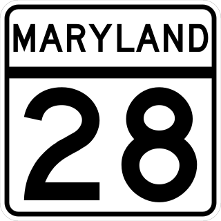
Maryland Route 28 is a state highway in the U.S. state of Maryland. The state highway runs 37.38 miles (60.16 km) from U.S. Route 15 in Point of Rocks east to MD 182 in Norwood. The western portion of MD 28 is a rural highway connecting several villages in southern Frederick County and western Montgomery County. By contrast, the eastern portion of the state highway is a major east–west commuter route, particularly within Gaithersburg and Rockville.

<span class="mw-page-title-main">Buckeystown, Maryland</span> Census-designated place in Maryland, United States

Buckeystown is an unincorporated community and census-designated place (CDP) in Frederick County, Maryland, United States. As of the 2010 census the population was 1,019. Buckeystown Historic District and Buckingham House and Industrial School Complex were listed on the National Register of Historic Places in 1982. Carrollton Manor was listed in 1997. Former Congressman Roscoe Bartlett lives on a farm in the town.

<span class="mw-page-title-main">Maryland Route 26</span> State highway in Maryland, US

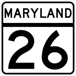
Maryland Route 26 is a state highway in the U.S. state of Maryland. Known for most of its length as Liberty Road, the state highway runs 44.10 miles (70.97 km) from U.S. Route 15 in Frederick east to MD 140 in Baltimore. MD 26 connects Frederick and Baltimore with the highway's namesake of Libertytown in eastern Frederick County, the suburban area of Eldersburg in southern Carroll County, and the western Baltimore County suburbs of Randallstown, Milford Mill, and Lochearn. The highway also serves as a major thoroughfare in the western part of Baltimore, where the street is named Liberty Heights Avenue. MD 26 is maintained by the Maryland State Highway Administration outside of Baltimore and by the Baltimore City Department of Transportation within the city.

<span class="mw-page-title-main">Maryland Route 194</span> State highway in Maryland, United States

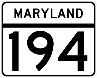
Maryland Route 194 (MD 194) is a state highway in the U.S. state of Maryland. The state highway runs 23.87 miles (38.42 km) from MD 26 in Ceresville north to the Pennsylvania state line near Taneytown, where the highway continues as Pennsylvania Route 194 (PA 194) toward Hanover. MD 194 is the main highway between Frederick and Hanover; the state highway connects the towns of Walkersville and Woodsboro in northeastern Frederick County with Keymar and Taneytown in northwestern Carroll County. MD 194 was blazed as a migration route in the 18th century and a pair of turnpikes in Frederick County in the 19th century, one of which was the last private toll road in Maryland. The state highway, which was originally designated MD 71, was built as a modern highway in Frederick County in the mid-1920s and constructed as Francis Scott Key Highway in Carroll County in the late 1920s and early 1930s. MD 194 received its modern route number in 1956 as part of a three-route number swap. The state highway's bypasses of Walkersville and Woodsboro opened in the early 1980s and mid-1990s, respectively.

<span class="mw-page-title-main">U.S. Route 15 in Maryland</span> Part of the U.S. Highway System that runs from Walterboro, South Carolina to Painted Post, New York

U.S. Route 15 (US 15) is a part of the U.S. Highway System that runs from Walterboro, South Carolina to Painted Post, New York. In Maryland, the highway runs 37.85 miles (60.91 km) from the Virginia state line at the Potomac River in Point of Rocks north to the Pennsylvania state line near Emmitsburg. Known for most of its length as Catoctin Mountain Highway, US 15 is the primary north–south highway of Frederick County. The highway connects the county seat of Frederick with Point of Rocks, Leesburg, Virginia, and Charles Town, West Virginia, to the south and with Thurmont, Emmitsburg, and Gettysburg, Pennsylvania, to the north. US 15 is a four-lane divided highway throughout the state except for the portion between the Point of Rocks Bridge and the highway's junction with US 340 near Jefferson. The highway is a freeway along its concurrency with US 340 and through Frederick, where the highway meets US 40 and Interstate 70 (I-70). US 15 has a business route through Emmitsburg.

<span class="mw-page-title-main">Maryland Route 77</span> State highway in Maryland, US

Maryland Route 77 is a state highway in the U.S. state of Maryland. The state highway runs 20.74 miles (33.38 km) from MD 64 in Smithsburg east to MD 194 in Keymar. MD 77 is the main east–west highway of northern Frederick County. The state highway connects Thurmont with eastern Washington County via Foxville, which lies between South Mountain and Catoctin Mountain near Catoctin Mountain Park and Cunningham Falls State Park. MD 77 links Thurmont with western Carroll County through the communities of Graceham, Rocky Ridge, and Detour in the Monocacy River valley. MD 77 was constructed from Thurmont east to Detour in the 1920s and early 1930s. A disjoint section of MD 77 was built between Cavetown and Foxville in the late 1930s. The portions of the modern highway between Foxville and Thurmont and from Detour to Keymar were county highways until they were designated part of MD 77 in 1956. MD 77's western terminus was moved east to MD 64 in Smithsburg in 1960.

<span class="mw-page-title-main">Graceham Moravian Church and Parsonage</span> Historic church in Maryland, United States

Graceham Moravian Church and Parsonage is a historic church building and parsonage located at 8231 Rocky Ridge Road, MD 77 in Graceham, east of Thurmont, Frederick County, Maryland. It is a two-story Flemish bond brick church built in 1822, and covered with white stucco because of deteriorated masonry. The church was built as an addition to the adjacent meeting house and parsonage built in 1797. This building and the church's cemetery having uniform flat gravestones represents Maryland's only remaining 18th century Moravian settlement.

<span class="mw-page-title-main">Creagerstown, Maryland</span> Unincorporated community in Maryland, United States

Creagerstown is an unincorporated community in Frederick County, Maryland, United States. It is playfully known by its residents as "4 miles from everywhere" because of its situation at 4 miles (6.4 km) from Thurmont, Woodsboro, Rocky Ridge, and Lewistown.

<span class="mw-page-title-main">Beallsville, Maryland</span> Community in Montgomery County, Maryland, United States

Beallsville is an unincorporated community in Montgomery County, Maryland, United States. It is a small community located north of Poolesville. The ZIP Code for Beallsville is 20839.

<span class="mw-page-title-main">Maryland Route 550</span>

Maryland Route 550 is a state highway in the U.S. state of Maryland. The state highway runs 24.43 miles (39.32 km) from MD 26 in Libertytown north to Pen Mar Road in Fort Ritchie. MD 550 runs southeast–northwest across central Frederick County, connecting Fort Ritchie in the northeastern corner of Washington County and Libertytown with the towns of Thurmont and Woodsboro and the smaller communities of Creagerstown and Sabillasville. South of the highway's junction with U.S. Route 15 in Thurmont, the state highway passes through the wide valley of the Monocacy River; to the north, the highway passes along the northern edge of Catoctin Mountain and crests South Mountain near Blue Ridge Summit, Pennsylvania.

<span class="mw-page-title-main">U.S. Route 40 Alternate (Hagerstown–Frederick, Maryland)</span> Highway in Washington and Frederick counties in Maryland

U.S. Route 40 Alternate (US 40 Alternate) is an alternate route of US 40 in the U.S. state of Maryland. The highway runs 22.97 miles (36.97 km) from Potomac Street in Hagerstown east to US 40 in Frederick. US 40 Alternate parallels US 40 and much of Interstate 70 (I-70) to the south through eastern Washington County and western Frederick County. The alternate route connects Hagerstown and Frederick with Funkstown, Boonsboro, Middletown, and Braddock Heights. US 40 Alternate crosses two major north–south components of the Blue Ridge Mountains that separate the Great Appalachian Valley and the Piedmont: South Mountain between Boonsboro and Middletown and Catoctin Mountain, which is locally known as Braddock Mountain, at Braddock Heights.

<span class="mw-page-title-main">Broad Run, Maryland</span> Unincorporated community in Maryland, United States

Broad Run is an unincorporated community in Frederick County, Maryland, United States. Broad Run is located on Maryland Route 383, 4.5 miles (7.2 km) southeast of Middletown.

<span class="mw-page-title-main">Frederick and Pennsylvania Line Railroad Company</span> U.S. railroad

The Frederick and Pennsylvania Line railroad ran from Frederick, Maryland to the Pennsylvania-Maryland State line, or Mason–Dixon line near Kingsdale, Pennsylvania consisting of 28 miles (45.1 km) of center-line track and 29.93 miles (48.17 km) of total track including sidings. Chartered in 1867, the railroad started construction in 1869 and cost $868,687.50.

References

  1. 1 2 3 O'Donoghue, compiled by Louis B. (2008). Gazetteer of old, odd & obscure : place names of Frederick County, Maryland. Frederick, Md.: Historical Society of Frederick County. ISBN   978-0-9714376-6-1.
  2. 1 2 3 4 5 Seibel Jr., Fred R. (23 October 1932). "A Ghost Town of Western Maryland". The Baltimore Sun.
  3. 1 2 3 4 5 6 7 8 9 10 11 12 Williams, T.J.C.; McKinsey, Folger (1979). History of Frederick County, Maryland (Repr. of the orig. ed. of [Frederick, Md.] 1910. ed.). Baltimore: Regional Pub. Co. ISBN   0-8063-7973-1.
  4. Rice, Millard Milburn (1976). New Facts and Old Families: From the Records of Frederick County, Maryland. Baltimore, MD: Genealogical Publishing Company. p. 173. ISBN   9780806310763.
  5. Maryland Historical Magazine. Baltimore, MD: Maryland Historical Society. 1920. p. 366. monocacy md never existed.
  6. 1 2 "Searching for a lost town". Baltimore Sun Magazine. 25 May 1969.
  7. 1 2 3 4 5 6 Gordon, Paul (13 April 1998). "The archaeological needle". Frederick Gazette.
  8. Wilson, Ike (27 March 1999). "'Monocacy' film premieres Sunday". The Frederick News Post.