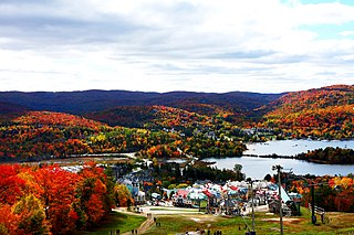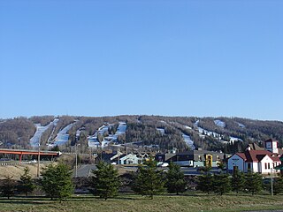
The Laurentian Mountains, also known as the Laurentians or Laurentides, are a mountain range in Canada. The range is 1,448 km long and ranges in height from 500 m with peaks over 1,000 m. The Laurentian Mountains extend across Labrador and Quebec within the Laurentian Upland, which contains foothills in northeastern Ontario. The range is located near the rivers of Ottawa, St. Lawrence, and Saguenay. The Laurentian Mountains primarily stretch across multiple regions in Quebec, with geologic formations such as the Jacques-Cartier Massif located within the range.

Lucile Wheeler is a former alpine ski racer from Canada. She was a double world champion in 1958, the first North American to win a world title in the downhill event.

Mont Tremblant Ski Resort is a year-round resort in the Laurentian Mountains of Quebec, Canada, located about 130 km (80 mi) northwest of Montreal. It is best known as a ski destination, but also features Lake Tremblant suitable for swimming and two golf courses in the summer months. The name of the mountain, Mont Tremblant, was derived from the Algonquin indigenous people, who called it the "trembling mountain." The summit is at an elevation of 875 m (2,871 ft), which makes it one of the tallest peaks in the Laurentians. One km north of the principal down hill area is the Edge, an area of glade skiing and 2.8 km (1.7 mi) north of that is the true summit, Pic Johanssen, which has a trail over the top and is Black Diamond for skiers and boarders. The resort is owned by Alterra Mountain Company.

The Laurentides is a region of Quebec. While it is often called the Laurentians in English, the region includes only part of the Laurentian mountains. It has a total land area of 20,779.19 km2 (8,022.89 sq mi) and its population was 589,400 inhabitants as of the 2016 Census.
Tremblant most commonly refers to:

Mont-Tremblant public transit is a small scale public transit system that services the resort town of Mont Tremblant in the Laurentian Mountains of Quebec, Canada, approximately 130 kilometres (81 mi) north of Montreal. Service requirements depend on the season and the routes and frequency of service will vary accordingly.

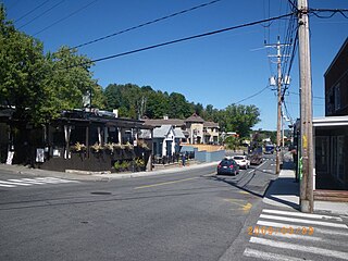
Mont-Tremblant is a city in the Laurentian Mountains of Quebec, Canada, approximately 130 kilometres (81 mi) northwest of Montreal and 140 kilometres (87 mi) northeast of Ottawa, Ontario. The current municipality with city status was formed in 2000. Mont-Tremblant is most famous for its ski resort, the Mont-Tremblant Ski Resort, which is seven kilometres from the village proper, at the foot of a mountain called Mont Tremblant.

Mount Orford is a mountain and ski resort located in the Mont-Orford National Park in the Estrie region of Quebec, Canada. It is 10 km (6 mi) northwest of the centre of the city of Magog.

Sainte-Adèle is a municipality in Quebec, Canada, and is part of the Les Pays-d'en-Haut Regional County Municipality. It lies on Route 117 about 70 kilometres (43 mi) north-west of Montreal. Its tourism-based economy centres on its skiing and hotel industry. Sainte-Adèle had a population of 12,137 as of 2011.

Sainte-Agathe-des-Monts is a town in the province of Quebec, Canada, in the regional county municipality of Les Laurentides in the administrative region of Laurentides, also known as the "Laurentians" or the Laurentian Mountains. Sainte-Agathe-des-Monts borders on a lake called Lac des Sables, and is located approximately 80 kilometres (50 mi) northwest of Montreal, and 130 kilometres (81 mi) northeast of Ottawa.

Mont Pourri (3,779 m) is a mountain in the Vanoise Massif in the Graian Alps. It is located in the Vanoise National Park, nearby Les Arcs ski resort.

Mont-Tremblant National Park is a provincial park in Canada located north of the town of Mont-Tremblant, and the village of Saint-Donat and Saint-Côme, in the administrative regions of Laurentides and Lanaudière, in Quebec, in Canada.

Sommet Saint-Sauveur , commonly Saint-Sauveur, is a ski mountain and resort located in Saint-Sauveur, Quebec, 45 minutes north of Montreal, Quebec, Canada, in the Laurentian mountains.
Gray Rocks was a year-round privately owned resort in the Laurentian Mountains of Quebec, Canada, first developed as a ski destination on Sugarloaf Hill. The ski hill had 22 downhill trails: four easy, ten intermediate, eight expert. Also available was a snowboarding park and instruction from the Snow Eagle Ski School.

Sommet Olympia is a ski school and resort in Quebec, Canada. The resort is located not far from Montreal, in the Laurentians. According to ski express magazine, Mont Olympia is "the best" ski mountain for beginners. The resort has 140 acres (0.57 km2) of skiable terrain with 6 ski lifts and a vertical drop of 200 meters.

Mont Blanc is a ski resort in the Laurentian Mountains and south of Mont-Tremblant, in Les Laurentides Regional County Municipality (MRC), in administrative region of Laurentides (region), in Quebec, Canada. It is located in the municipality of Mont-Blanc, just east of Mont Tremblant.

Mont-Sainte-Anne is a ski resort in eastern Canada, located in the town of Beaupré, Quebec, about 40 km (25 mi) northeast of Quebec City. The mountain is part of the Laurentian mountain chain and has a summit elevation of 800 m (2,625 ft) above sea level with a vertical drop of 625 m (2,051 ft).
Sommet Morin Heights is an all-year outdoor resort located in the Laurentians, more specifically in Morin Heights, Quebec. The resort, which is part of Mont Saint-Sauveur International, is equipped with the installations necessary to practice many types of activities, such as alpine skiing, cross country skiing, and snowboarding during the cold season, as well as mountain biking, zip lining, camping, and playing tennis during the warm season months.


