
Fayetteville is a town in and the county seat of Fayette County, West Virginia, United States. The population was 2,892 at the 2010 census.

The Iron Gates is a gorge on the river Danube. It forms part of the boundary between Serbia and Romania (north). In the broad sense it encompasses a route of 134 km (83 mi); in the narrow sense it only encompasses the last barrier on this route, just beyond the Romanian city of Orșova, that contains two hydroelectric dams, with two power stations, Iron Gate I Hydroelectric Power Station and Iron Gate II Hydroelectric Power Station.

The Šar Mountains or Sharr Mountains, form a mountain range in the Balkans that extends from Kosovo and the northwest of North Macedonia, to northeastern Albania. The mountain is colloquially called Šara and forms part of a national park in Kosovo. The section in Kosovo is a national park.

The Shire is the largest river in Malawi. The river has been known as the Shiré or Chire River. It is the only outlet of Lake Malawi and flows into the Zambezi River in Mozambique. Its length is 402 kilometres (250 mi). The upper Shire River issues from Lake Malawi and runs approximately 12 miles before it enters shallow Lake Malombe. It then drains Lake Malombe and flows south through Liwonde National Park where large concentrations of hippopotamus are common along its shores. Between the towns of Matope and Chikwawa, the middle river drops approximately 1,300 feet through a series of falls and gorges. Two hydroelectric dams have been built along the Shire northwest of Blantyre.

Charyn Canyon is a canyon on the Sharyn River in Kazakhstan. The canyon is roughly 90 kilometres (56 mi) in length. It is part of the Charyn National Park, and is located within the territory of the Uygur District, Raiymbek District and Enbekshikazakh District. Over time, the canyon has gained colorful formations of varying shapes and sizes. Though it is much smaller than the Grand Canyon, it has been described as being equally impressive.

Awash National Park is one of the national parks of Ethiopia. Spanning across the southern tip of the Afar Region and the northeastern corner of the Misraq Shewa Zone of Oromia, this park is 225 kilometers east of Addis Ababa, with its southern boundary along the Awash River, and covers 756 square kilometers of acacia woodland and grassland. The Addis Ababa - Dire Dawa highway passes through this park, separating the Illala Saha Plains to the south from the Kudu Valley to the north. In the south of the park the Awash River gorge has amazing waterfalls. In the upper Kudu Valley at Filwoha are hot springs amid groves of palm trees.
The Udzungwa Mountains are a mountain range southeast of Dodoma in Tanzania and are part of the Eastern Arc Mountains. They are clad mostly in rainforest and house a biodiverse community of flora and fauna with large numbers of endemic species.

Capileira is the highest and most northerly of the three villages in the gorge of the Poqueira river in the La Alpujarra district of the province of Granada, in Spain. It is located at latitude 36° 57' N and longitude 3° 21' W, about 1 km north of Bubión. Its altitude is officially recorded as 1436 metres, though there is a considerable altitude difference between the oldest part of the village, which is at the lower, southern end, and the highest part, where tourist-oriented development is currently concentrated. The area of the municipality is 57 km².

The Dzoraget is a river in the Debeda hydrological region in the Lori region in Northern Armenia. It originates in the Bazum Mountains and flows west to east through spectacular gorges around Stepanavan. It finally feeds into the Debed river near Dzoragyugh, which ultimately drains to the Kura river.
The wildlife of Mauritius is composed of its flora and fauna. Mauritius is located in the Indian Ocean to the east of Madagascar. Due to its isolation, it has a relatively low diversity of wildlife; however, a high proportion of these are endemic species occurring nowhere else in the world. Many of these are now threatened with extinction because of human activities including habitat destruction and the introduction of non-native species. Some have already become extinct, most famously the dodo which disappeared in the 17th century.
The A832 is a road in the Scottish Highlands, linking Cromarty, on the east coast, to Gairloch on the west coast, and beyond Gairloch to Braemore Junction. It is 126 miles (203 km) long and runs entirely in the former county of Ross and Cromarty. The road forms part of the Wester Ross Coastal Trail.
The Cambanoora Gorge runs between the source of the Condamine River and the town of Killarney in Queensland, Australia. It is also known as the Condamine Gorge or the 14 River Crossings.

23°12′36″N57°23′11.4″E
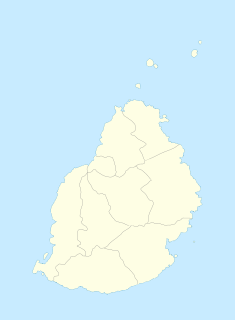
Chamarel is a village in Mauritius located in Rivière Noire District, the eastern part of the village also lies in the Savanne District. The village is administered by the Chamarel Village Council under the aegis of the Rivière Noire District Council.

Tmogvi is a ruined fortress in the southern Georgian region of Samtskhe-Javakheti, on the left bank of the Kura River, a few kilometers downstream of the cave city of Vardzia.

The Tsiribihina or Tsiribinha is a river of western Madagascar. It flows through Tsingy de Bemaraha National Park. The river is surrounded by mangroves.

The Kanangra Creek, a perennial stream of the Hawkesbury-Nepean catchment, is located in the Blue Mountains region of New South Wales, Australia.

Bras d'Eau National Park is one of only three national parks in Mauritius. It is located in the north-east of the island.


