Montana Vista, Texas

Last updated

Location of Horizon City, Texas TXMap-doton-HorizonCity.PNG
Location of Horizon City, Texas

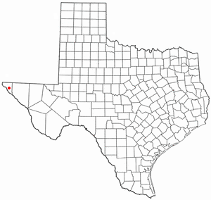
Montana Vista is an unincorporated community in El Paso County, Texas, United States. This Colonia lies northeast of Horizon City and far east of El Paso.

Montana Vista is located at 32°41′55″N107°12′47″W / 32.69861°N 107.21306°W / 32.69861; -107.21306 (31.682315, -106.196127). [1] The community is part of the El Paso Metropolitan Statistical Area.

Related Research Articles

<span class="mw-page-title-main">El Paso County, Texas</span> County in Texas, United States

El Paso County is the westernmost county in the U.S. state of Texas. As of the 2020 census, the population was 865,657, making it the ninth-most populous county in the state of Texas. Its seat is the city of El Paso, the sixth-most populous city in Texas and the 22nd-most populous city in the United States. The county was created in 1850 and later organized in 1871.

<span class="mw-page-title-main">Anthony, New Mexico</span> City in New Mexico, United States

Anthony is a city in Doña Ana County, New Mexico, United States. The population was 9,360 at the 2010 census. It is located on the New Mexico–Texas state line in the Upper Mesilla Valley, and on Interstate 10, 24 miles south of Las Cruces and 18 miles north of El Paso, Texas.

<span class="mw-page-title-main">Chaparral, New Mexico</span> Census-designated place in New Mexico, United States

Chaparral is an unincorporated community and census-designated place (CDP) in Doña Ana and Otero counties, New Mexico. The population was 14,631 at the 2010 census. Chaparral is primarily a bedroom community for the neighboring city of El Paso, Texas, and the neighboring military installations of White Sands Missile Range and Fort Bliss. It is officially part of the Las Cruces Metropolitan Statistical Area.

<span class="mw-page-title-main">Hatch, New Mexico</span> Village in New Mexico, United States

Hatch is a village in Doña Ana County, New Mexico, United States. The population was 1,648 at the 2010 census. The town is experiencing moderate growth, along with its outliers of Salem, Arrey, Derry, and Rincon. Hatch is widely known as the "best chile place in the World," for growing a wide variety of peppers, especially the New Mexican cuisine staple, and one of New Mexico's state vegetables, the New Mexico chile.

<span class="mw-page-title-main">Mesquite, New Mexico</span> Census-designated place in New Mexico, United States

Mesquite is an unincorporated community and census-designated place (CDP) in Doña Ana County, New Mexico, United States. The population was 1,112 at the 2010 census, up from 948 at the 2000 census. It is part of the Las Cruces Metropolitan Statistical Area.

<span class="mw-page-title-main">El Paso, Arkansas</span> Unincorporated community in southwestern White County, Arkansas

El Paso is an unincorporated community and census-designated place (CDP) in southwestern White County, Arkansas, United States. It was first listed as a CDP in the 2020 census with a population of 267. Its name is Spanish for "the pass", referring to a small gap in the hills on the community's northern edge. Once known as Peach Orchard Gap in its early settlement, the origin of El Paso's Spanish name is unknown.

<span class="mw-page-title-main">East El Paso</span>

East El Paso is an area of El Paso, Texas, United States, that is located north of Interstate 10, east of Airway Blvd., and south of Montana Ave. East El Paso is the fastest growing area of town. With a population of over 150,000, east El Paso is also the largest area of town. Its neighborhoods are mainly middle-class, but east El Paso does have a considerable number of affluent neighborhoods. East El Paso is noted also for its ridges and cliffs which offer desirable views of the Lower Valley, Ciudad Juárez, the Franklin Mountains, and Downtown El Paso. It also possesses the greatest number of entertainment venues in the city.

<span class="mw-page-title-main">El Paso Community College</span>

El Paso Community College (EPCC) is a community college district headquartered in El Paso, Texas, United States. EPCC operates five campuses in the Greater El Paso area, as well as courses offered at nearby Fort Bliss.

The El Paso Metropolitan Statistical Area, as defined by the United States Census Bureau, is an area consisting of two counties – El Paso and Hudspeth – in far West Texas, anchored by the city of El Paso. As of the 2020 United States Census, the MSA had a population of 868,859. The El Paso MSA forms part of the larger El Paso–Las Cruces combined statistical area, with a total population of 1,088,420 as of the 2020 United States Census.

<span class="mw-page-title-main">Buffalo, Kentucky</span> Unincorporated community in Kentucky, United States

Buffalo is an unincorporated community and census-designated place (CDP) in southern LaRue County, Kentucky, United States. Its population was 498 as of the 2010 census. It lies along Kentucky Route 61 south of the city of Hodgenville, the county seat of LaRue County. Its elevation is 748 feet (228 m), and it is located at 37°30′43″N85°41′55″W. Although Buffalo is unincorporated, it has a post office, with the ZIP code of 42716.

The United States Border Patrol operates 71 traffic checkpoints, including 33 permanent traffic checkpoints, near the Mexico–United States border. The stated primary purpose of these inspection stations is to deter illegal immigration and smuggling activities. After the September 11 attacks in 2001, they took on the additional role of terrorism deterrence. These checkpoints are located between 25 and 75 miles of the Mexico–United States border along major U.S. highways; near the southern border of the contiguous United States. Their situation at interior locations allow them to deter illegal activities that may have bypassed official border crossings along the frontier. The checkpoints are divided among nine Border Patrol sectors. There are a number of these checkpoints near the northern border of the contiguous U.S. as well, within 100 miles (160 km) of the Canada–U.S. border.

<span class="mw-page-title-main">Austin High School (El Paso, Texas)</span> Public school in El Paso, Texas, United States

Stephen F. Austin High School is a high school in El Paso, Texas. Austin opened in 1930. It is part of the El Paso Independent School District. The school's mascot is a golden panther named "Henry." Austin High School is located in the heart of historic Central El Paso and serves the Central community.

Las Cruces Air Force Station is a closed United States Air Force General Surveillance Radar station. It is located 12.1 miles (19.5 km) west-southwest of Las Cruces, New Mexico. It was closed in 1963.

La Union is a census-designated place in Doña Ana County, New Mexico, United States. Its population was 1,106 as of the 2010 census. NM 182 connects the community to NM 28.

References

  1. "US Gazetteer files: 2010, 2000, and 1990". United States Census Bureau. February 12, 2011. Retrieved April 23, 2011.