
The Sainte-Anne River, a north shore tributary of Saint Lawrence River, the mouth river is located at Sainte-Anne-de-la-Pérade. This river flows in the province of Quebec, Canada.
Administrative regions
Capitale-Nationale:
Mauricie:

Batiscan River has its source in the region of Lac Édouard, in the Laurentians Mountains, the Batiscan River flows over a length of 177 km. It receives water from numerous tributaries, including, in its upper reach, the Rivière aux Éclairs and the Jeannotte river. In its downstream part, it waters Saint-Narcisse and Sainte-Geneviève-de-Batiscan before flowing into the St. Lawrence River at Batiscan.

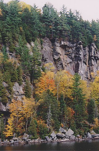
The Noire River flows in the municipality of rivière-à-Pierre, Saint-Alban and Saint-Casimir, in the Portneuf Regional County Municipality, in the administrative region of Capitale-Nationale, in Quebec, in Canada.

The Blanche River (St-Casimir) is a stream flowing in the municipalities of Saint-Ubalde, Saint-Thuribe, Saint-Alban and Saint-Casimir, in the Portneuf Regional County Municipality, in the administrative region from Capitale-Nationale, to Quebec, to Canada.

The Weller River (Stream) is a tributary left bank of the Blanche River (St-Casimir) whose confluence is found east of the municipality of Saint-Ubalde, in the Portneuf Regional County Municipality, in the administrative region of Capitale-Nationale, in the province of Quebec in Canada.
The Rondeau River is a tributary of the Jacquot River flowing in the municipality of Saint-Léonard-de-Portneuf, in the MRC Portneuf Regional County Municipality, in the administrative region of Capitale-Nationale, in Quebec, in Canada.
The Rivière Jacquot is a tributary of the Sainte-Anne River flowing in the municipalities of Saint-Léonard-de-Portneuf and Sainte-Christine-d'Auvergne, in the MRC Portneuf Regional County Municipality, in the administrative region of Capitale-Nationale, in Quebec, in Canada.
The Mauvaise river is a tributary of the Bras du Nord flowing in the town of Saint-Raymond, in the Portneuf Regional County Municipality, in the administrative region of Capitale-Nationale, in Quebec, in Canada.

Portneuf Regional Natural Park is a Quebec regional park (Canada) spanning five municipalities in the northwestern part of the Portneuf Regional County Municipality: Saint-Ubalde, Saint-Alban, Saint-Casimir, Portneuf and Rivière-à-Pierre. This park is administered on the basis of a social economy enterprise with the mission of showing visitors around an exceptional territory and contributing to its preservation and enhancement.
Lac Sept Îles is a freshwater body straddling the municipalities of Saint-Ubalde and Saint-Alban, in the Portneuf Regional County Municipality, in the administrative region of Capitale-Nationale, in the province of Quebec, Canada.
The lac Long is crossed by the Noire River, entirely in the municipality of Saint-Alban, in the MRC of Portneuf Regional County Municipality, in the administrative region of Capitale-Nationale, in province, Canada.
The lac Carillon is located on the north shore of the St. Lawrence River, in the province of Quebec, in Canada. This lake straddles the municipalities of:
The lac Clair is part of the hydrographic side of the Noire River, in the municipalities of Sainte-Christine-d'Auvergne and Saint-Alban, in the MRC of Portneuf Regional County Municipality, in the administrative region of Capitale-Nationale, in province of Quebec, Canada.
The lac Émeraude is located in the northern part of the municipality of Saint-Ubalde, in the MRC of Portneuf Regional County Municipality, in the administrative region of the Capitale-Nationale, in the province of Quebec, in Canada.
The Lac Blanc is located in the northern part of the municipality of Saint-Ubalde, in the MRC of Portneuf Regional County Municipality, in the administrative region of the Capitale-Nationale, in the province of Quebec, in Canada.
The Rivière des Pins is a freshwater stream, in Quebec, in Canada. This river crosses the municipalities of:
The Rivière Blanche is a tributary of the Portneuf River, flowing in the municipalities of Sainte-Catherine-de-la-Jacques-Cartier, Pont-Rouge and Saint-Basile, in the regional county municipality (MRC) of Portneuf Regional County Municipality, in the administrative region of Capitale-Nationale, in the province of Quebec, in Canada.

The Rivière Portneuf is a tributary of the north shore of the Saint-Laurent river, crossing the municipalities of Saint-Raymond, Pont-Rouge, Sant-Basile and Portneuf, in the Portneuf Regional County Municipality, in the administrative region of the Capitale-Nationale, in the province of Quebec, in Canada.
Lac Grandbois is a freshwater body straddling the municipalities of Rivière-à-Pierre and Saint-Raymond, in Portneuf Regional County Municipality, in the administrative region of Capitale-Nationale, in the province of Quebec, in Canada. Lac Grandbois proves to be the main head of the Noire River.

The Rivière Mékinac du Sud is a watercourse flowing from Grandes-Piles to Saint-Tite and Hérouxville in Mékinac Regional County Municipality (RCM), Mauricie, administrative region, Quebec, Canada.

