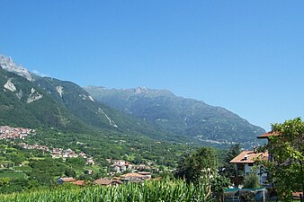
Erice is a historic town and comune in the province of Trapani, Sicily, in southern Italy.

The Dolomites, also known as the Dolomite Mountains, Dolomite Alps or Dolomitic Alps, are a mountain range in northeastern Italy. They form part of the Southern Limestone Alps and extend from the River Adige in the west to the Piave Valley in the east. The northern and southern borders are defined by the Puster Valley and the Sugana Valley. The Dolomites are in the regions of Veneto, Trentino-Alto Adige/Südtirol and Friuli Venezia Giulia, covering an area shared between the provinces of Belluno, Vicenza, Verona, Trentino, South Tyrol, Udine and Pordenone.
Mount Roraima is the highest of the Pakaraima chain of tepuis or plateaux in South America. It is located at the junction of Venezuela, Brazil and Guyana. A characteristic large flat-topped mountain surrounded by cliffs 400 to 1,000 meters high. The highest point of Mount Roraima is located on the southern edge of the cliff at an altitude of 2,810 meters in Venezuela, and another protrusion at an altitude of 2,772 meters at the junction of the three countries in the north of the plateau is the highest point in Guyana. The name of Mount Roraima came from the native Pemon people. Roroi in the Pemon language means "blue-green", and ma means "great".

The Province of Brescia is a Province in the Lombardy administrative region of northern Italy. It has a population of some 1,265,964 and its capital is the city of Brescia.

Capo di Ponte is an Italian comune in Val Camonica, province of Brescia, in Lombardy.
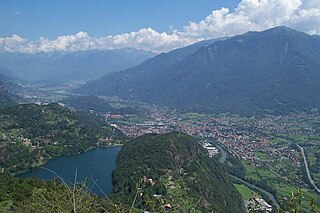
Darfo Boario Terme is a comune in the province of Brescia, in Lombardy, northern Italy. The name combines Darfo, the capoluogo, with Boario Terme, the largest frazione.
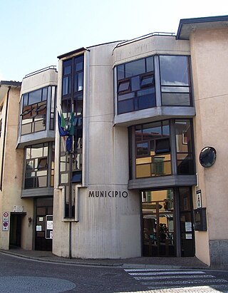
Esine is a comune in the province of Brescia, in the Italian region Lombardy, in the Camonica valley, located 43 kilometres north of Brescia.

Monno is a village and comune in the province of Brescia, in Lombardy. It is situated above the right bank of the river Oglio, in upper Val Camonica.

Lake Iseo or Iseo lake, also known as Sebino, is the fourth largest lake in Lombardy, Italy, fed by the Oglio River.
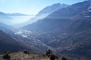
Sellero is a comune of 1,503 people in the province of Brescia in the middle Val Camonica.

Temù is an Italian comune of 1.113 inhabitants in the province of Brescia, in Lombardy, Italy.

Monte Rosa is a mountain massif in the eastern part of the Pennine Alps. It is between Italy's and Switzerland's (Valais). Monte Rosa is the second highest mountain in the Alps and western Europe, after Mont Blanc.

Val Camonica is one of the largest valleys of the central Alps, in eastern Lombardy, Italy. It extends about 90 kilometres (56 mi) from the Tonale Pass to Corna Trentapassi, in the commune of Pisogne near Lake Iseo. It has an area of about 1,335 km2 (515 sq mi) and 118,323 inhabitants.

The Oglio is a left-side tributary of the river Po in Lombardy, Italy. It is 280 kilometres (170 mi) long. In the hierarchy of the Po's tributaries, with its 280 kilometres (170 mi) of length, it occupies the 2nd place per length, while it is the 4th per basin surface, and the 3rd per average discharge at the mouth.

Monte Titano is a mountain of the Apennines and the highest peak in San Marino. It stands 739 m (2,425 ft) above sea level and is located immediately to the east of the capital, San Marino. It was inscribed as a UNESCO World Heritage Site in 2008 under the combined title "San Marino Historic Centre and Mount Titano". Inscribed under reference no. 1245 criteria iii, the two together encompass an area of 55 ha with a buffer zone of 167 ha. It encompasses Mount Titano and the other structures such as the fortification towers, walls, gates and bastions, as well as a neo-classical basilica located on it and its slopes forming a small but unique urban conglomerate.

Porto Santo Stefano is a seaport town on the west coast of Italy, in the municipality of Monte Argentario, in the Province of Grosseto, Tuscany. It is the municipal seat of Monte Argentario and one of the two major towns that form the township, along with Porto Ercole. The region is on the slopes of Mount Argentario, which dominates the whole area. Porto Santo Stefano is 150 kilometres northwest of Rome.
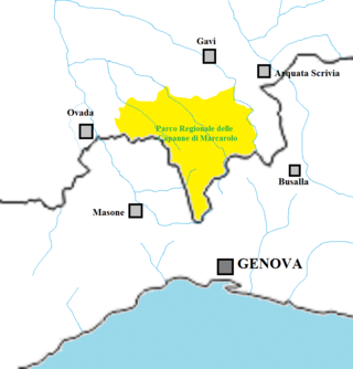
The Capanne di Marcarolo Natural Regional Park is a natural park in the province of Alessandria. It gets the name from a small village in the protected area, Capanne di Marcarolo.

Carmo di Brocchi is a 1,610-metre (5,282 ft) mountain of the Ligurian Alps, in Italy.
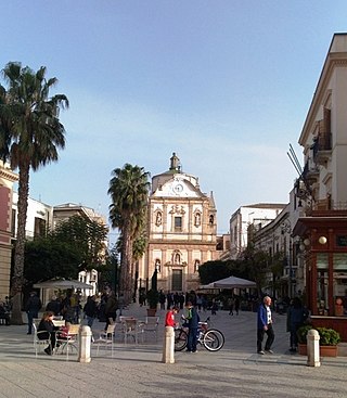
Piazza Ciullo is the main square of Alcamo, in the province of Trapani, Sicily, Italy. Being located in the very town centre, it is a meeting place for people and an attraction for important events, especially for teenagers.


