Monte Lake, British Columbia

Last updated
Monte Lake
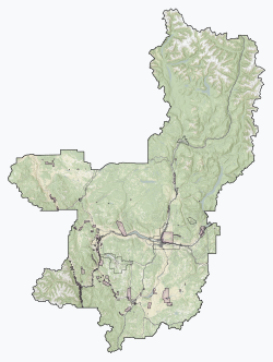
9 Thompson-Nicola Regional District British Columbia.svg
Red pog.svg
Monte Lake
Canada British Columbia location map 2.svg
Red pog.svg
Monte Lake
Coordinates: 50°32′00″N119°50′00″W / 50.53333°N 119.83333°W / 50.53333; -119.83333 Coordinates: 50°32′00″N119°50′00″W / 50.53333°N 119.83333°W / 50.53333; -119.83333
Country Canada
Province British Columbia
Regional district Thompson-Nicola
Electoral area Electoral Area L (Grasslands)

Monte Lake is an unincorporated, seasonally inhabited community located at the north end of the lake of the same name. [1] It lies in a valley connecting the Thompson Country to the Okanagan region in the south-central Interior of British Columbia, Canada. The area has a negligible permanent population and is not considered a designated place by Statistics Canada, but seasonal residents can number nearly 3,000. On 5-6 August 2021, the community was destroyed by the White Rock Lake fire. [2]
See also

Related Research Articles

Kelowna City in British Columbia, Canada

Kelowna is a city on Okanagan Lake in the Okanagan Valley in the southern interior of British Columbia, Canada. It serves as the head office of the Regional District of Central Okanagan. The name Kelowna derives from the Okanagan word kiʔláwnaʔ, referring to a male grizzly bear.

Whistler, British Columbia Resort municipality in British Columbia, Canada

Whistler is a resort municipality in the southern Pacific Ranges of the Coast Mountains in British Columbia, Canada. Approximately 125 km (78 mi) north of Vancouver and 36 km (22 mi) south of Pemberton, it is incorporated as the Resort Municipality of Whistler (RMOW). It has a permanent population of approximately 11,854, as well as a larger but rotating population of seasonal workers, who are typically younger people from beyond British Columbia, notably from Australia and Europe.

Kamloops City in British Columbia, Canada

Kamloops is a city in south-central British Columbia, Canada, at the confluence of the two branches of the Thompson River and east of Kamloops Lake. It is located in the Thompson-Nicola Regional District, whose district offices are based here. The surrounding region is more commonly referred to as the Thompson Country.

Vernon, British Columbia City in British Columbia, Canada

Vernon is a city in the Okanagan region of the Southern Interior of British Columbia, Canada. It is 440 km (270 mi) northeast of Vancouver. Named after Forbes George Vernon, a former MLA of British Columbia who helped establish the Coldstream Ranch in nearby Coldstream, the City of Vernon was incorporated on December 30, 1892. The City of Vernon has a population of 40,000 (2013), while its metropolitan region, Greater Vernon, has a population of 58,584 as of the Canada 2011 Census. With this population, Vernon is the largest city in the North Okanagan Regional District. A resident of Vernon is called a "Vernonite".

Penticton City in British Columbia, Canada

Penticton is a city in the Okanagan Valley of the Southern Interior of British Columbia, Canada, situated between Okanagan and Skaha lakes. In the 2016 Canadian Census, its population was 33,761, while its census agglomeration population was 43,432.

Crowsnest Pass

Crowsnest Pass is a low mountain pass across the Continental Divide of the Canadian Rockies on the Alberta–British Columbia border.

Pender Island Island in British Columbia, Canada

Pender Island is one of the Southern Gulf Islands located in the Gulf of Georgia, British Columbia, Canada. Pender Island is approximately 34 km2 (13 sq mi) in area and is home to about 2,250 permanent residents, as well as a large seasonal population. Like most of the rest of the Southern Gulf Islands, Pender Island enjoys a sub-Mediterranean climate and features open farmland, rolling forested hills, several lakes and small mountains, as well as many coves and beaches.

Highway 97 is the longest continuously numbered route in the Canadian province of British Columbia, running 2,081 km (1,293 mi) from the Canada–United States border near Osoyoos in the south to the British Columbia/Yukon boundary in the north at Watson Lake, Yukon. The route takes its number from U.S. Route 97, with which it connects at the international border. The highway was initially designated '97' in 1953.

Salmon Arm City in British Columbia, Canada

Salmon Arm is a city in the Columbia Shuswap Regional District of the Southern Interior of the Canadian province of British Columbia that has a population of 17,706 (2016). Salmon Arm was incorporated as a municipal district on May 15, 1905. The city of Salmon Arm separated from the district in 1912, but was downgraded to a village in 1958. In 1970, the city of Salmon Arm once again reunited with the District Municipality. Salmon Arm once again became a city in 2005, and is now the location of the head offices of the Columbia-Shuswap Regional District. It is a tourist town in the summer, with many beaches, camping facilities and house boat rentals. Salmon Arm is home to the longest freshwater wooden wharf in North America.

Burning of Washington Event in the War of 1812

The Burning of Washington was a British invasion of Washington City, the capital of the United States, during the Chesapeake Campaign of the War of 1812. To this date, it remains the only time since the American Revolutionary War that a foreign power has captured and occupied the capital of the United States.

Grand Forks, British Columbia City in British Columbia, Canada

Grand Forks, population 4,049, is a city in the Boundary Country of the West Kootenay region of British Columbia, Canada. It is located at the confluence of the Granby and Kettle Rivers, a tributary of the Columbia River. The city is just north of the Canada–United States border, approximately 500 km (310 mi) from Vancouver and 200 km (120 mi) from Kelowna and 23 km (14 mi) west of the resort area of Christina Lake by road.

Chilcotin River

The Chilcotin River /tʃɪlˈkoʊtɪn/ located in Southern British Columbia, Canada is a 241 km (150 mi) long tributary of the Fraser River. The name Chilcotin comes from Tŝilhqot’in, meaning "ochre river people," where ochre refers to the mineral used by Tŝilhqot’in Nation and other Indigenous communities as a base for paint or dye. The Chilcotin River, Chilko River and Lake, and Taseko River and Lake make up the Chilcotin River watershed. This 19,200 km2 (7,400 sq mi) watershed drains the Chilcotin Plateau which reaches north to south from the Nechako Plateau to Bridge River county and east to west from Fraser River to the Coast Mountains. It is also one of twelve watersheds that make up the Fraser River Basin. Made up of seven major tributaries, Chilcotin River starts northeast of Itcha Mountain, flowing southeast until it joins the Fraser River south of Williams Lake, 22 km (14 mi) upstream from Gang Ranch.

Barriere, British Columbia District municipality in British Columbia, Canada

Barriere is a district municipality in central British Columbia, Canada, located 66 km (41 mi) north of the larger city of Kamloops on Highway 5. It is situated at the confluence of the Barrière River and North Thompson Rivers in the Central North Thompson Valley.

Kaslo Village in British Columbia, Canada

Kaslo is a village on the west shore of Kootenay Lake in the West Kootenay region of southeastern British Columbia. A member municipality of the Central Kootenay Regional District, the name derives from the adjacent Kaslo River. At 2016, the population was 968, and the idyllic village is regarded at the "Little Switzerland of Canada"

Houston, British Columbia District municipality in British Columbia, Canada

Houston is a forestry, mining and tourism town in the Bulkley Valley of the Northern Interior of British Columbia, Canada. Its urban population is approximately 3600 people, with approximately 2000 in the surrounding rural area. It is known as the "steelhead capital" and it has the world's largest fly fishing rod. Houston's tourism industry is largely based on ecotourism and Steelhead Park, situated along Highway 16. Houston is named in honour of the pioneer newspaperman John Houston.

Monte Lake Provincial Park

Monte Lake Provincial Park is a provincial park in British Columbia, Canada, located on the east side of Monte Lake and to the south of the community of Monte Lake, British Columbia which is at the north end of the lake. About five hectares in size, it protects an area of Ponderosa pine and grasslands.

Cultus Lake, British Columbia

Cultus Lake is a lake, associated community and provincial park in the Fraser Valley region of British Columbia, Canada. It is the source of the Sweltzer River. The lake itself is warm, and the area has become a popular recreation destination with ample opportunities for fishing, water skiing, wind surfing, wakesurfing, kayaking, standup paddle-boarding and hiking. Cultus Lake is located 11 kilometers (6.8 mi) south of the Chilliwack River, near the city of Chilliwack and approximately 80 kilometers (50 mi) east of Vancouver. In 1950, Cultus Lake became a Provincial park of British Columbia. Cultus Lake covers an area of 656 hectares, evenly on either side of the lake. At one time the lake had a sawmill and booming ground until it became a provincial park in the 1950s.

2021 British Columbia wildfires

The 2021 British Columbia wildfires burned across the Canadian province of British Columbia. The severity of the 2021 wildfire season is believed to have been caused by a "perfect storm" of environmental factors exacerbated by human-caused climate change.

Lytton wildfire Wildfire in Lytton, British Columbia on June 30, 2021

The Lytton Fire, also known as the Lytton Creek Fire, was a wildfire that burned on June 30, 2021 just south of the village of Lytton in the interior of British Columbia, Canada. The fire destroyed much of Lytton and caused two civilian fatalities, announced July 3. Several missing residents, still unaccounted for at that time, were later located. The fire, one of the 2021 British Columbia wildfires throughout the province, was facilitated by the 2021 Western North America heat wave.

The White Rock Lake fire is an ongoing wildfire in Thompson-Nicola Regional District, British Columbia. It began July 13, 2021 as one of the 2021 B.C. wildfires and resulted in the destruction of Monte Lake. As of August 18, 2021 it totalled 81,139 hectares and was classified as out of control. Insured losses total an estimated $77 million Canadian, according to one agency, which in late September expected the number of claims to top 800, most of them related to residential property.

References

  1. BC Names entry "Monte Lake (community)"
  2. "Second western Canada town destroyed by 'exceedingly aggressive' wildfire". 6 August 2021.