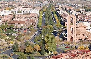
Pozuelo de Alarcón is a municipality in the Community of Madrid, Spain. Bordering the Moncloa-Aravaca district of Madrid proper to its west, Pozuelo de Alarcón is surrounded by large Mediterranean pine-tree forests: the Casa de Campo, the Monte del Pardo, and the Monte del Pilar. As of 2022, it ranks as the wealthiest municipality in Spain. La Finca, an isolated luxury residential area known by its affluent residents, most notably football players, lies within the municipality bounds.

The Sierra de Guadarrama is a mountain range forming the main eastern section of the Sistema Central, the system of mountain ranges along the centre of the Iberian Peninsula. It is located between the systems Sierra de Gredos in the province of Ávila, and Sierra de Ayllón in the province of Guadalajara.

The Royal Palace of El Pardo is one of the official residences of the Spanish royal family and one of the oldest, being used by the Spanish monarchs since Henry III of Castile in the 15th century. It is administered by the Patrimonio Nacional agency and it currently serves as a state guest house.

Hispanidad is a Spanish term describing a shared cultural, linguistic, or political identity among speakers of the Spanish language or members of the Hispanic diaspora. The term can have various, different implications and meanings depending on the regional, socio-political, or cultural context in which it is used.

Torrelodones is a municipality in the northwest of the Autonomous Community of Madrid, Spain. It is situated 29 kilometers northwest from the city of Madrid. Because of its location between the Sierra de Guadarrama and the metropolitan area of the capital, it is linked to two districts in Madrid: the agricultural area of Guadarrama and the metropolitan area of Madrid.

El Pardo is a ward (barrio) of Madrid belonging to the district of Fuencarral-El Pardo. As of 2008 its population was of 3,656.

Paseo de la Castellana, commonly known as La Castellana, is a major thoroughfare in Madrid, Spain. Cutting across the city from south to north, it has been described as the "true structuring axis" of the city.

Fuencarral-El Pardo is one of the 21 districts that form the city of Madrid, Spain.

Soto de Viñuelas is a meadow-oak forest north of the city of Madrid, south of Tres Cantos and San Agustín del Guadalix, east of the Monte de El Pardo and west of San Sebastián de los Reyes, all municipalities are parts of the Community of Madrid, Spain. Much of it is a fenced property of 3,000 hectares, which includes important ecological values, landscape and art. It belongs to the municipality of Madrid, although it contains small areas to the north, corresponding to Tres Cantos, including a development of the same name. Other developments nearby are Ciudalcampo and Fuente del Fresno, situated on its western boundary. King's College, the British School of Madrid, is also located in the development of Soto de Viñuelas, abutting the Regional Park. In 1985 Soto de Viñuelas was turned into the Regional Park of the Cuenca Alta del Manzanares, the largest protected natural area in the region. It has been classified as Area B, a legal instrument that allows agricultural land use. Soto de Viñuelas also received the status of Special Protection Area for Birds. It is accessed from the M-607 Freeway, exit 20. Soto de Viñuelas and Tres Cantos are both listed on the exit sign.

Campo de Cartagena is a natural region (comarca) located in the Region of Murcia, in Spain. For administrative purposes, it is also known as Comarca del Campo de Cartagena or Comarca de Cartagena. It is located in the southeast of the Iberian Peninsula, forming a plain which extends from the Sierra de Carrascoy to the Mediterranean. The capital city is Cartagena, the most important Naval Base of the Spanish Navy in the Mediterranean Sea.

San Pedro de Arlanza is a ruined Benedictine monastery in north central Spain. It is located in the valley of the river Arlanza in Hortigüela, Burgos. Founded in 912, it has been called the "cradle of Castile". It was abandoned in 1841 during the confiscations of Juan Álvarez Mendizábal's government, when ecclesiastical properties were roundly redistributed.

The Torre de la Parada is a former hunting lodge that was located in present-day Monte de El Pardo in Fuencarral-El Pardo, near the Royal Palace of El Pardo, some way outside Madrid in the Sierra de Guadarrama. It was mostly destroyed by fire when taken in 1714 by Austrian troops in the War of Spanish Succession, though the ruins remain.

Granastrapotherium is an extinct genus of ungulate mammals, described from remains found in rocks of the Honda Group in the Tatacoa Desert, in the Colombian departments of Huila and Tolima, at the Miocene fossil site La Venta. The only species formally recognized is Granastrapotherium snorki. Remains found in Bolivia and Peru, seem to belong to Granastrapotherium or a very similar animal.

Valdemarín is a ward (barrio) of Madrid belonging to the district of Moncloa-Aravaca. Its code number is 95 and, as of 2006, its population was of 4,000.

Madrid is the capital and most populous city of Spain. The city has almost 3.4 million inhabitants and a metropolitan area population of approximately 7 million. It is the second-largest city in the European Union (EU), and its monocentric metropolitan area is the second-largest in the EU. The municipality covers 604.3 km2 (233.3 sq mi) geographical area. Madrid lies on the River Manzanares in the central part of the Iberian Peninsula at about 650 meters above mean sea level. The capital city of both Spain and the surrounding autonomous community of Madrid, it is also the political, economic, and cultural centre of the country. The climate of Madrid features hot summers and cool winters.

The Iglesia de Santo Tomé is a church located in the historical center of the city of Toledo (Spain), and was founded after the reconquest of this city by King Alfonso VI of León. It appears quoted in the 12th century, as constructed on the site of an old mosque of the 11th century. This mosque, together with other mosques in the city, were used as Christian churches without major changes, since in the taking of the city there was no destruction of buildings.

The Muslim Walls of Madrid, of which some vestiges remain, are located in the Spanish capital city of Madrid. They are probably the oldest construction extant in the city. They were built in the 9th century, during the Muslim domination of the Iberian Peninsula, on a promontory next to Manzanares river. They were part of a fortress around which developed the urban nucleus of Madrid. They were declared an Artistic-Historic Monument in 1954.

Gonzalo Werther Miró Romero is a Spanish television presenter. He is the son of filmmaker Pilar Miró.

The Cuenca Alta del Manzanares Regional Park, created in 1985, is the natural space protected area with the largest extension in the Community of Madrid (Spain) and one of the most ecologically and scenically valuable. It is located in the northwest of the region and extends around the upper course of the Manzanares River, along 42 583 ha. Its main municipalities of reference are Manzanares el Real and Hoyo de Manzanares. Unesco declared it a Biosphere Reserve in 1992.

The Sierra de Hoyo or Sierra de Hoyo de Manzanares is a mountain chain located in the northwest of the Community of Madrid (Spain), near the Sierra de Guadarrama. Geologically it belongs to this mountainous formation, but there is a flat separation of about ten kilometers between the two. Its main municipality of reference is Hoyo de Manzanares, located on its southern slope, from which it takes its name.
