
Perambalur is one of the 38 districts in the state of Tamil Nadu, India. The district headquarters is located at Perambalur. The district occupies an area of 1,752 km2 and had a population of 565,223 with a sex-ratio of 1,003 females for every 1,000 males in 2011.
Panruti is a town, municipality and taluk headquarters of Cuddalore district, Tamil Nadu, India. Panruti is located between Cuddalore and Neyveli. Panruti is famous for jackfruits and cashew nuts. The jackfruit grown here is exported worldwide and is very sweet. It is a business capital of Cuddalore district. Kananchavadi one of the villages in panruti taluk, famous for palm juice. It has been a great commercial area for more than 200 years. The name Panruti came from the Tamil words "Pann" and "Urutti" meaning "composing song and music", as the place is where many saints and great religious singers such as nayanmars and vainavas sung. A 150-year-old government school was built here by the British East India Company and a more-than-1000-year-old temple Veerattaneswarar temple is nearby in Thiruvathigai. As of 2011, the town had a population of 60,323.

Cheyyar, officially Tiruvetipuram is a Town in the Tiruvannamalai District in the Tamil Nadu state of South India. The most common name of this town is Cheyyar but it is also referred to as Tiruvetipuram in many government records. The town has an ancient temple called Vedapureeswarar Temple situated on the banks of the river.
Kanjikoil is a panchayat town in Erode district in the Indian state of Tamil Nadu. The ancient name of the town is "Kanji Kooval" and it is called by the Name Kanji koil or Kanji Kovil.
Mohanur is a taluk in the Namakkal district of the Indian state of Tamil Nadu. The Mohanur Panchayat Union includes Mohanur Town, Pettapalayam, Manappalli, Rasipalayam, Kumaripalayam, Sengappalli, Ediyar, Peramandampalayam, Ariyur, Aniyapuram, and Valayapatti. It is linked to Tiruchirappalli, Salem, Erode, and Karur districts by road.
Peravurani is a panchayat town in Thanjavur district in the Indian state of Tamil Nadu. It is the administrative headquarters of the Peravurani Taluk and Peravurani. It is declared as Selection Grade Town Panchayat.
State Highway 68 (SH-68) in Tamil Nadu, India connects Cuddalore with Sankarapuram. Total length of SH-68 is 108 km.
Mahagaon is located in Pusad subdivision of Yavatmal district in the state of Maharashtra, India.

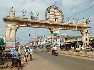
Tirukoilur also spelt as Tirukkoyilur or Tirukovilur is a city and the headquarters of Tirukoilur taluk in Kallakurichi District, Tamil Nadu, India. The town is located on the southern bank of Thenpennai River and famous for Ulagalantha Perumal TempleTirukoilur is located on the highway connecting cities of Tiruvannamalai and Vellore with Southern Tamil Nadu. The town is served by Tirukoilur railway station.
Chetpet is a major town panchayat in Tiruvannamalai district in the state of Tamil Nadu, India. Chetpet's major economical activity is processing paddy and the town is home to one of the largest organised paddy exchange markets of the state. Chetpet is one of the very few places of German colonisation in Indian history. A village called Nedungunam nearby has one of the Famous temples of Lord Rama. The temple is very famous and called Sri Yoga Rama temple.
Velayuthampalayam is a town located in Karur District in the Indian state of Tamil Nadu. It comes under the jurisdiction of Pugalur municipality. This town is situated on the footsteps of Pugali Malai Arunattan Malai, which houses Lord Murugan. The river Cauvery is 3 kilometers away from the town. It is very close to TNPL Kagithapuram. The adjacent places are TNPL Kagithapuram, Thottakuritchi and Karappalayam.
Anniyur is a village located in the District of Viluppuram in the southern state of Tamil Nadu under the Union of India. It lies 25 kilometres from Gingee, Vilupuram

Devikapuram, also called Devigai, is a town and a Panchayat board in Tiruvannamalai district, located in Tamil Nadu, India. The town is famous for handlooms, Silk weaving and ricemills, which process Arni Ponni rice. Located on the Polur - Sadras state highway, 45 kilometres from the city of Tiruvannamalai, also the district headquarters.
Melnariyappanur is a village panchayat located near Chinnasalem taluk of Kallakurichi district, Tamil Nadu. It is famous for the shrine dedicated to the King of Miracles, Saint Antony of Padua. His feast is celebrated every year on 13 June. People in the area cultivate turmeric, rice, corn, cotton, green chilis, pulses, tapioca sugar, tamarind, and yellow lentils.
Brammadesam is an Indian Panchayat village located in Tindivanam taluk of Villupuram district in the state of Tamil Nadu. It is one of the 56 village panchayats coming under Marakkanam block of the Villupuram district. The village code for Brahmadesam is 10 and it falls under the Marakkanam Block.
Brahmadesam is an Indian Panchayat, town panchayat village located in Vembakkam Taluk of Tiruvannamalai district in the state of Tamil Nadu. It is one of the 64 village panchayats under Vembakkam block of the Thiruvannamalai district. Brahmadesam is located on Right Bank of Palar River. The village code for Brahmadesam is 07 and it falls under the Venbakkam Block.

Tiruvannamalai district is the second largest district in Tamil Nadu by area after Dindigul District and one of the 38 districts in the state of Tamil Nadu, in South India. It was formed in the year 1989 through the bifurcation of North Arcot into the Tiruvannamalai Sambuvarayar and Vellore Ambedkar districts. The city of Tiruvannamalai is the district headquarters.
Tamil Nadu Sugar Corporation Limited (TASCO) (Tamil: தமிழ்நாடு சர்க்கரைக் கழகம் வரையறுக்கப்பட்டது) is a state-government undertaking of the Government of Tamil Nadu located in the Indian state of Tamil Nadu. It is a producer of sugar, molasses and power.
Devapandalam is a panchayat village in Sankarapuram taluk in Kallakurichi district in the Indian state of Tamil Nadu. Located on Kallakurichi - Tiruvannamalai State High Way. Tirukovilur is just 15 km away. Devapandalam was a settlement of tamil shaiva mutt followers and hosts the school of Tamil hymns and Mutt administration.
Kallakurichi is one of the 38 districts in the state of Tamil Nadu in India. The district headquarter is Kallakurichi. Kallakurichi District was announced on 8 January 2019 and it came into existence on 26 November 2019.
