Related Research Articles

Neasden is a suburban area in northwest London, England. It forms part of the London Borough of Brent. Neasden also includes Brent Park and St Raphael's Estate.

Oldham is a town in Greater Manchester, England, amid the Pennines and between the rivers Irk and Medlock, 5.3 miles (8.5 km) southeast of Rochdale and 6.9 miles (11.1 km) northeast of Manchester. It is the administrative centre of the Metropolitan Borough of Oldham, which had a population of 230,800 in 2015.

Chadderton is a town within the Metropolitan Borough of Oldham, in Lancashire, England. It lies along the course of the River Irk and the Rochdale Canal, on undulating land in the foothills of the Pennines, 1 mile (1.6 km) west of Oldham, 4.5 miles (7.2 km) south of Rochdale and 6 miles (9.7 km) northeast of the city of Manchester.
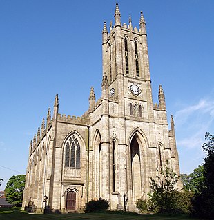
Whitefield is a town in the Metropolitan Borough of Bury, Greater Manchester, England. It lies on undulating ground above the Irwell Valley, along the south bank of the River Irwell, 3 miles (4.8 km) south-southeast of Bury, and 4.9 miles (7.9 km) to the north-northwest of the city of Manchester. Prestwich and the M60 motorway lie just to the south.

Royton is a town in the Metropolitan Borough of Oldham, [Lancashire]], England, with a population of 21,284 in 2011. Close to the source of the River Irk, near undulating land at the foothills of the South Pennines, it is 1.7 miles (2.7 km) northwest of Oldham, 3.2 miles (5.1 km) southeast of Rochdale and 7.6 miles (12.2 km) northeast of Manchester.
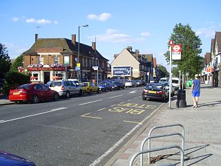
Motspur Park, also known locally as West Barnes, is a residential suburb in south-west London, in the New Malden district. It straddles the boroughs of Kingston upon Thames and Merton.

Swinton is a town in Greater Manchester, England, southwest of the River Irwell, 3.4 miles (5.5 km) northwest of Salford and 4.2 miles (6.8 km) northwest of Manchester, adjoining the towns of Pendlebury and Clifton. In 2014, it had a population of 22,931.

Eccleshill is an area, former village, and ward within the City of Bradford Metropolitan District Council in the county of West Yorkshire, England. The ward population of Eccleshill is 17,540, increasing at the 2011 Census to 17,945. Eccleshill is a more or less completely residential urban area with very little open space although there is substantial open land directly to the east.
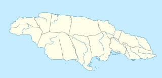
Portmore is a large coastal town in southern Jamaica in Saint Catherine, and a dormitory town for the neighbouring city of Kingston and Spanish Town.
Oldham Coliseum Theatre is a theatre in Oldham, Greater Manchester, England.

Edgworth is a small village within the borough of Blackburn with Darwen, Lancashire, England. It is north east of North Turton between Broadhead Brook on the west and Quarlton Brook in the south east. The ground ranges from 650 feet (200 m) to 1,100 feet (340 m) above sea level.

Sholver is an area of Oldham, in Greater Manchester, England. An elevated, residential area, it lies near the middle of the Oldham part of the valley of the River Beal, 2.1 miles (3.4 km) northeast of Oldham's commercial centre, nearly at the northeastern-most extremity of the town, by open countryside close to the source of the River Medlock and by the border with Saddleworth.
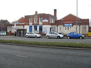
New Moston is a district within the City of Manchester, in North West England.

Cowhill is a locality of Chadderton, in the Metropolitan Borough of Oldham, Greater Manchester, England.
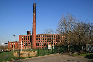
Freehold is an urban area of Werneth in Oldham, Greater Manchester, England. It occupies an area in the west of Werneth along the Oldham township boundary with Chadderton. It is contiguous on all sides with other urban areas including other parts of Werneth to the north and east and with Cowhill, Block Lane and Butler Green/Washbrook in Chadderton.

Coalshaw Green is a locality in the town of Chadderton in the Metropolitan Borough of Oldham, Greater Manchester.
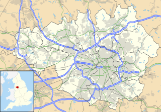
Butler Green is a residential area in the town of Chadderton in the Metropolitan Borough of Oldham, Greater Manchester. The area is also commonly known as Washbrook.

Block Lane is a locality in the town of Chadderton in the Metropolitan Borough of Oldham, Greater Manchester. It is located on Chadderton's eastern border with Oldham, contiguous with the Freehold area of that town, and with Cowhill and Butler Green.

Middleton Junction is an industrial and residential district lying on the common border of Middleton in the Metropolitan Borough of Rochdale and Chadderton in the Metropolitan Borough of Oldham, Greater Manchester.

Alt is a semi-rural and suburban area lying on the borders of the towns of Oldham and Ashton-under-Lyne in Greater Manchester.
References
- ↑ http://www.moorsidecricketandbowlingclub.co.uk/history-of-the-club%7C%5B%5D History of Moorside Cricket and Bowling Club. Retrieved 15 July 2013
- ↑ http://www.stthomasmoorside.org.uk/history/local_history.htm%7C%5B%5D Local history, St Thomas's, Moorside. Retrieved 15 July 2013
Coordinates: 53°33′38″N2°04′33″W / 53.5605°N 2.0757°W
| This Greater Manchester location article is a stub. You can help Wikipedia by expanding it. |