Moose River (New York)

Last updated
Moose River
NORTH BRANCH OF THE MOOSE RIVER SEEN FROM THE BRIDGE ON BIG MOOSE ROAD - NARA - 554406.jpg
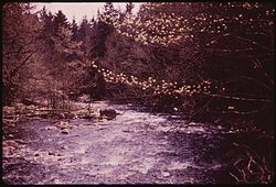
North Branch Moose River in 1973
Location
Country United States
State New York
Physical characteristics
Source Middle Branch Moose River, South Branch Moose River
  location McKeever, New York
Mouth Black River
  location
Lyons Falls, New York
  coordinates
43°36′47″N75°20′12″W / 43.61306°N 75.33667°W / 43.61306; -75.33667
  elevation
849 ft (259 m)
Basin size429 sq mi (1,110 km2)

The Moose River is a mountain waterway in Upstate New York which consists of three branches: the North Branch, the Middle Branch and the South Branch. The outlet of Big Moose Lake forms the North Branch in northern Herkimer County. The Middle Branch originates at the Fulton Chain Lakes in Old Forge. And the Southern Branch has its headwaters in Little Moose Lake in Hamilton County. The North and Middle branches merge in old Forge, New York, then flow a few miles before merging with the South branch, and then becomes just Moose River. It flows generally westwardly through Herkimer County into Lewis County, reaching its confluence with the Black River in Lyons Falls.

Contents

Geography

Owing to its high gradient as it drops out of the mountains, The Moose is a favorite destination for whitewater rafters, kayakers and canoeists. There are three whitewater sections below McKeever with increasing degrees of difficulty. The Middle Moose is a Class II-III section of river from the gaging station in McKeever to Rock Island. The Lower is a Class III-V section from Rock Island to just above Fowlerville Falls, which is run commercially in early spring and includes drops such as Tannery, Froth Hole, Mixmaster and Miller's Falls. The Bottom Moose is a Class V+ section from Fowlerville on. In the Spring and Fall of each year, hundreds of whitewater paddlers descend on the Moose from all parts of the US and eastern Canada. The Bottom Moose (see below), in particular, is a favorite run for paddlers who enjoy Class-V whitewater. This run has several waterfalls, ranging from straightforward and easy to difficult and dangerous.

Also because of its high gradient, there are several hydropower projects along the Moose's course.

See also

Related Research Articles

<span class="mw-page-title-main">Rapids</span> River section with increased velocity and turbulence

Rapids are sections of a river where the river bed has a relatively steep gradient, causing an increase in water velocity and turbulence. Flow, gradient, constriction, and obstacles are four factors that are needed for a rapid to be created.

<span class="mw-page-title-main">Webb, New York</span> Town in New York, United States

Webb is the northernmost town in Herkimer County, New York, United States. As of the 2010 census it had a population of 1,807.

<span class="mw-page-title-main">Whitewater</span> Turbulent and aerated water

Whitewater forms in a rapid context, in particular, when a river's gradient changes enough to generate so much turbulence that air is trapped within the water. This forms an unstable current that froths, making the water appear opaque and white.

<span class="mw-page-title-main">Snoqualmie River</span> River in northwest Washington, United States

The Snoqualmie River is a 45-mile (72 km) long river in King County and Snohomish County in the U.S. state of Washington. The river's three main tributaries are the North, Middle, and South Forks, which drain the west side of the Cascade Mountains near the town of North Bend and join near the town of Snoqualmie just above the Snoqualmie Falls. After the falls the river flows north through rich farmland and the towns of Fall City, Carnation, and Duvall before meeting the Skykomish River to form the Snohomish River near Monroe. The Snohomish River empties into Puget Sound at Everett. Other tributaries of the Snoqualmie River include the Taylor River and the Pratt River, both of which enter the Middle Fork, the Tolt River, which joins at Carnation, and the Raging River at Fall City.

<span class="mw-page-title-main">Youghiogheny River</span> River in Pennsylvania, West Virginia and Maryland, U.S.

The Youghiogheny River, or the Yough for short, is a 134-mile-long (216 km) tributary of the Monongahela River in the U.S. states of West Virginia, Maryland, and Pennsylvania. It drains an area on the west side of the Allegheny Mountains northward into Pennsylvania, providing a small watershed in extreme western Maryland into the tributaries of the Mississippi River. Youghiogheny is a Lenape word meaning "a stream flowing in a contrary direction".

<span class="mw-page-title-main">Cheat River</span> River in West Virginia, United States

The Cheat River is a 78.3-mile-long (126.0 km) tributary of the Monongahela River in eastern West Virginia and southwestern Pennsylvania in the United States. Via the Ohio River, the Cheat and Monongahela are part of the Mississippi River watershed. Owing to the ruggedness of the surrounding Allegheny Mountains, the Cheat remains largely remote with few settlements or developments along its banks. Its headwaters are in the Cheat-Potomac Ranger District of the Monongahela National Forest.

<span class="mw-page-title-main">Black River (New York)</span> River in New York state, United States

The Black River is a 125-mile-long (201 km) blackwater river that empties into the eastern end of Lake Ontario on the shore of Jefferson County, New York in the United States. The origin of the name is not clear, but it may stem from the natural tannic acid that darkens the water in places. The river flows in a generally northwest direction, with its valley dividing the Adirondack Mountains on the east from the Tug Hill region to the west.

<span class="mw-page-title-main">Payette River</span> River in Idaho

The Payette River is an 82.7-mile-long (133.1 km) river in southwestern Idaho and is a major tributary of the Snake River.

<span class="mw-page-title-main">Nantahala River</span> Stream in North Carolina, USA

The Nantahala River is a river in western North Carolina in the United States, within the Nantahala National Forest, and near the Great Smoky Mountains National Park. Two-lane U.S. Highway 19/74 runs along the river, picnic areas dotting the route. In 1839, this was an unimproved large path, part of what became known as the Trail of Tears as the Cherokee people were forcibly removed from their homelands in this region to west of the Mississippi River and Indian Territory.

<span class="mw-page-title-main">Saranac River</span> River in New York, United States

Saranac River is an 81-mile-long (130 km) river in the U.S. state of New York.

<span class="mw-page-title-main">Savage River (Maryland)</span>

The Savage River is a 29.5-mile-long (47.5 km) river in Garrett County, Maryland, and is the first major tributary of the North Branch Potomac River from its source. The river was named for 18th century surveyor John Savage.

<span class="mw-page-title-main">Beaver River (New York)</span> River in New York, United States

The Beaver River is a small mountain stream which flows from the Adirondack Mountains to the Black River at Naumburg, north of Lowville in northwestern New York. The Beaver flows through parts of Hamilton, Herkimer, and Lewis counties. Its source is Lake Lila in Long Lake.

<span class="mw-page-title-main">Green River (North Carolina)</span> Stream in North Carolina, USA

The Green River is a dam-release river that flows through the mountains of North Carolina, south of Asheville. The Green has numerous tributaries, but much of its water flows from a confluence with Big Hungry Creek. The Green River is itself a tributary of the Broad River. The river is dammed to form Lake Summit, in Tuxedo, North Carolina, and Lake Adger near Mill Spring, NC. The Green River is named for its deep green color but runs brown after heavy rains.

<span class="mw-page-title-main">Kettle River (St. Croix River tributary)</span> River in Minnesota, United States

The Kettle is an 83.6-mile-long (134.5 km) tributary of the St. Croix River in eastern Minnesota in the United States. Via the St. Croix River, it is part of the watershed of the Mississippi River. The river's English name is due to the large number of large rounded holes (kettles) in the sandstone in and around the river, carved out by the swirling waters of the river. The river's Dakota name Céġa watpa entered into English via the Anishinaabe people's Akiko-ziibi, both meaning "Kettle River".

<span class="mw-page-title-main">Dead River (Kennebec River tributary)</span> River in the United States

The Dead River, sometimes called the West Branch, is a 42.6-mile-long (68.6 km) river in central Maine in the United States. Its source is Flagstaff Lake, where its two main tributaries, South Branch Dead River and North Branch Dead River, join. It flows generally east to join the Kennebec River at The Forks, Maine.

The Independence River is a small mountain stream which originates near the western edge of Adirondack Park. Situated north of the Moose River and south of the Beaver River, it begins in Herkimer County and flows west into Lewis County, toward its confluence with the Black River in Watson, north of Lyons Falls and just south of Lowville.

<span class="mw-page-title-main">Whitewater canoeing</span> Paddling a canoe on a moving body of water

Whitewater canoeing is the sport of paddling a canoe on a moving body of water, typically a whitewater river. Whitewater canoeing can range from simple, carefree gently moving water, to demanding, dangerous whitewater. River rapids are graded like ski runs according to the difficulty, danger or severity of the rapid. Whitewater grades range from I or 1 to VI or 6. Grade/Class I can be described as slightly moving water with ripples. Grade/Class VI can be described as severe or almost unrunnable whitewater, such as Niagara Falls.

<span class="mw-page-title-main">Boonton Gorge</span>

The Boonton Gorge is a river gorge in Boonton, New Jersey where the Rockaway River drops over several waterfalls, and travels for slightly over a mile before emptying into the Jersey City Reservoir.

The South Branch Moose River is a river located in Herkimer County, New York. The river starts at Little Moose Lake. South of Old Forge, New York the South Branch and Middle Branch join to become Moose River. Limekiln Falls is located on the South Branch Moose River.

References