Moot Hall, Keswick

Last updated

The Moot Hall
Moot Hall, Keswick - geograph.org.uk - 609044.jpg
The Moot Hall
Location Keswick
Coordinates 54°36′2″N3°8′14″W / 54.60056°N 3.13722°W / 54.60056; -3.13722 Coordinates: 54°36′2″N3°8′14″W / 54.60056°N 3.13722°W / 54.60056; -3.13722
Built1813
Listed Building – Grade II*
Designated2 October 1951
Reference no.1137345
Location map United Kingdom Allerdale.svg
Red pog.svg
The Moot Hall
Location in Allerdale, Cumbria
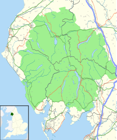
Lake District National Park UK location map.svg
Red pog.svg
The Moot Hall

The Moot Hall is a prominent historic building situated at the southern end of Main Street in Keswick, Cumbria, England. It is Grade II* listed. [1]

Contents

History

The hall has its origins in a medieval courthouse, used by the manor of Castlerigg and Derwentwater, which was in the ownership of the Radclyffe family by the 16th century. [2] Richard Dudley, of Yanwath, acting as the local overseer on behalf of the "Company of Mines Royal", took a lease on the building from Lady Catherine Radclyffe of Derwentwater, the wife of Sir George Radclyffe of Derwentwater (1517-1579), [3] in 1570. [2] Dudley converted it into a storehouse for "weighing and keeping copper". [2] He wrote to the Secretary of State, Sir William Cecil, in October 1570 to report that the works were ongoing and it appears that those works, which involved "pulling down of the old house", were completed the following year. [4]

The upper floor continued to be used as the manorial courtroom while the ground floor was used to store the copper from the mines; once demand for copper reduced, the ground floor was used as a market hall. [2] After the building fell into a dilapidated condition, it was thought to have been rebuilt with stones from the remains of the Radclyffe mansion on Lord's Island in 1695. [5] The freehold ownership of the building passed to the James Radclyffe, 3rd Earl of Derwentwater on the death of his father in 1705; however after James Radclyffe was executed for his involvement in the Jacobite rising of 1715, his property was seized and passed to the trustees of Greenwich Hospital. [6]

The current structure, built of lime-washed stone and slate walling, was commissioned by the trustees of Greenwich Hospital in 1813. [1] [7] It was designed with a square tower on the north end with a round-arched doorway and a double flight of steps inside and with what the Keswick Tourist Information Board describes as an "unusual one-handed clock" at the top. [8] The clock, attributed to Richard Young of Newcastle, [9] is dated 1814; it strikes the hours on a bell which (along with the weather vane on the roof) is said to have come from Lord's Island on Derwentwater. [6]

The Marshall family acquired the building from the trustees of Greenwich Hospital in 1832. [10] It became home to the Keswick Museum of Local and Natural History, a creation of the Keswick Literary and Scientific Society, in 1873. [6] The museum collection included a three-dimensional model of the Lake District, measuring 12 feet by 9 feet, made by Joseph and James Flintoft in 1837. [6] The building was used for civic assemblies [11] and meetings of the Keswick Urban District Council after it was formed in 1894: the local council acquired the building from the Marshall family in 1896, and the museum moved out to purpose-built facilities in Station Road in 1897. [6] However, it ceased to be the local seat of government when the Allerdale Borough Council was formed in 1974. [12] In the late-1970s a Tourist Information Centre was established on the ground floor, [6] while an art gallery was created on the floor above. [13]

As a central landmark in Keswick, the Moot Hall is used as the official start and/or finish point for various challenge events including the Bob Graham Round [14] and runs visiting all the 214 Wainwrights. [15]

Related Research Articles

<span class="mw-page-title-main">Derwentwater</span> Lake in the Lake District, Cumbria, England

Derwentwater or Derwent Water, is one of the principal bodies of water in the Lake District National Park in north west England. It lies wholly within the Borough of Allerdale, in the county of Cumbria.

<span class="mw-page-title-main">Keswick, Cumbria</span> Town in the Lake District, England

Keswick is a market town and civil parish in Cumbria, England. Historically, until 1974, it was part of Cumberland. It lies within the Lake District National Park, Keswick is just north of Derwentwater and is four miles from Bassenthwaite Lake. It had a population of 5,243 at the 2011 census.

<span class="mw-page-title-main">Appleby-in-Westmorland</span> Market town in Cumbria, England

Appleby-in-Westmorland is a market town and civil parish in Westmorland and Furness, Cumbria, England, with a population of 3,048 at the 2011 Census. Crossed by the River Eden, Appleby was the county town of the historic county of Westmorland. It was known just as Appleby until 1974–1976, when the council of the successor parish to the borough changed it to retain the name Westmorland, which was abolished as an administrative area under the Local Government Act 1972, before being revived as Westmorland and Furness in 2023. It lies 14 miles (23 km) south-east of Penrith, 32 miles (51 km) south-east of Carlisle, 27 miles (43 km) north-east of Kendal and 45 miles (72 km) west of Darlington.

<span class="mw-page-title-main">Alston, Cumbria</span> Town in England

Alston is a town in Westmorland and Furness, Cumbria, England, within the civil parish of Alston Moor on the River South Tyne. It shares the title of the 'highest market town in England', at about 1,000 feet (300 m) above sea level, with Buxton, Derbyshire. Despite its altitude, the town is easily accessible via the many roads which link the town to Weardale, Teesdale, and towns in Cumbria such as Penrith via Hartside Pass, as well as Tynedale. Historically part of Cumberland, Alston lies within the North Pennines, a designated Area of Outstanding Natural Beauty. Much of the town centre is a designated Conservation Area which includes several listed buildings.

<span class="mw-page-title-main">Skiddaw</span> Mountain in the Lake District, England

Skiddaw is a mountain in the Lake District National Park in England. Its 931-metre (3,054 ft) summit is the sixth-highest in England. It lies just north of the town of Keswick, Cumbria, and dominates the skyline in this part of the northern lakes. It is the simplest of the Lake District mountains of this height to ascend and, as such, many walking guides recommend it to the occasional walker wishing to climb a mountain. This is the first summit of the fell running challenge known as the Bob Graham Round when undertaken in a clockwise direction.

<span class="mw-page-title-main">Earl of Derwentwater</span>

Earl of Derwentwater was a title in the Peerage of England. It was created in 1688 for Sir Francis Radclyffe, 3rd Baronet. He was made Baron Tyndale, of Tyndale in the County of Northumberland, and Viscount Radclyffe and Langley at the same time, also in the Peerage of England. He was succeeded by his son, the second Earl, who married Lady Mary Tudor, daughter of Charles II by his mistress Moll Davis.

<span class="mw-page-title-main">Borrowdale</span> Human settlement in England

Borrowdale is a valley and civil parish in the English Lake District in Cumbria, England. It lies within the historic county boundaries of Cumberland. It is sometimes referred to as Cumberland Borrowdale to distinguish it from another Borrowdale in the historic county of Westmorland.

<span class="mw-page-title-main">Keswick Museum</span>

Keswick Museum is a local museum based in Keswick in the English Lake District, which exhibits aspects of the landscape, history and culture of the area.

<span class="mw-page-title-main">Lord's Island</span>

Lord's Island, which is one of the seven islands on Derwent Water in Keswick, Cumbria, England, got its name from the Earls of Derwentwater who used to live here. Not only was there a fine house on this island but it also had a drawbridge which was used to cross to the mainland.

<span class="mw-page-title-main">Underskiddaw</span> Civil parish in Cumbria, England

Underskiddaw is a civil parish in the Borough of Allerdale in the English county of Cumbria. The parish lies immediately to the north of the town of Keswick, and includes the southern and eastern flanks of Skiddaw as well as part of the valley of the rivers Greta and Derwent, and a small part of Bassenthwaite Lake. The parish includes the settlements of Applethwaite, Millbeck and Ormathwaite, all of which lie along the line where the southern slopes of Skiddaw meet the valley.

<span class="mw-page-title-main">Portinscale</span> Human settlement in England

Portinscale is a village in Cumbria, England, close to the western shore of Derwentwater in the Lake District National Park 1+12 miles from Keswick.

<span class="mw-page-title-main">Barrow House, Cumbria</span> Late eighteenth-century manssion in the Lake District, England

Barrow House is a late 18th-century mansion situated on the eastern shore of Derwentwater in Borrowdale within the Lake District National Park, in the county of Cumbria, England. The house is a Grade II listed building which since the time of its construction has had various uses, it was originally a private dwelling and has since served as a hotel, a youth hostel run by the YHA and is now an independent hostel.

<span class="mw-page-title-main">County Offices, Kendal</span> County building in Kendal, Cumbria, England

The County Offices, formerly Westmorland County Hall, is a municipal building in Stricklandgate, Kendal, Cumbria, England. The structure, which was the headquarters of Westmorland County Council from 1939 to 1974, is a Grade II listed building.

<span class="mw-page-title-main">Kendal Town Hall</span> Municipal building in Kendal, Cumbria, England

The Town Hall is a municipal building in Highgate, Kendal, Cumbria. It is a Grade II listed building. It serves as the headquarters of Kendal Town Council and also forms part of the complex of buildings which served as the headquarters of the former South Lakeland District Council.

<span class="mw-page-title-main">Old Town Hall, Carlisle</span> Municipal building in Carlisle, Cumbria, England

The Old Town Hall is a municipal building in the Market Place, Carlisle, England. It is a Grade I listed building.

<span class="mw-page-title-main">Alston Town Hall</span> Municipal building in Alston, Cumbria, England

Alston Town Hall is a municipal building in Front Street, Alston, Cumbria, England. The town hall, which is currently used as a public library, is a Grade II listed building.

<span class="mw-page-title-main">Moot Hall, Appleby-in-Westmorland</span> Municipal building in Appleby-in-Westmorland, Cumbria, England

The Moot Hall is a municipal building in Boroughgate, Appleby-in-Westmorland, Cumbria, England. The building, which is currently used as the meeting place of Appleby-in-Westmorland Town Council, is a Grade II* listed building.

<span class="mw-page-title-main">Shire Hall, Appleby-in-Westmorland</span> Judicial building in Appleby-in-Westmorland, Cumbria, England

The Shire Hall is a municipal building in The Sands, Appleby-in-Westmorland, Cumbria, England. The shire hall, which is currently used as a dental surgery and business centre, is a Grade II listed building.

<span class="mw-page-title-main">Moot Hall, Brampton</span> Judicial building in Brampton, Cumbria, England

The Moot Hall is a municipal building in The Market Place in Brampton, Cumbria, England. The building, which is used as a local tourist information office and as a meeting place for Brampton Parish Council, is a Grade II* listed building.

References

  1. 1 2 Historic England. "The Moot Hall, Keswick (1137345)". National Heritage List for England . Retrieved 22 April 2020.
  2. 1 2 3 4 "A new look for an old landmark". Cumberland and Westmorland Herald. 12 May 2001. Retrieved 1 August 2020.
  3. "Radclyffe of Derwentwater". Tudor Place. Retrieved 1 August 2020.
  4. Tyson, Blake (1995). "Rebuilding the Medieval Court-House at Keswick in 1571" (PDF). Cumberland and Westmorland Antiquarian and Archaeological Society. pp. 119–136. Retrieved 1 August 2020.
  5. Otley, p. 64
  6. 1 2 3 4 5 6 "Moot Hall". Lake District National Park. Retrieved 1 August 2020.
  7. Pevsner, Nikolaus (1967). Cumberland and Westmorland (Buildings of England Series). Yale University Press. p. 34. ISBN   978-0300095906.
  8. "Explore Keswick on Derwentwater". Keswick.org. Retrieved 1 August 2020.
  9. "Moot Hall clock, Keswick". Civic Time. Retrieved 18 April 2023.
  10. "Keswick". Cumbria County History Trust. Retrieved 1 August 2020.
  11. Dalton, p.624
  12. Local Government Act 1972. 1972 c.70. The Stationery Office Ltd. 1997. ISBN   0-10-547072-4.
  13. "Keswick Tourist Information Centre". Visit Cumbria. Retrieved 31 August 2014.
  14. "The Bob Graham 24 Hour Club". www.bobgrahamclub.org.uk. Retrieved 23 October 2022.
  15. Smith, Bob (24 December 2019). "Six days, six hours, four minutes: how Paul Tierney broke the Wainwrights running record". www.grough.co.uk. Retrieved 23 October 2022.

Sources