
Chintalavalasa is a census town in Vizianagaram district of the Indian state of Andhra Pradesh. It is located in Denkada mandal of Vizianagaram revenue division.

Gajapathinagaram is a census town in Vizianagaram district of the Indian state of Andhra Pradesh. It is located in Gajapathinagaram mandal of Vizianagaram revenue division. It is located on National Highway 26 between Vizianagaram and Ramabhadrapuram.
Jarajapupeta is a census town in Vizianagaram district of the Indian state of Andhra Pradesh. It is located in Nellimarla mandal of Vizianagaram revenue division.
Kanapaka is a census town in Vizianagaram district in the Indian state of Andhra Pradesh.
Kandukur or Kandukuru is a town in Prakasam district of the Indian state of Andhra Pradesh. It is a municipality and the mandal headquarters of Kandukur mandal in Kandukur revenue division.
Kantabamsuguda is a census town in Visakhapatnam district of the Indian state of Andhra Pradesh. It is the headquarters of Araku Valley mandal.

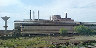
Kothavalasa is a census town in Vizianagaram district of the Indian state of Andhra Pradesh. It is located in Kothavalasa mandal of Vizianagaram revenue division. It is located 30 km from City Visakhapatanam
Narayanavanam is a census town in Chittoor district of the Indian state of Andhra Pradesh. It is the mandal headquarters of Narayanavanam mandal in Chittoor revenue division. The town is known for Kalyana Venkateswara Temple dedicated to Lord Venkateswara and was constructed in the year 1541 AD.
Papampeta is a census town in Anantapur district of the Indian state of Andhra Pradesh. It is located in Anantapur mandal of Anantapur revenue division. The town is a constituent of Anantapur urban agglomeration.
Ramanayyapeta is a census town in East Godavari district of the Indian state of Andhra Pradesh. It is located in Kakinada (rural) mandal of Kakinada revenue division. The town is a constituent of Kakinada urban agglomeration.
Rayachoty or "Rachaveedu" or "Rayachoti" or "Rajaveedu" is a town in Kadapa district of the Indian state of Andhra Pradesh. It is a municipality in Rayachoty mandal of Kadapa revenue division. It is one of the oldest town in Andhra Pradesh. Rayachoty is famous for thousand years old The Lord Sri Veerabhadra Swamy temple.it is also called Dakshina Kaasi.this is build on bank of Mandavya river. Rayachoti is the 3rd biggest town after Kadapa and Proddatur towns in Kadapa district. It is the one of major Educational Hub in the district. Recently state government announced that Rayachoti is the part of Annamayya Urban Development Agency, it is the good sign for growth of this region. Uniqueness of this temple is that Daksha Prajapati appears in worshiping form of the Lord Veerabhadra.

Rayadurga is a town in Anantapur district of the Indian state of Andhra Pradesh. It is the headquarters of Rayadurgam mandal in Kalyandurg revenue division. The town is renowned for its Handloom industry.
Sriramnagar is a census town in Vizianagaram district of the Indian state of Andhra Pradesh. It is located in Garividi mandal of Vizianagaram revenue division.
Srishailam or Srisailam is a census town in Kurnool district of the Indian state of Andhra Pradesh. It is the mandal headquarters of Srisailam mandal in Kurnool revenue division. The town is famus for Mallikarjuna Jyotirlinga Temple and is one of the holy pilgrimage site for Saivism and Shaktism sects of Hinduism. The town is classified as both Jyotirlinga and Shakti Peetha.
Suryaraopeta is a census town in East Godavari district of the Indian state of Andhra Pradesh. It is located in Kakinada (rural) mandal of Kakinada revenue division. The town is a constituent of Kakinada urban agglomeration.
Uravakonda is a census town in Anantapur district of the Indian state of Andhra Pradesh. It is the headquarters of Uravakonda mandal in Anantapur revenue division. The town is a constituent of urban agglomeration.
Vetapalem is a census town in Prakasam district of the Indian state of Andhra Pradesh. It is the mandal headquarters of Vetapalem mandal in Ongole revenue division.

Nagari is a town in Chittoor district of the Indian state of Andhra Pradesh. It is the mandal headquarters of Nagari mandal in Chittoor revenue division.
Rameswaram is a census town in Cuddapah district in the Indian state of Andhra Pradesh.
Vaddeswaram is a census town in Guntur district of the Indian state of Andhra Pradesh. It is located at a distance of 5 km (3.1 mi) from Krishna River, in Tadepalle mandal of Guntur revenue division.


