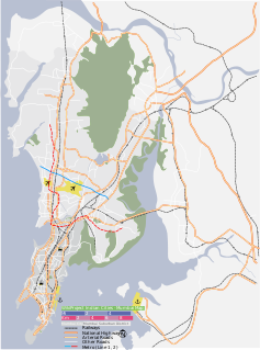
Navi Mumbai, also known by its former name New Bombay, is the largest planned city in the entire world, situated on the west coast of the Indian subcontinent, Maharashtra in Konkan division, on the mainland of India. The city is divided into two parts, North Navi Mumbai and South Navi Mumbai, for the individual development of Panvel Mega City, which includes the area from Kharghar to Uran, including Taloja and Old Panvel nodes strictly in the city of Navi Mumbai. Navi Mumbai has a population of 1,119,477 as per the 2011 provisional census. It has an average city elevation of 14 meters, excluding forest area.

The Daman Ganga also called Dawan River is a river in western India. The river's headwaters are on the western slope of the Western Ghats range, and it flows west into the Arabian Sea. The river flows through Maharashtra and Gujarat states, as well as the Union territory of Dadra and Nagar Haveli and Daman and Diu. The industrial towns of Vapi, Dadra and Silvassa lie on the north bank of the river, and the town of Daman occupies both banks of the river's estuary.

Panshet Dam, also called Tanajisagar Dam, is a dam on the Ambi river, a tributary of the Mutha River, about 50 km (31 mi) southwest of the city of Pune in western India. The dam was constructed in late 1950s for irrigation and, along with three other dams nearby, Varasgaon, Temghar and Khadakwasla, it supplies drinking water to Pune.

Bhatsa Dam, is an earthfill and gravity dam on Bhatsa river near Shahapur, Thane district in state of Maharashtra in India.

Ujjani Dam, also known as Bhima Dam or Bhima Irrigation Project, on the Bhima River, a tributary of the Krishna River, is an earthfill cum Masonry gravity dam located near Ujjani village of Madha Taluk in Solapur district of the state of Maharashtra in India.

Waghur Dam is an earthfill dam located on the Waghur River near Kandari and Varadsim, Jalgaon district in the Indian state of Maharashtra.

Vihar dam, is an earthfill dam on Vihar river in Mumbai, near Bhandup in the state of Maharashtra in India.

Tulshi dam, is an earthfill and gravity dam on Tulshi river in Mumbai near Mulund in the state of Maharashtra in India.

Tansa dam, is an earthfill and gravity dam on Tansa river near Mumbai, Thane district in the state of Maharashtra in India. The dam is one of the seven sources of drinking water to the city of Mumbai.

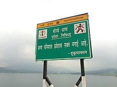
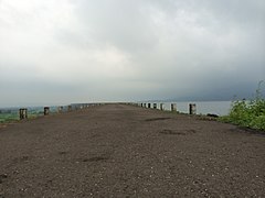
Vaitarna Dam, also called Modaksagar Dam, is a Gravity dams on Vaitarna river which supplies water to Palghar, Mumbai, but located in Palghar & Nashik district in the state of Maharashtra in India. It was opened in 1957.

Pujaritola Dam is an earthfill and gravity dam on Bagh river near Amgaon, Gondia district in the state of Maharashtra in India.

Mula Dam is an earthfill and gravity dam on Mula river near Rahuri in Ahmednagar district of the state of Maharashtra in India.

Upper Vaitarana Dam, is an earthfill and gravity dam on west flowing Vaitarna river near Igatpuri, Nashik district of Maharashtra state in India. The reservoir created by this dam spreads on both Vaitarna and Godavari rivers catchment area.

Adhala Dam, is an earthfill dam on Adhala river near Akole, Deothan, Ahmednagar district in state of Maharashtra in India.

Dhom Dam is an earthfill and gravity dam on Krishna river near Wai in state of Maharashtra in India. Its co-ordinates are 17.9815° N, 73.7954° E.

Shahanoor Dam, is an earthfill dam on Shahanoor river near Anjangaon Surji, Amravati district in the state of Maharashtra in India.

The Upper Wardha Dam is an earthfill straight gravity dam across the Wardha River, a tributary of the Godavari River, near Simbhora village in Morshi taluk in Amravati district in the Indian state of Maharashtra. The dam provides multipurpose benefits of irrigation, drinking water supply, flood control and hydropower generation.
Hetwane Dam, is an earthfill dam on Bhogeshwari river near Pen, Raigad district in the state of Maharashtra in India.

Chargad Dam, is an earthfill dam on Chargad river near Amravati in state of Maharashtra in India.

Purna Dam, is an earthfill dam on Purna river near Amravati in the state of Maharashtra in India.


