
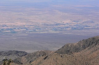
Mesquite is a city in Clark County, Nevada, United States adjacent to the Arizona state line and 80 miles (130 km) northeast of Las Vegas on Interstate 15. As of the 2020 census, the city had a population of 20,471. The city is located in the Virgin River valley adjacent to the Virgin Mountains in the northeastern part of the Mojave Desert. It is home to a growing retirement community, as well as several casino resorts and golf courses.

Michael Heizer is an American land artist specializing in large-scale and site-specific sculptures. Working largely outside the confines of the traditional art spaces of galleries and museums, Heizer has redefined sculpture in terms of size, mass, gesture, and process. A pioneer of 20th-century land art or Earthworks movement, he is widely recognized for sculptures and environmental structures made with earth-moving equipment, which he began creating in the American West in 1967. He currently lives and works in Hiko, Nevada, and New York City.
Double Negative is a piece of land art located in the Moapa Valley on Mormon Mesa near Overton, Nevada. Double Negative was created in 1969 by artist Michael Heizer, and consists of a trench dug into the earth.

St. Thomas, Nevada is a ghost town in Clark County, Nevada, United States, near where the Muddy River flows into the Colorado River. St. Thomas was purchased by the US Federal Government and abandoned as the waters of Lake Mead submerged the town in the 1930s.
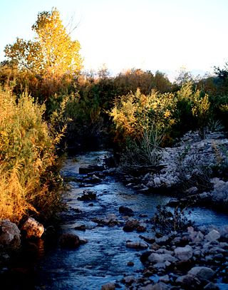
The Muddy River, formerly known as the Moapa River, is a short river located in Clark County, in southern Nevada, United States. It is in the Mojave Desert, approximately 60 miles (97 km) north of Las Vegas.
The Fish Slough Area of Critical Environmental Concern is a protected slough in Inyo County, eastern California. It is located on the western side of the Chalfant Valley, 5 miles (8.0 km) north of Bishop in the northern Owens Valley area.

The Jawbone–Butterbredt Area of Critical Environmental Concern (ACEC), is located in the Mojave Desert and Southern Sierra Nevada, northwest of California City and California State Route 14, in Kern County, California.

The Mojave Road, also known as Old Government Road, is a historic route and present day dirt road across what is now the Mojave National Preserve in the Mojave Desert in the United States. This rough road stretched 147 miles (237 km) from Beale's Crossing, to Fork of the Road location along the north bank of the Mojave River where the old Mojave Road split off from the route of the Old Spanish Trail/Mormon Road.
The Beaver Dam Wash is a seasonal stream near the southwestern Utah-Nevada border in the United States. At its southern end in northern Arizona, near the point where it empties into the Virgin River, the stream flows throughout the year. Part of the wash is in the Beaver Dam Wash National Conservation Area, managed by the Bureau of Land Management. The wash was so named on account of beaver dams which once were built on its course.

The Warm Springs Natural Area, also known as the Warm Springs Ranch, is located near the Moapa Indian Reservation in Clark County, Nevada, at an elevation of 2,123 feet (647 m). The 1,179-acre (477 ha) area is owned by the Southern Nevada Water Authority (SNWA). The area is a natural oasis in the Mojave Desert. The oasis is fed by close to 24 natural warm springs and contains many naturally occurring California fan palms, creating an ecosystem normally limited to the "low" Colorado Desert and so unique to the "high" Mojave Desert. The springs are the headwaters for the Muddy River.
Areas of Critical Environmental Concern (ACEC) is a conservation ecology program in the Western United States, managed by the Bureau of Land Management (BLM). The ACEC program was conceived in the 1976 Federal Lands Policy and Management Act (FLPMA), which established the first conservation ecology mandate for the BLM. The FLPMA mandate directs the BLM to protect important riparian corridors, threatened and endangered species habitats, cultural and archeological resources, as well as unique scenic landscapes that the agency assesses as in need of special management attention.
The Virgin Valley is a valley in northwest Arizona and southeast Nevada on the Virgin River. The Virgin River drains southwest Utah and southeast Nevada; parts of Arizona, especially the Arizona Strip region drain southwards into the Virgin River and Valley.

Callville Bay is a waterway on the northwestern side of Lake Mead in the U.S. state of Nevada. It has a marina and camping resort. Situated east of Las Vegas and upstream from Las Vegas Bay, it lies within the Lake Mead National Recreation Area, which was established in 1935. Its name derives from the settlement of Callville which was established in 1865 by Anson Call under a directive led by Brigham Young. Though the settlement was abandoned in 1869, and submerged under Lake Mead when the Colorado River was dammed, Callville Bay retained the name.

Callville is a former settlement of Clark County in the U.S. state of Nevada. Abandoned in 1869, it was submerged under Lake Mead when the Colorado River was dammed, Callville Bay retaining the name. At one time, it was noted to be the southernmost outpost of the Mormon settlement.

Little Finland is a scenic red rock area, located in a remote section of Clark County, Nevada, south of Mesquite, known for its red rock scenery and strangely-shaped, delicate rock formations. The landscape is similar to Valley of Fire State Park, which is about 20 miles (32 km) to the west, across Lake Mead. The rock formations are composed of red Aztec Sandstone, fossil sand dunes. Many of the features are small erosional fins, hence the name.
Stone's Ferry is a former settlement founded by members of the Church of Jesus Christ of Latter-day Saints and ferry crossing of the Colorado River between Nevada and Arizona, in Clark County, Nevada, United States.
California Wash is an arroyo tributary to the Muddy River, in Clark County, Nevada. Its mouth is at its confluence with the Muddy River over a mile southwest of Moapa and a mile and a half west of Glendale, Nevada. Its source is at an elevation of 3320 feet at the southwestern end of the Muddy Mountains, at 36°17′14″N114°48′09″W. From there it drains northeastward to its mouth on the Muddy River.
Virgin Hill is a summit in Clark County, Nevada. It rises to an elevation of 1,808 feet / 551 meters.
Toquop Wash is a stream in Clark County, and Lincoln County, Nevada. Its mouth is at its confluence with the Virgin River at an elevation of 1,470 feet (450 m) in Clark County. Its source is at 37°02′25″N114°18′49″W at an elevation of 2,920 feet (890 m), above Toquop Gap between the East Mormon Mountains and Tule Springs Hills, at the confluence of Garden Wash and Sams Camp Wash in Lincoln County.
Mormon Road, also known to the 49ers as the Southern Route, of the California Trail in the Western United States, was a seasonal wagon road pioneered by a Mormon party from Salt Lake City, Utah led by Jefferson Hunt, that followed the route of Spanish explorers and the Old Spanish Trail across southwestern Utah, northwestern Arizona, southern Nevada and the Mojave Desert of California to Los Angeles in 1847. From 1855, it became a military and commercial wagon route between California and Utah, called the Los Angeles – Salt Lake Road. In later decades this route was variously called the "Old Mormon Road", the "Old Southern Road", or the "Immigrant Road" in California. In Utah, Arizona and Nevada it was known as the "California Road".
