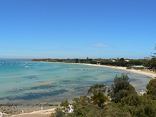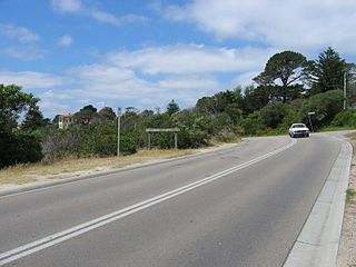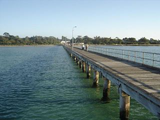
The Mornington Peninsula is a peninsula located south of Melbourne, Victoria, Australia. It is surrounded by Port Phillip to the west, Western Port to the east and Bass Strait to the south, and is connected to the mainland in the north. Geographically, the peninsula begins its protrusion from the mainland in the area between Pearcedale and an area north of Frankston. The area was originally home to the Mayone-bulluk and Boonwurrung-Balluk clans and formed part of the Boonwurrung nation's territory prior to European settlement.

The Shire of Cardinia is a local government area in Victoria, Australia, in the south-east of Melbourne between Western Port and the Yarra Ranges on the outskirts of Melbourne. It has an area of 1,283 square kilometres, and had a population of 107,120 in June 2018.

Sorrento is a coastal town on the Mornington Peninsula in Melbourne, Victoria, Australia, 61 km (38 mi) south-west of Melbourne's Central Business District, located within the Shire of Mornington Peninsula local government area. Sorrento recorded a population of 2,013 at the 2021 census.

Frankston is a suburb in Melbourne, Victoria, Australia, 41 km (25 mi) south-east of Melbourne's Central Business District, located within the City of Frankston local government area. Frankston recorded a population of 37,331 at the 2021 census.

Baxter is a township and rural locality beyond the Urban Growth Boundary in Victoria, Australia, 48 km (30 mi) south-east of Melbourne's Central Business District, located within the Shire of Mornington Peninsula local government area. Baxter recorded a population of 2,166 at the 2021 census.

Mount Eliza is a seaside suburb on the Mornington Peninsula in Melbourne, Victoria, Australia, 42 km (26 mi) south-east of Melbourne's Central Business District, located within the Shire of Mornington Peninsula local government area. Mount Eliza recorded a population of 18,734 at the 2021 census.

Mount Martha is a suburb on the Mornington Peninsula in Melbourne, Victoria, Australia, 50 kilometres (31 mi) south-east of Melbourne's Central Business District, located within the Shire of Mornington Peninsula local government area. Mount Martha recorded a population of 19,846 at the 2021 census.

Rosebud is a seaside town on the Mornington Peninsula in Melbourne, Victoria, Australia, approximately 61 km (38 mi) south of Melbourne's Central Business District, located within the Shire of Mornington Peninsula local government area. Rosebud recorded a population of 14,381 at the 2021 census.

Safety Beach is a seaside town on the Mornington Peninsula in Melbourne, Victoria, Australia, 56 km (35 mi) south of Melbourne's Central Business District, located within the Shire of Mornington Peninsula local government area. Safety Beach recorded a population of 6,328 at the 2021 census.

Frankston railway station, in Victoria, Australia, is the terminus of the suburban electrified Frankston line and diesel-hauled services on the Stony Point line. It serves the south-eastern Melbourne suburb of Frankston, and opened on 1 August 1882.

Nepean Highway is a major highway in Victoria, running south from St Kilda Junction in inner-southern Melbourne to Portsea, tracing close to the eastern shore of Port Phillip for the majority of its length. It is the primary road route from central Melbourne through Melbourne's southern suburbs. This name covers a few consecutive roads and is not widely known to most drivers except for its central section, as the entire allocation is still best known by the names of its constituent parts: St Kilda Road, Brighton Road and Nepean Highway proper, and Point Nepean Road. This article will deal with the entire length of the corridor for sake of completion, as well to avoid confusion between declarations.

Mount Gambier is the second most populated city in South Australia, with an estimated urban population of 33,233 as of 2021. The city is located on the slopes of Mount Gambier, a volcano in the south east of the state, about 450 kilometres (280 mi) south-east of the capital Adelaide and just 17 kilometres (11 mi) from the Victorian border. The traditional owners of the area are the Bungandidj people. Mount Gambier is the most important settlement in the Limestone Coast region and the seat of government for both the City of Mount Gambier and the District Council of Grant.

The Mornington Peninsula Freeway is a freeway in Melbourne, Victoria, Australia, that provides a link from south-eastern suburban Melbourne to the Mornington Peninsula. Whilst the entire freeway from Dingley Village to Rosebud is declared by VicRoads as the Mornington Peninsula Freeway, the section between EastLink in Carrum Downs and Moorooduc Highway in Moorooduc is locally and commonly known as Peninsula Link. The entire freeway corridor bears the designation M11.

Olivers Hill is a locality located in the City of Frankston, Victoria in Australia. It is the first major rise in terrain along the eastern coastline of Port Phillip, between Melbourne and the Mornington Peninsula. It was named after local Frankston fisherman, James Oliver, who built the first cottage atop the hill in the mid-19th century, from where he kept watch for fish in the waters below.

Fawkner Memorial Park is located in the north-western Melbourne suburb of Fawkner, Victoria, Australia. It is the largest cemetery by land size in the state, and managed by Greater Metropolitan Cemeteries Trust.

The Shire of Mornington was a local government area about 50 kilometres (31 mi) south of Melbourne, the state capital of Victoria, Australia, encompassing the western extremity of the Mornington Peninsula. The shire covered an area of 90.65 square kilometres (35.0 sq mi) immediately to the south of Frankston, and existed from 1860 until 1994.
Tuerong is a rural locality on the Mornington Peninsula in Melbourne, Victoria, Australia, 55 km (34 mi) south-east of Melbourne's Central Business District, located within the Shire of Mornington Peninsula local government area. Tuerong recorded a population of 357 at the 2021 census.

Mount Thompson Memorial Gardens and Crematorium includes a heritage-listed chapel, columbaria and other features. It is located on north-western slopes of Mount Thompson in Brisbane, Australia. The street address is Nursery Road in Holland Park. It was established in 1934 as the first crematorium in Queensland.
Gordon Ross Hamilton was an Australian rules footballer who played with South Melbourne in the Victorian Football League (VFL). He was the first South Melbourne player to die on active service in World War II.
Burwood Cemetery is a cemetery in Burwood, Victoria in Australia. It dates back to 1858, and was originally known as Nunawading General Cemetery. It is known as a resting place of notable figures from Melbourne. The site is operated by Greater Metropolitan Cemeteries Trust, who also manage eighteen other cemeteries and memorial parks around Victoria, including Preston Cemetery, Fawkner Memorial Park, Altona Memorial Park and Coburg Pine Ridge Cemetery.


