
San Luis Obispo County, officially the County of San Luis Obispo, is a county on the Central Coast of California. As of the 2020 census, the population was 282,424. The county seat is San Luis Obispo.
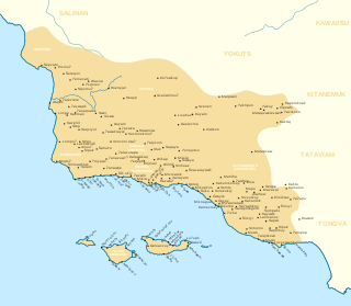
The Chumash are a Native American people of the central and southern coastal regions of California, in portions of what is now San Luis Obispo, Santa Barbara, Ventura and Los Angeles counties, extending from Morro Bay in the north to Malibu in the south. Their territory included three of the Channel Islands: Santa Cruz, Santa Rosa, and San Miguel; the smaller island of Anacapa was likely inhabited seasonally due to the lack of a consistent water source.
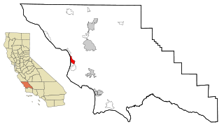
Morro Bay is a seaside city in San Luis Obispo County, California. Located on the Central Coast of California, the city population was 10,757, as of the 2020 census, up from 10,234 at the 2010 census. The town overlooks Morro Bay, a natural embayment with an all-weather small craft commercial and recreational harbor.

San Diego Bay is a natural harbor and deepwater port located in San Diego County, California near the U.S.–Mexico border. The bay, which is 12 miles (19 km) long and 1 to 3 miles wide, is the third largest of the three large, protected natural bays on California's 840 miles (1,350 km) of coastline, after San Francisco Bay and Humboldt Bay. The highly urbanized land adjacent to the bay includes the city of San Diego and four other cities: National City, Chula Vista, Imperial Beach and Coronado.
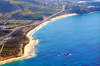
Crystal Cove State Park is a state park of California, United States, encompassing 3.2 miles (5.1 km) of Pacific coastline, inland chaparral canyons, and the Crystal Cove Historic District of beach houses. The park is located in Newport Beach, and is part of the larger South Coast Wilderness area. Crystal Cove is a stretch of coastal cliffs and a beachfront cove situated between the Pacific Coast Highway and the Pacific Ocean just north of Laguna Beach. The 3,936-acre (1,593 ha) park was established in 1979. The entire park hosts a total of 3 miles of beaches and tide pools, a 1,400 acre marine Conservation Area as well as underwater park, 400 acres of bluffs, and 2,400 acres of canyons.
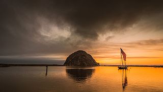
Morro Bay State Park is a state park on the Morro Bay lagoon, in western San Luis Obispo County, on the Central Coast of California. On the lagoon's northeastern and eastern edges in the park, there are saltwater and brackish marshes that support thriving bird populations.

Morro Rock is a volcanic plug in Morro Bay, California, on the Pacific Coast at the entrance to Morro Bay harbor. A causeway connects it with the shore, making it a tied island. The rock is protected as the Morro Rock State Preserve.

Los Osos is an unincorporated town and census-designated place (CDP) in San Luis Obispo County, California. Located on the Central Coast of California, Los Osos had a population estimated to be 16,533 in 2019.

Estero Bay is a bay located on the Pacific Coast in San Luis Obispo County, central California. It is about 15 miles (24 km) from its south end at Point Buchon/Montana de Oro State Park, to its north end at Point Estero, which is about 5 miles (8 km) northwest of Cayucos. It is indented about 5 miles (8 km) into the California coast.

Montaña de Oro is a state park in Central Coastal California, six miles southwest of Morro Bay and two miles south of Los Osos.
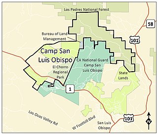
Camp San Luis Obispo is the original home of the California Army National Guard. It served as an Infantry Division Camp and Cantonment Area for the United States Army during World War II.
San Leandro Creek is a 21.7-mile-long (34.9 km) year-round natural stream in the hills above Oakland in Alameda County and Contra Costa County of the East Bay in northern California.

Hearst San Simeon State Park is a state park of California, United States, preserving rocky coast and rare habitats. It is located between Cambria and San Simeon. The 3,409-acre (1,380 ha) park was first established in 1932. The park includes the Santa Rosa Creek Natural Preserve, the San Simeon Natural Preserve and the Pa-nu Cultural Preserve, which were established in 1990.

The Los Osos Valley is a valley within San Luis Obispo County, in the Central Coast of California region.
Morro Creek is a coastal stream in San Luis Obispo County, in the central region of the U.S. state of California. The watercourse flows from the Santa Lucia Mountains to discharge into the Pacific Ocean, at its mouth on Estero Bay, near the city of Morro Bay.

The Elfin Forest Natural Area is a nature preserve protecting a unique plant community in Los Osos-Baywood Park, San Luis Obispo County, central California. It consists of prehistoric sand dunes, rising 150 feet (46 m) above southern Morro Bay, on the north of Los Osos-Baywood Park.
Los Osos Back Bay is a prehistoric Chumash archaeological site in the Los Osos Valley, near the coast in San Luis Obispo County, California.

Morro Bay State Marine Recreational Management Area (SMRMA) and Morro Bay State Marine Reserve (SMR) are two marine protected areas that provide protection for Morro Bay Estuary on California's central coast. The two marine protected areas together encompass 3.31 square miles (8.6 km2). Within the SMRMA, fishing and take of any living marine resources is prohibited except that north of latitude 35° 19.70′ N the recreational take of finfish and aquaculture of oysters, pursuant to a valid state water bottom lease and permit, is permitted. And recreational hunting of waterfowl is allowed unless otherwise restricted by hunting regulations. The SMR protects all marine life within its boundaries. Fishing and take of any living marine resources is prohibited.

The Water Quality Control Policy for the Enclosed Bays and Estuaries of California is published by the California State Water Resources Control Board as guidelines to prevent water quality degradation. The policy is revised as needed.
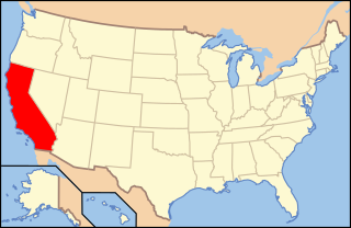
Paleontology in California refers to paleontologist research occurring within or conducted by people from the U.S. state of California. California contains rocks of almost every age from the Precambrian to the Recent. Precambrian fossils are present but rare in California.


