
South Bay is a 11.6 kilometres (7.2 mi) wide bay indenting for 12.5 kilometres (7.8 mi) the south coast of Livingston Island in the South Shetland Islands, Antarctica. The bay is lying northwest of False Bay and east of Walker Bay, and is entered between Hannah Point and Miers Bluff. The glaciers Kamchiya, Pimpirev, Perunika, Contell, Johnsons and Hurd Ice Cap feed the bay.

Morton Strait is the 9 km (4.9 nmi)-long and 6.2 km (3.3 nmi)-wide strait between Snow Island on the southwest and Rugged Island and Livingston Island on the northeast, in the South Shetland Islands, Antarctica. The Aim Rocks and Long Rock lie in the strait.

Neck or Nothing Passage is a narrow passage leading from Blythe Bay between Iratais Point in the south end of Desolation Island and Miladinovi Islets, in the South Shetland Islands. The name was applied prior to 1830, probably by whalers who frequented Blythe Bay and who at times ran their vessels to sea via this passage to escape severe easterly gales.

Duff Point is a point on Archar Peninsula forming the western extremity of Greenwich Island, in the South Shetland Islands, Antarctica. The name Duffs Straits was applied to McFarlane Strait by James Weddell in 1820–23, after Captain Norwich Duff under whom Weddell served in HMS Espoir in 1814. The name Duff Point was given by the UK Antarctic Place-Names Committee in 1961 in order to preserve Weddell's name in the area; this point forms the northeast entrance to McFarlane Strait.

Mount Cabeza is a mountain in Stavertsi Ridge on the southeast side of Pare Glacier, 1 nautical mile (2 km) southwest of Hales Peak, in the northeast portion of Brabant Island, Palmer Archipelago in Antarctica. The name "Monte Cabeza" was used on a 1957 Argentine hydrographic chart.
Conway Island lies in Crates Bay to the west of Lens Peak and facing Bregare Point, off the northeast coast of Stresher Peninsula, Graham Land. It was photographed by Hunting Aerosurveys Ltd in 1956–57, and mapped from these photos by the Falkland Islands Dependencies Survey. It was named by the UK Antarctic Place-Names Committee in 1959 for Martin Conway, 1st Baron Conway of Allington, an English mountaineer and a pioneer of polar skiing during his crossing of Vestspitsbergen in 1896.

Dragon Beach is a broad gravel and bounder strewn area flanking Dragon Cove, and extending up to about 10 metres (33 ft) above sea level on Varna Peninsula, Livingston Island in Antarctica. To the north it ascends to the Williams Point platform, to the south it is bounded by an ice ramp, and rises to the west onto the flank of Gargoyle Bastion. The feature is a major source of petrified wood, which is abundantly strewn over this area and has been exposed by weathering from an underlying, poorly exposed volcanic ignimbrite deposit. It was named by the UK Antarctic Place-Names Committee in 1998 in association with Dragon Cove.

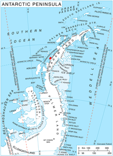
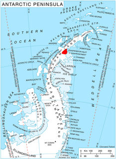
Ecology Glacier is a glacier flowing northeast into Admiralty Bay, King George Island, north of Llano Point. It was named by the Polish Antarctic Expedition, 1980, after the Institute of Ecology of the Polish Academy of Sciences, the sponsor of nearby Arctowski Station.

Mondor Glacier is a glacier 3.5 nautical miles (6 km) long flowing southwest from the head of Depot Glacier into Duse Bay, Trinity Peninsula, Antarctica. This glacier and Depot Glacier together fill the depression between Hope Bay and Duse Bay which marks the northern limit of Tabarin Peninsula. The glacier was mapped in 1946 and 1956 by the Falkland Islands Dependencies Survey (FIDS), who named the feature in association with Tabarin Peninsula. "Operation Tabarin" was derived from the "Bal Tabarin" in Paris. In Recueil General des Oeuvres et Fantaisies de Tabarin, Tabarin was the buffoon who attracted the crowd to the booth where Mondor sold his quack medicines.
Fram Mesa is a high, ice-capped mesa, 10 nautical miles (19 km) long and 1 to 3 nautical miles wide, that forms the northeastern portion of Nilsen Plateau in the Queen Maud Mountains of Antarctica. The feature may have been seen by Amundsen in 1911, and it was observed and partially mapped by the Byrd Antarctic Expeditions of 1928–30 and 1933–35. It was mapped in detail by the United States Geological Survey from surveys and U.S. Navy air photos, 1960–64, and was named by the Advisory Committee on Antarctic Names after the Fram, the ship used by Amundsen's South Pole expedition of 1910–12.
Gibbs Glacier is a glacier, 15 nautical miles (28 km) long, flowing southeast into the northern part of Mercator Ice Piedmont on the east side of the Antarctic Peninsula. This feature together with Neny Glacier, which flows northwest, occupy a transverse depression between Mercator Ice Piedmont and Neny Fjord on the west side of the Antarctic Peninsula. Gibbs Glacier was photographed from the air and first mapped by the United States Antarctic Service, 1939–41, and the Ronne Antarctic Research Expedition, 1947–48. It was named by the UK Antarctic Place-Names Committee for Peter M. Gibbs of the Falkland Islands Dependencies Survey, a surveyor at Horseshoe Island, 1957, and leader at Stonington Island, 1958, who was responsible for the first ground survey of the glacier.
Graptolite Island is an island 0.8 km (0.50 mi) long in the north-east part of Fitchie Bay, lying off the south-east portion of Laurie Island in the South Orkney Islands of Antarctica. James Weddell's chart published in 1825 shows two islands in essentially this position. Existence of a single island was determined in 1903 by the Scottish National Antarctic Expedition under William Speirs Bruce, who so named it because what were thought to be graptolite fossils were found there. Later analysis showed that the fossils on Graptolite Island were merely the remains of ancient plants.
Longton Point is a feature of sheer high rock cliffs alternating with steep icefalls, forming the southeast corner of Cook Island in the South Sandwich Islands. It was named by the UK Antarctic Place-Names Committee for Royce E. Longton, botanist of the survey of the South Sandwich Islands from HMS Protector in 1964.

McManus Glacier is a glacier flowing north into Palestrina Glacier, in northwestern Alexander Island, Antarctica. It separates Lassus Mountains on the west from Sofia University Mountains on the east. The glacier was surveyed by the British Antarctic Survey (BAS), 1975–76, and was named by the UK Antarctic Place-Names Committee in 1980 after Alan James McManus, a BAS cook at Grytviken and Faraday Research Station, 1971–73, and at Adelaide Island and Rothera Research Station, 1975–78.
Melville Glacier is a glacier, 12 nautical miles (22 km) long, between Mapple Glacier and Pequod Glacier on the east coast of Graham Land, Antarctica. It flows eastwards between Stevrek Ridge and Parlichev Ridge in the Aristotle Mountains, to enter Domlyan Bay in the Weddell Sea. It was surveyed by the Falkland Islands Dependencies Survey in 1947 and 1955, and was named by the UK Antarctic Place-Names Committee after Herman Melville, the author of Moby-Dick. Several other features in the area are named after characters in the story.
Mackellar Inlet is an inlet forming the northwestern head of Admiralty Bay, at King George Island in the South Shetland Islands. It was probably named by the Fourth French Antarctic Expedition under Jean-Baptiste Charcot, who charted Admiralty Bay in December 1909.

Savage Glacier is a glacier at the east end of Thurston Island, lying south of Tierney Peninsula and flowing east to Seraph Bay. The glacier was discovered on helicopter flights from the USS Glacier and Burton Island by personnel of the U.S. Navy Bellingshausen Sea Expedition in February 1960. The Advisory Committee on Antarctic Names named the glacier for Lieutenant John Savage, U.S. Navy, dental officer aboard the Glacier, who assisted in establishing geodetic control points in the area.
Tenorio Rock is a rock 0.4 nautical miles (0.7 km) offshore in western Discovery Bay, Greenwich Island, South Shetland Islands. The name derives from the forms "Islote Tenorio" and "Islote Aviador Tenorio" used on Chilean hydrographic charts of the 1950s. Humbert Tenorio Island was second pilot of the Sikorsky helicopter employed by the Chilean Antarctic Expedition of 1947.

Thompson Peninsula is a peninsula 3 nautical miles (6 km) long on the northeast coast of Anvers Island in the Palmer Archipelago, Antarctica. It is bounded by Patagonia Bay on the northwest and Fournier Bay on the southeast, and ends in Dralfa Point on the northeast.
Lagrange Peak is a conspicuous peak, 450 metres (1,500 ft) high, standing 5.5 nautical miles (10 km) northeast of Strath Point on the southeast coast of Brabant Island, in the Palmer Archipelago, Antarctica. A point on the coast just south of this peak was first charted and the name Lagrange applied by the Belgian Antarctic Expedition under Gerlache, 1897–99. On one of the photos published by the expedition, the name is applied to the southern tip of the island. To avoid confusion, the generic term has been altered and the name applied to this peak.


