Motta Santa Lucia

Last updated
Motta Santa Lucia
Comune di Motta Santa Lucia
Motta Santa Lucia 10 08 2007.jpg
Motta Santa Lucia-Stemma.png
Location of Motta Santa Lucia
Motta Santa Lucia
Italy provincial location map 2016.svg
Red pog.svg
Motta Santa Lucia
Location of Motta Santa Lucia in Italy
Italy Calabria location map.svg
Red pog.svg
Motta Santa Lucia
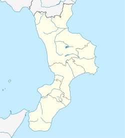
Motta Santa Lucia (Calabria)
Coordinates: 39°6′N16°18′E / 39.100°N 16.300°E / 39.100; 16.300
Country Italy
Region Calabria
Province Catanzaro (CZ)
Frazioni Casale, Marignano, Porchia, Salice
Government
  MayorIvano Egeo
Area
[1]
  Total
26.3 km2 (10.2 sq mi)
Elevation
590 m (1,940 ft)
Population
 (31 December 2013) [2]
  Total
875
  Density33/km2 (86/sq mi)
Demonym Mottesi
Time zone UTC+1 (CET)
  Summer (DST) UTC+2 (CEST)
Postal code
88040
Dialing code 0968
ISTAT code 079083
Patron saintSt. Lucy
Saint dayDecember 13th
Website Official website

Motta Santa Lucia is a comune and town in the province of Catanzaro, Calabria, southern Italy with 792 residents. [3]

Contents

Geography

Location

Motta Santa Lucia stands at the top of a hill 590 meters above sea level, geographically located in the lower Savuto valley, on the slopes of Sila Piccola, on the border with the province of Cosenza. The altimetric profile of the municipal territory is between 169 and 1351 meters above sea level.

The surface area of Motta Santa Lucia is 26.3 km2.

Climate

In Motta Santa Lucia, for the most part, summers are short, hot, dry and clear and winters are long, cold and rainy.

Borders

The town is bordered by Conflenti, Martirano, Decollatura, Pedivigliano (CS), Altilia (CS).

Events and festivals

See also

References

  1. "Superficie di Comuni Province e Regioni italiane al 9 ottobre 2011". Italian National Institute of Statistics. Retrieved 16 March 2019.
  2. All demographics and other statistics from the Italian statistical institute (Istat)
  3. "Bilancio demografico mensile". demo.istat.it. Retrieved 2024-09-12.

Sources