
Isère is a landlocked department in the southeastern French region of Auvergne-Rhône-Alpes. Named after the river Isère, it had a population of 1,271,166 in 2019. Its prefecture is Grenoble. It borders Rhône to the northwest, Ain to the north, Savoie to the east, Hautes-Alpes to the south, Drôme and Ardèche to the southwest and Loire to the west.

Chamonix-Mont-Blanc, more commonly known as Chamonix, is a commune in the Haute-Savoie department in the Auvergne-Rhône-Alpes region of southeastern France. It was the site of the first Winter Olympics in 1924. In 2019, it had a population of 8,640.

The 1968 Winter Olympics, officially known as the X Olympic Winter Games, were a winter multi-sport event held from 6 to 18 February 1968 in Grenoble, France. Thirty-seven countries participated. Frenchman Jean-Claude Killy won three gold medals in all the alpine skiing events.

The Vercors Massif is a range in France consisting of rugged plateaus and mountains straddling the départements of Isère and Drôme in the French Prealps. It lies west of the Dauphiné Alps, from which it is separated by the rivers Drac and Isère. The cliffs at the massif's eastern limit face the city of Grenoble.

Mont Aiguille is a mountain in the Vercors Massif of the French Prealps, located 58 km (36 mi) south of Grenoble, in the commune of Chichilianne, and the département of Isère. The mountain, known as one of the Seven Wonders of Dauphiné, is a relatively flat limestone mesa surrounded by steep cliffs. The mountain lies within an area designated in 1970 as the Vercors Regional Natural Park. Mont Aiguille's limestone cliffs, especially on the northwest side, are popular with climbers. Its first climb in 1492 was said to mark the birth of mountaineering.

The French Alps are the portions of the Alps mountain range that stand within France, located in the Auvergne-Rhône-Alpes and Provence-Alpes-Côte d'Azur regions. While some of the ranges of the French Alps are entirely in France, others, such as the Mont Blanc massif, are shared with Switzerland and Italy.

The Aiguille de Bionnassay is a mountain in the Mont Blanc massif of the Alps in France and Italy. It has been described as "one of the most attractive satellite peaks of Mont Blanc", and is located on its western side. The mountain's south and east ridges form the frontier between the two countries, and its summit is a knife-edge crest of snow and ice. Reaching it via any route provides a "splendid and serious snow and ice climb".

Jbel Toubkal or Tubkal is a mountain peak in southwestern Morocco, located in the Toubkal National Park. At 4,167 m (13,671 ft), it is the highest peak in Morocco, the Atlas Mountains, North Africa and the Arab world. Located 63 km (39 mi) south of the city of Marrakesh, and visible from it, Toubkal is an ultra prominent peak, the highest for over 2,000 km (1,200 mi).
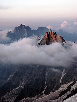
The Aiguille du Midi is a 3,842-metre-tall (12,605 ft) mountain in the Mont Blanc massif within the French Alps. It is a popular tourist destination and can be directly accessed by cable car from Chamonix that takes visitors close to Mont Blanc.

The Barre des Écrins is a mountain in the French Alps with a peak elevation of 4,102 metres (13,458 ft). It is the highest peak of the Massif des Écrins and the Dauphiné Alps and the most southerly alpine peak in Europe that is higher than 4,000 metres. It is the only 4,000-metre mountain in France that lies outside the Mont Blanc Massif. Before the annexation of Savoy in 1860 it was the highest mountain in France.

Villard-de-Lans is a commune in the Isère department of the Auvergne-Rhône-Alpes region in southeastern France. The town is also situated in the Vercors Massif. It was the administrative centre of the eponymous canton until the departmental elections of 2015. After the elections, Villard-de-Lans and the communes of its former canton were all incorporated into the new canton of Fontaine-Vercors. The town remains the seat of the Community of Communes in the Vercors Massif (CCMV).

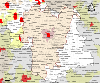
The arrondissement of Grenoble is an arrondissement of France in the Isère department in the Auvergne-Rhône-Alpes region. It has 263 communes. Its population is 738,149 (2016), and its area is 4,398.7 km2 (1,698.3 sq mi).

The Dents du Midi are a three-kilometre-long mountain range in the Chablais Alps in the canton of Valais, Switzerland. Overlooking the Val d'Illiez and the Rhône valley to the south, they face the Lac de Salanfe, an artificial reservoir, and are part of the geological ensemble of the Giffre massif. Their seven peaks are, from north-east to south-west: the Cime de l'Est, the Forteresse, the Cathédrale, the Éperon, the Dent Jaune, the Doigts and the Haute Cime. They are mainly composed of limestone rock, with gritty limestone rock in the upper parts.

Le Massif de Charlevoix, known as just Le Massif, is a ski area in Quebec, Canada, northeast of Quebec City and directly overlooking the St. Lawrence River.

Autrans is a former commune in the Isère department in the Rhône-Alpes region of south-eastern France. On 1 January 2016, it was merged into the new commune of Autrans-Méaudre-en-Vercors.

Saint-Nizier-du-Moucherotte is a commune in the Isère department in the Auvergne-Rhône-Alpes region in Southeastern France. In 2019, it had a population of 1,083.
Grenoble metropolitan area as defined by INSEE in 2020 is the functional urban area of the city of Grenoble, southeastern France. It covers 204 communes, all in the Isère department. It has 714,799 inhabitants (2018) in an area of 2,876 km2 (1,110 sq mi), which is 39% of the Isère department. Grenoble and 15 other communes form the pôle urbain or urban cluster, the other 188 communes form the couronne or commuter belt. The most populous communes in the functional area are Grenoble, Échirolles, Fontaine, Meylan, Le Pont-de-Claix, Saint-Égrève, Saint-Martin-d'Hères, Sassenage, Seyssinet-Pariset and Voiron, all except Voiron part of the pôle urbain. It is the 11th-most populous functional urban area in France.

The Rocher Rond is a summit in the Dévoluy massif of the French Alps. It is the highest point of the Vercors Regional Natural Park, although it is not part of the Vercors massif, and also the highest point in the department of Drôme. It has an elevation of 2453 metres, and an isolation of 8.77 km. It is the 14th highest French department highpoint.
The canton of Fontaine-Vercors is an administrative division of the Isère department, eastern France. It was created at the French canton reorganisation which came into effect in March 2015. Its seat is in Fontaine.

Charmant Som is a mountain in the French department of Isère, rising to 1,867 meters in the Chartreuse Mountains in the Alps. It is made up of limestone, but its relief is less pronounced than that of the surrounding mountains, which is why it is covered with alpine meadows, the origin of its name. These have been occupied and tended by shepherds since the Middle Ages. They are accessible via a road built between the two world wars from the Col de Porte to 200 meters below the main summit. The road leads to two buildings serving as inn, chalet and cheese dairy.

