Related Research Articles
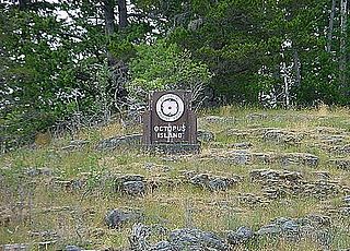
Octopus Islands Marine Provincial Park is a provincial park in British Columbia, Canada. It is located between Quadra Island and Maurelle Island in Okisollo Channel.
Loveland Bay Provincial Park is a provincial park on Vancouver Island, British Columbia, Canada, located on the north side of Campbell Lake, just west of the city of Campbell River.
Morton Lake Provincial Park is a provincial park in British Columbia, Canada, located on Vancouver Island northwest of the city of Campbell River.
Mount Blanchet Provincial Park is a provincial park in British Columbia, Canada, located on the west side of the southern end of Takla Lake, north of Smithers.
Mount Griffin Provincial Park is a provincial park in British Columbia, Canada, located southwest of Three Valley Gap.
Mount Savona Provincial Park is a provincial park in British Columbia, Canada. The park is located west of the city of Kamloops and contains cultural sites of the Skeetchestn First Nation.

Paul Lake Provincial Park is a provincial park in British Columbia, Canada, located southwest of Heffley Lake and to the northeast of the city of Kamloops.
Read Island Provincial Park is a provincial park in British Columbia, Canada. It is located on the south end of Read Island. Established in 1996, the park contains approximately 637 ha.

Rebecca Spit Marine Provincial Park is a provincial park in British Columbia, Canada, located on the east side of Quadra Island, near the city of Campbell River.
Rendezvous Island South Provincial Park is a provincial park in British Columbia, Canada, located in the Rendezvous Islands in Calm Channel, to the east of the north end of Read Island in the Discovery Islands at the northern end of the Strait of Georgia region. The park contains a total of 164 ha. 113 ha. of it upland, 53 ha. of it foreshore.
Rock Bay Marine Provincial Park is a provincial park in British Columbia, Canada, located on the Inside Passage at the junction of Johnstone Strait and Discovery Passage. The park contains approximately 525 ha. Rock Bay is located on the shore of Vancouver Island, immediately south of East Thurlow Island.
Small Inlet Marine Provincial Park is a provincial park in British Columbia, Canada on the northwest side of Quadra Island, near the city of Campbell River.
Surge Narrows Provincial Park is a provincial park in British Columbia, Canada, located on the south tip of Maurelle Island and on adjacent islands in the Discovery Islands archipelago in that province's South Coast region.
Thurston Bay Marine Provincial Park is a provincial park on the northwest side of Sonora Island in British Columbia, Canada.
Frederick Arm is an inlet on the South Coast of British Columbia, extending north from Cordero Channel between Lougborough and Bute Inlets.
The Pembroke Range is a small mountain range in southwestern British Columbia, Canada, between Loughborough Inlet and Phillips Arm. It has an area of 75 km2 and is a subrange of the Pacific Ranges which in turn form part of the Coast Mountains.
Mount Lolo, 1748m (5735'), prominence 818m, is a summit 20 km northeast of Kamloops, British Columbia, Canada, between Paul and Heffley Lakes. The summit is part of a small portion of the Interior Plateau which lies within the angle of the confluence of the South and North Thompson Rivers, to the east of which is an upland area known as the Shuswap Highland.
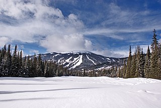
Mount Tod commonly known as Tod Mountain, is a summit 50 km northeast of Kamloops, British Columbia, Canada. Located northeast of the junction of Louis and McGillivray Creeks, it is part of the upland area between the Interior Plateau (W) and the Monashee Mountains (E) known as the Shuswap Highland, the mountain is the highest of three summits comprising the Sun Peaks alpine ski resort.
Parallel Glacier is part of the Waddington Range in the southern British Columbia Coast Mountains. It is a small alpine glacier on the north side of Umbra Ridge. It extends to the northeast from Mount Geddes toward Pocket Valley.
Chaos Glacier is part of the Waddington Range in the southern British Columbia Coast Mountains in Canada, located at 51°25′25″N125°15′5″W. It flows to the north from Mount Tiedemann for approximately four kilometers before joining the larger Scimitar Glacier. The name was officially adopted in 1978 from field sketches of the area by mountaineer Don Munday. The area's steep terrain makes this an excellent example of a continuous ice fall.
References
- ↑ "British Columbia Basemap elevation point". Archived from the original on 2012-12-03. Retrieved 2010-04-01.
- ↑ "Lolo, Mount". BC Geographical Names .
- ↑ "Lolo, Mount". BC Geographical Names ., citing Helen and GPV Akrigg, British Columbia Place Names
50°08′52″N125°20′39″W / 50.14778°N 125.34417°W
| | This article related to a mountain in British Columbia, Canada is a stub. You can help Wikipedia by expanding it. |
| | This article about a location on the South Coast of British Columbia, Canada is a stub. You can help Wikipedia by expanding it. |