Related Research Articles

Kennebec County is a county in the U.S. state of Maine, in the United States. As of the 2010 census, the population was 121,581. Its county seat is Augusta, the state capital. The county was established on February 20, 1799 from portions of Cumberland and Lincoln Counties. The name Kennebec comes from the Eastern Abenaki /kínipekʷ/, meaning "large body of still water, large bay."

Mount Monadnock, or Grand Monadnock, is a 3,165 ft (965 m) mountain in the towns of Jaffrey and Dublin, New Hampshire. It is the most prominent mountain peak in southern New Hampshire and is the highest point in Cheshire County. It lies 38 miles (61 km) southwest of Concord and 62 miles (100 km) northwest of Boston. At 3,165 feet (965 m), Mount Monadnock is nearly 1,000 feet (305 m) higher than any other mountain peak within 30 miles (48 km) and rises 2,000 feet (610 m) above the surrounding landscape. It is known for being featured in the writings of Ralph Waldo Emerson and Henry David Thoreau.

The Angeles National Forest (ANF) of the U.S. Forest Service is located in the San Gabriel Mountains and Sierra Pelona Mountains, primarily within Los Angeles County in southern California. The ANF manages a majority of the San Gabriel Mountains National Monument.
Mount Ascutney is a mountain in the U.S. state of Vermont. At 3,144 feet (958 m), it is the second-highest peak in Windsor County. Mount Ascutney is a monadnock that rises abruptly from the surrounding lowlands. For example, the Windsor Trail is 2.7 miles (4.3 km) to the summit with 2,514 feet (766 m) of elevation gain and an overall 18% grade. Particularly noteworthy are the mountain's granite outcrops, one of which, near the summit, serves as a launching point for hang-gliders.

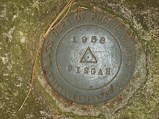
Mount Pisgah is a mountain in the Appalachian Mountain Range and part of the Blue Ridge Mountains of North Carolina, United States. The mountain's height is 5,721 feet above sea level, and it sits approximately 15 miles southwest of Asheville, near the crossing of the boundaries of Buncombe, Haywood, Henderson and Transylvania counties. It is located on the border of Buncombe and Haywood counties, close to the point where Henderson and Transylvania meet them, but not actually within the latter two counties. The mountain is easily accessible via a hiking trail from the Blue Ridge Parkway, near the Pisgah Inn.

Mount Grace State Forest is a publicly owned forest with recreational features located in the town of Warwick. The state forest centers around Mount Grace, which at 1,621 feet (494 m) is the third highest point in Massachusetts east of the Connecticut River after Mount Wachusett and Mount Watatic. It is bordered by portions of Warwick State Forest to the east and west and is managed by the Massachusetts Department of Conservation and Recreation.

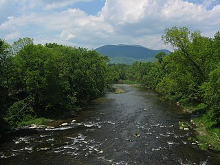
Mount Pisgah is a hill in Lane County, Oregon, United States, rising 1,060 feet (320 m) above the surrounding Willamette Valley to a maximum elevation of 1,531 feet (467 m). It was named after the biblical Mount Pisgah. It is situated between the Coast Fork and Middle Fork of the Willamette River, two miles (3 km) southeast of their confluence. Springfield is immediately north of Mount Pisgah, and the city of Eugene is a few miles west. It is the site of the 2363-acre Howard Buford Recreation Area as well as the non-profit Mount Pisgah Arboretum at its base.
Mount Grace, 1,617 feet (493 m), is a prominent monadnock located in north central Massachusetts in the town of Warwick, approximately two miles south of the New Hampshire border. The mountain is rugged and largely wooded, but a firetower on the summit provides expansive views of the surrounding rural countryside. Little Mount Grace, 1,226 feet (374 m), is the southern summit of the mountain. Mount Grace supports a predominantly northern hardwood forest as well as stands of red spruce near its summit.
Mount Pisgah is the highest point in Northborough, Massachusetts.

Samuel S. Lewis State Park is an 85-acre (34 ha) Pennsylvania state park in Lower Windsor Township, York County, Pennsylvania, in the United States. Mt. Pisgah is an 885-foot-high (270 m) ridge that is the focus of recreation for the park. The ridge separates East Prospect Valley from Kreutz Creek Valley. An overlook on Mt. Pisgah gives visitors of view of the Susquehanna River Valley. Samuel S. Lewis Park is twelve miles (19 km) east of York near U.S. Highway 30.

Mt. Pisgah State Park is a 1,302-acre (527 ha) Pennsylvania state park in Smithfield, Springfield, Troy and West Burlington Townships, Bradford County, Pennsylvania in the United States. The park is located almost exactly halfway between Troy and Towanda, along Pennsylvania State Route 3019, near U.S. Route 6, at the base of Mt. Pisgah. The park is bordered by Mill Creek, Mt. Pisgah County Park and State Game Land 289. Mill Creek which flows through the park has been dammed and forms Stephen Foster Lake a 75-acre (30 ha) man-made lake.

Mount Redington is a mountain located in Franklin County, Maine. Redington is flanked to the northeast by South Crocker Mountain and to the west by Black Nubble. Redington stands just northeast of the U.S. Navy Survival Escape and Evasion Training Facility (USSEAETF).

Coburn Mountain is a mountain located in Somerset County, Maine.
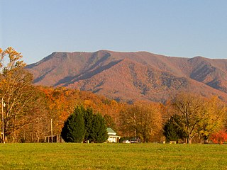
Mount Cammerer is a mountain on the northeastern fringe of the Great Smoky Mountains, in the Southeastern United States. The mountain is situated on the state line between Cocke County, Tennessee and Haywood County, North Carolina. The Appalachian Trail traverses Cammerer's south slope and a restored fire lookout at the summit offers panoramic views of the eastern Smokies, Cocke County, and the Blue Ridge Mountains.
Black Nubble is a mountain located in Franklin County, Maine. Black Nubble is flanked to the southeast by Mount Redington. Redington stands just north of the U.S. Navy Survival Escape and Evasion Training Facility (USSEAETF).

Hadley Mountain is a mountain located in the southern Adirondacks in the U.S. state of New York and is the second highest peak in Saratoga County after neighboring Tenant Mountain. The Hadley Mountain Fire Observation Station was listed on the National Register of Historic Places on September 23, 2001 for its role as a Fire lookout tower with the New York State Forest Preserve. Hadley Mountain is the highest of the three peaks that form the West Mountain ridge.

Mount Holmes is a prominent mountain peak in Yellowstone National Park. It is the tallest mountain in the Wyoming portion of the Gallatin Range. Mount Holmes is located in the northwestern part of the park and marks the southern terminus of the Gallatin Range. It is the source of Indian Creek, a tributary of the Gardner River.
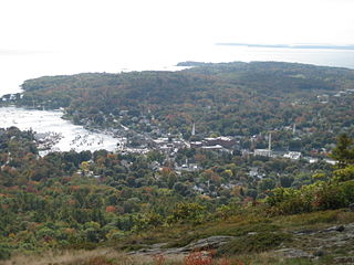
Camden Hills State Park is a 5,710-acre (2,310 ha) public recreation area overlooking Penobscot Bay in the town of Camden, Knox County, Maine. The state park features multi-use trails to Mount Battie, Mount Megunticook, and other scenic locales. The park is managed by the Maine Department of Agriculture, Conservation and Forestry.
Winthrop is a town in Kennebec County, Maine, United States. The population was 6,092 at the 2010 census. Winthrop's population, however, approximately doubles during the summer months as part-year residents return to seasonal camps located on the shores of Winthrop's Lakes and Ponds. A recreational area located among lakes, the town includes the villages of Winthrop and East Winthrop, and is the center of the Winthrop Lakes Region. Winthrop is included in the Augusta, Maine Micropolitan New England City and Town Area.
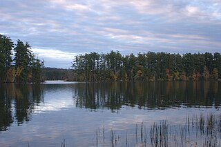
Echo Lake, also known as Crotched Pond, is a lake located in the towns of Fayette, Mount Vernon and Readfield, Maine. It is 117 feet (36 m) deep, and covers about 1.9 square miles (5 km2) in surface area. One of the major bodies of water in the Winthrop Lakes Region, the lake is known for its rocky shores, scenery, deep cool water, and naturally reproducing lake trout population. A public boat launch is located on the north shore in Mount Vernon off State Route #41.
References
- ↑ "Kennebec County ME Peaks List". listsofjohn.com. Retrieved 2019-07-17.
- ↑ "Mt. Pisgah Conservation Area". Kennebec Land Trust. Retrieved 2019-07-17.
- ↑ "Mt. Pisgah Conservation Area". Kennebec Land Trust. Retrieved 2019-07-17.
- ↑ "Mount Pisgah Fire Tower | National Historic Lookout Register". nhlr.org. Retrieved 2019-07-17.
- ↑ Eichacker, Charles (2017-08-07). "Expansion of Mount Pisgah trails reaches halfway point". Press Herald. Retrieved 2019-07-18.
- ↑ Writer, Charles EichackerStaff (2017-08-06). "Kennebec Land Trust expands trail system on Mount Pisgah in Winthrop". Kennebec Journal and Morning Sentinel. Retrieved 2019-07-18.