Athos Range is the northernmost range in the Prince Charles Mountains of Mac. Robertson Land, Antarctica. The range consists of a large number of individual mountains and nunataks that trend east-west for 40 miles (60 km) along the north side of Scylla Glacier.
Mount Paterson is a mountain, 2,195 m, standing 2 miles north-northwest of Mount Carse in the Salvesen Range of South Georgia. Surveyed by the SGS in the period 1951-57, and named for Stanley B. Paterson, assistant surveyor of the SGS, 1955-56.
The McCuddin Mountains is a small cluster of mountains in Antarctica consisting mainly of two large mountains, Mount Flint and Mount Petras, along with several scattered peaks and nunataks. Located in Marie Byrd Land, 64 km (40 mi) east of the Ames Range. The mountains were discovered and photographed from the air in a flight from West Base of the U.S. Antarctic Service on Dec. 14, 1940. They were mapped by U.S. Geological Survey (USGS) from surveys and U.S. Navy air photos, 1959-65. Named by Advisory Committee on Antarctic Names (US-ACAN) for Rear Admiral Leo B. McCuddin, U.S. Navy (USN), Commander of the U.S. Naval Support Force, Antarctica, 1972.

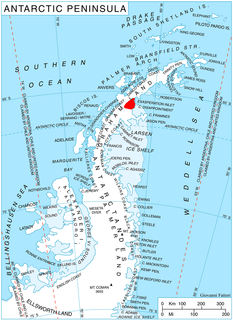
Mount Baleen is a prominent peak of 910 m and of pyramidal shape when viewed from Larsen Ice Shelf, standing in Padesh Ridge between Rachel and Starbuck Glaciers in Aristotle Mountains on the east coast of Graham Land. The naming by United Kingdom Antarctic Place-Names Committee (UK-APC) is one in a group in this vicinity that reflects a whaling theme. Baleen whales are distinguished by the presence of a sieve of horny baleen (whalebone) plates suspended from the upper jaw, and by the absence of teeth.
Mount Baume is a mountain, 1,910 metres (6,270 ft) high, rising midway along the north flank of Novosilski Glacier near the southeast end of South Georgia. It was surveyed by the South Georgia Survey (SGS) in the period 1951–57 and named for Louis C. Baume, a member of the SGS in 1955–56.

Mount Cabeza is a mountain in Stavertsi Ridge on the southeast side of Pare Glacier, 1 nautical mile (2 km) southwest of Hales Peak, in the northeast portion of Brabant Island, Palmer Archipelago in Antarctica. The name "Monte Cabeza" was used on a 1957 Argentine hydrographic chart.

Cachalot Peak is a peak, 1,040 metres (3,400 ft) high, between Stubb Glacier and Starbuck Glacier in southeastern Aristotle Mountains, about 3.5 nautical miles (6 km) west of Mount Queequeg, near the east coast of Graham Land. The toponym is one in a group by the UK Antarctic Place-Names Committee that reflects a whaling theme, "cachalot" being the sperm whale.
Mount Creighton is a mountain about 3 nautical miles (6 km) east-northeast of Mount Gavaghan in the Porthos Range of the Prince Charles Mountains. It was plotted from Australian National Antarctic Research Expeditions air photos and named for D.F. Creighton, an electronics engineer at Mawson Station in 1963.

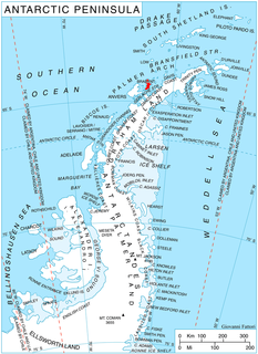
Jeroboam Glacier is a southwestern tributary glacier in the north foothills of Mount Sara Teodora that joins Starbuck Glacier just east of Gabriel Peak in Aristotle Mountains, on the east side of Graham Land, Antarctica. The toponym is one of several in the vicinity applied by the UK Antarctic Place-Names Committee from Herman Melville's Moby-Dick, the Jeroboam being the ship that met the Pequod.

Stubb Glacier is a glacier 11 nautical miles (20 km) long in Aristotle Mountains on the east coast of Graham Land, flowing east into Scar Inlet between Mount Queequeg and Tashtego Point. The lower reaches of this glacier were surveyed and photographed by the Falkland Islands Dependencies Survey (FIDS) in 1947, and the upper reaches were surveyed in 1955. Named by the United Kingdom Antarctic Place-Names Committee (UK-APC) in 1956 after the second mate on the Pequod in Herman Melville's Moby Dick.

Pippin Peaks is an east-west line of several Antarctic peaks ranging in height from 880 m to 1,160 m and formed of white or pink granite. The feature is situated in the southern Aristotle Mountains, at the west end of Stubb Glacier where it forms a part of the glacier's north wall, and is connected to Mount Sara Teodora to the west-southwest.
Mount Poster is a mountain lying west of the Latady Mountains and 9 nautical miles (17 km) northwest of Mount Tenney, in Palmer Land. Mapped by United States Geological Survey (USGS) from surveys and U.S. Navy air photos, 1961-67. Named by Advisory Committee on Antarctic Names (US-ACAN) for Carl K. Poster, geophysicist with the United States Antarctic Research Program (USARP) South Pole—Queen Maud Land Traverse III, summer 1967-68.

Mount Fedallah is a mountain approximately 1,250 metres (4,100 ft) high, situated east of the Pip Cliffs, on the north side of Flask Glacier, in the south-east foothills of Madrid Dome in Aristotle Mountains, eastern Graham Land Antarctica. It was named by the UK Antarctic Place-Names Committee in 1987, after a crewman of the Pequod in association with other names from Moby-Dick in this area.

Gabriel Peak is a peak, 1,220 metres (4,000 ft) high, at the confluence of Starbuck Glacier and Jeroboam Glacier in Aristotle Mountains on the east side of Graham Land, Antarctica. The name is one of several in the vicinity applied by the UK Antarctic Place-Names Committee from Herman Melville's Moby-Dick, Gabriel being a crewman of the ship Jeroboam.
Mount Hicks is a ridgelike mountain with two peaks, about 12 nautical miles (22 km) southwest of Husky Massif in the Prince Charles Mountains of Antarctica. It was plotted from Australian National Antarctic Research Expeditions air photos taken in 1960, and was named for Dr. K.E. Hicks, a medical officer at Wilkes Station in 1963 and 1965.

Mount Mayhew is a peak rising to 1,200 metres (4,000 ft) in Taridin Ridge, between Pequod Glacier and Starbuck Glacier, in the Aristotle Mountains on the east side of Graham Land, Antarctica. The southwest face of the peak is rocky and very steep, while the northeast face is snow-covered. The name is one of several in the vicinity applied by the UK Antarctic Place-Names Committee from Herman Melville's Moby-Dick, Mayhew being the captain of the Jeroboam.

Starbuck Glacier is a glacier 15 nautical miles (28 km) long, flowing east along the south side of Taridin Ridge and Padesh Ridge, and entering Scar Inlet immediately north of Mount Queequeg, on the east coast of Graham Land. Surveyed and partially photographed by the Falkland Islands Dependencies Survey (FIDS) in 1947. The entire glacier was photographed by the Falkland Islands and Dependencies Aerial Survey Expedition (FIDASE) in 1955-56, and mapped from these photos by the FIDS in 1957. Named by the United Kingdom Antarctic Place-Names Committee (UK-APC) after the first mate on the Pequod in Herman Melville's Moby-Dick.

Hotine Glacier is a glacier 10 nautical miles (19 km) long which is divided at its mouth by Mount Cloos, flowing west into both Deloncle Bay and Girard Bay on Kiev Peninsula, on the west coast of Graham Land, Antarctica. It was first charted by the Belgian Antarctic Expedition under Gerlache, 1897–99, and was named by the UK Antarctic Place-Names Committee in 1959 for Brigadier Martin Hotine, Director of Overseas Surveys.

Mount Rorqual is a peak between Starbuck and Stubb Glaciers in southeastern Aristotle Mountains, 5 nautical miles (9 km) west of Mount Queequeg, on the east side of Graham Land. The feature is rocky and precipitous, rises to 1,110 m and is separated from Cachalot Peak by a narrow ridge. The name is one of a group in the area applied by United Kingdom Antarctic Place-Names Committee (UK-APC) that reflects a whaling theme, the Rorquals being a species of baleen whales.
Mount Lampert is a mountain about 6 nautical miles (11 km) west of Kelsey Cliff in the southeast part of the Guettard Range, in Palmer Land, Antarctica. It was mapped by the United States Geological Survey from surveys and U.S. Navy air photos, 1961–67, and was named by the Advisory Committee on Antarctic Names for Irwin Ronald Lampert, a storekeeper at South Pole Station in 1964.


