
The Scullin Monolith is a crescent-shaped rock fronting the sea 6 km (3.7 mi) west of the similar Murray Monolith, and 8 km (5.0 mi) from Torlyn Mountain, in Mac. Robertson Land, Antarctica. It is a steep massif of metasedimentary gneiss and granitic origin, with the adjacent coastline consisting of 40 m high ice cliffs. The monolith rises steeply to extend from 435 m high Mikkelsen Peak westward in a crescent that forms Douglas Bay.

The Prince Charles Mountains are a major group of mountains in Mac. Robertson Land in Antarctica, including the Athos Range, the Porthos Range, and the Aramis Range. The highest peak is Mount Menzies, with a height of 3,228 m (10,591 ft). Other prominent peaks are Mount Izabelle and Mount Stinear. These mountains, together with other scattered peaks, form an arc about 420 km (260 mi) long, extending from the vicinity of Mount Starlight in the north to Goodspeed Nunataks in the south.
Mount Codrington is a prominent mountain, 1,520 metres (5,000 ft) high, standing 24 miles (39 km) south-southeast of Cape Close, 17 miles (27 km) east of Johnston Peak, and 11 miles (18 km) south of Simmers Peaks. Mount Codrington forms the northeastern end of the Napier Mountains.
The Tula Mountains are a group of extensive mountains lying immediately eastward of Amundsen Bay in Enderby Land, Antarctica. They were discovered on January 14, 1930, by the British Australian New Zealand Antarctic Research Expedition (BANZARE) under Mawson and named "Tula Range" by him after John Biscoe's brig, the Tula, from which Biscoe discovered Enderby Land in 1831. The term "mountains" was recommended for the group following an ANARE sledge survey in 1958 by G.A. Knuckey.
The Scott Mountains are a large number of isolated peaks lying south of Amundsen Bay in Enderby Land of East Antarctica, Antarctica. Discovered on 13 January 1930 by the British Australian New Zealand Antarctic Research Expedition (BANZARE) under Sir Douglas Mawson. He named the feature Scott Range after Captain Robert Falcon Scott, Royal Navy. The term mountains is considered more appropriate because of the isolation of its individual features.

Enderby Land is a projecting landmass of Antarctica. Its shore extends from Shinnan Glacier at about 67°55′S44°38′E to William Scoresby Bay at 67°24′S59°34′E, approximately 1⁄24 of the earth's longitude. It was first documented in western and eastern literature in February 1831 by John Biscoe aboard the whaling brig Tula, and named after the Enderby Brothers of London, the ship's owners who encouraged their captains to combine exploration with sealing.
Mount Vang is an isolated mountain standing southward of George VI Sound and 80 miles east-southeast of Eklund Islands in southern Palmer Land. It was discovered by Finn Ronne and Carl Eklund of the US Antarctic Service (USAS), 1939–41, during their sledge journey through George VI Sound, and resighted from the air on a flight of December 3, 1947 by the Ronne Antarctic Research Expedition (RARE) under Ronne.
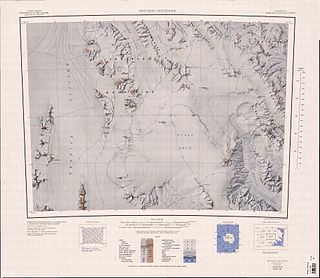
The Porthos Range is the second range south in the Prince Charles Mountains of Antarctica, extending for about 30 miles in an east-to-west direction between Scylla Glacier and Charybdis Glacier. First visited in December 1956 by the Australian National Antarctic Research Expeditions (ANARE) southern party under W.G. Bewsher (1956-57) and named after Porthos, a character in Alexandre Dumas, père's novel The Three Musketeers, the most popular book read on the southern journey.
On the continent of Antarctica, the Aramis Range is the third range south in the Prince Charles Mountains, situated 11 miles southeast of the Porthos Range and extending for about 30 miles in a southwest–northeast direction. It was first visited in January 1957 by Australian National Antarctic Research Expeditions (ANARE) southern party led by W.G. Bewsher, who named it for a character in Alexandre Dumas' novel The Three Musketeers, the most popular book read on the southern journey.
The Freyberg Mountains are a group of mountains in Victoria Land, Antarctica, bounded by Rennick Glacier, Bowers Mountains, Black Glacier, and Evans Neve. Named for New Zealand's most famous General, Lord Bernard Freyberg, by the Northern Party of New Zealand Geological Survey Antarctic Expedition (NZGSAE), 1963-64. This mountain group includes the Alamein Range. These topographical features all lie situated on the Pennell Coast, a portion of Antarctica lying between Cape Williams and Cape Adare.
Mount Dungey is a mountain 1 nautical mile (2 km) west of Pythagoras Peak in the Tula Mountains, Enderby Land, Antarctica. It was plotted from air photos taken from Australian National Antarctic Research Expeditions aircraft in 1956, and was named by the Antarctic Names Committee of Australia for F.G. Dungey, a member of the crew of the Discovery during the British Australian New Zealand Antarctic Research Expedition of 1929–31.
Mount Park is a mountain 3 nautical miles (6 km) west of Mount Tomlinson in the northeast part of the Scott Mountains, Enderby Land. It was plotted from air photos taken from ANARE aircraft in 1956 and was named by the Antarctic Names Committee of Australia (ANCA) for J.A. Park, a member of the crew of the Discovery during the British Australian New Zealand Antarctic Research Expedition (BANZARE) of 1929–31.
Mill Mountain is a large flat-topped mountain, 2,730 metres (8,960 ft) high, forming the eastern end of Festive Plateau in the Cook Mountains of Antarctica. This mountain was probably sighted by the British National Antarctic Expedition (1901–04) under Captain Robert F. Scott, who gave the name "Mount Mill," after British Antarctic historian Hugh Robert Mill, to a summit in the nearby Reeves Bluffs. This area was mapped by the United States Geological Survey from surveys and U.S. Navy photography (1959–63). A prominent mountain does not rise from the bluffs, and since the name "Mount Mill" is in use elsewhere in Antarctica, the Advisory Committee on Antarctic Names (1965) altered the original name to Mill Mountain and applied it to the prominent mountain described.
Mount Marsden is a bare rock mountain, 600 metres (2,000 ft) high, lying 3 nautical miles (6 km) southwest of Mount Rivett in the Gustav Bull Mountains of Mac. Robertson Land, Antarctica. On 13 February 1931 the British Australian New Zealand Antarctic Research Expedition (1929–31) under Douglas Mawson made a landing on nearby Scullin Monolith. They named this mountain for Ernest Marsden, Director of the New Zealand Department of Scientific and Industrial Research.
Mount Mangin is a mountain, 2,040 metres (6,700 ft) high, standing 5 nautical miles (9 km) northeast of Mount Barre on Adelaide Island, Antarctica. It was discovered by the French Antarctic Expedition, 1908–10, and named by Jean-Baptiste Charcot for the noted French botanist Louis A. Mangin.
Seavers Ridge is a rock ridge 14 nautical miles (26 km) east-southeast of Mount Renouard in Enderby Land. Plotted from air photos taken from ANARE aircraft in 1957. Named by Antarctic Names Committee of Australia (ANCA) for J.A. Seavers, assistant cook at Mawson Station in 1961.
Raggatt Mountains is a group of peaks westward from the Scott Mountains, lying east of Rayner Glacier and north of Thyer Glacier. Delineated by ANARE from air photos taken by RAAF Antarctic Flight of 1956. Named by Antarctic Names Committee of Australia (ANCA) for Dr. H.G. Raggatt, Secretary of the Australian Dept. of National Development.
Mount Rendu is a mountain between Reid Glacier and Heim Glacier on Arrowsmith Peninsula in Graham Land. Mapped by Falkland Islands Dependencies Survey (FIDS) from surveys and air photos, 1948–59. Named by United Kingdom Antarctic Place-Names Committee (UK-APC) for Louis Rendu (1789–1859), French Bishop and scientist, author of Theorie des glaciers de la Savoie, an important book on the mechanism of glacier flow.
Mount Charles is a mountain, 1,110 m, standing 3 nautical miles (6 km) south of Mount Cronus in Enderby Land. Plotted from air photos taken by ANARE in 1956 and 1957. The chart drawn by John Biscoe (1830–31) shows four mountains in what is now named Scott Mountains; these four mountains were named Charles, Henry, Gordon and George, probably for the Enderby Brothers, owners of Biscoe's vessels. It has not been possible to identify the mountain so named by Biscoe, but in order to perpetuate the name Antarctic Names Committee of Australia (ANCA) applied it to this feature in 1962.