French Polynesia is an overseas collectivity of France and its sole overseas country. It comprises 121 geographically dispersed islands and atolls stretching over more than 2,000 kilometres (1,200 mi) in the South Pacific Ocean. The total land area of French Polynesia is 3,521 square kilometres (1,359 sq mi), with a population of 278,786 of which at least 205,000 live in the Society Islands and the remaining population lives in the rest of the archipelago.

Tahiti is the largest island of the Windward group of the Society Islands in French Polynesia. It is located in the central part of the Pacific Ocean and the nearest major landmass is Australia. Divided into two parts, Tahiti Nui and Tahiti Iti, the island was formed from volcanic activity; it is high and mountainous with surrounding coral reefs. Its population was 189,517 in 2017, making it by far the most populous island in French Polynesia and accounting for 68.7% of its total population; the 2022 Census recorded a population of 191,779.

The Marquesas Islands are a group of volcanic islands in French Polynesia, an overseas collectivity of France in the southern Pacific Ocean. Their highest point is the peak of Mount Oave on Ua Pou island, at 1,230 m (4,035 ft) above sea level.

Tupuaʻi is the main island of the Austral Island group, located 640 km (400 mi) south of Tahiti. In addition to Tubuai, the group of islands include Rimatara, Rurutu, Raivavae, Rapa and the uninhabited Îles Maria. They are part of the Austral Islands in the far southwest of French Polynesia in the south Pacific Ocean. Tubuai island sustains a population of 2,185 people on 45 km2 of land. Due to its southerly position, Tubuai has notably cooler weather than Tahiti.

Bora Bora is an island group in the Leeward Islands in the South Pacific. The Leeward Islands comprise the western part of the Society Islands of French Polynesia, which is an overseas collectivity of the French Republic in the Pacific Ocean. Bora Bora has a total land area of 30.55 km2 (12 sq mi). The main island, located about 230 kilometres northwest of Papeete, is surrounded by a lagoon and a barrier reef. In the center of the island are the remnants of an extinct volcano, rising to two peaks, Mount Pahia and Mount Otemanu; the highest point is at 727 m (2,385 ft). Bora Bora is part of the Commune of Bora-Bora, which also includes the atoll of Tūpai. The main languages spoken in Bora Bora are Tahitian and French. However, due to the high tourist population, many natives of Bora Bora have learned to speak English.

Moʻorea, also spelled Moorea, is a volcanic island in French Polynesia. It is one of the Windward Islands, a group that is part of the Society Islands, 17 kilometres (11 mi) northwest of Tahiti. The name comes from the Tahitian word Moʻoreʻa, meaning "yellow lizard": Moʻo = lizard; Reʻa = yellow. An older name for the island is ʻAimeho, sometimes spelled ʻAimeo or ʻEimeo. Early Western colonists and voyagers also referred to Moʻorea as York Island or Santo Domingo.

Huahine is an island located among the Society Islands, in French Polynesia, an overseas territory of France in the South Pacific Ocean. It is part of the Leeward Islands group (Îles sous le Vent). At the 2022 census it had a population of 6,263.

Raʻiātea or Raiatea is the second largest of the Society Islands, after Tahiti, in French Polynesia, in the South Pacific Ocean. The island is widely regarded as the "centre" of the eastern islands in ancient Polynesia and it is likely that the organised migrations to the Hawaiian Islands, and other parts of East Polynesia started at Raʻiātea.

Tahaʻa is an island located among the western group, the Leeward Islands, of the Society Islands in French Polynesia, an overseas territory of France in the South Pacific Ocean. The islands of Tahaʻa and neighboring Raiatea to the immediate south are enclosed by the same coral reef, and they may once have been a single island. At the 2022 census it had a population of 5,296. The island has an area of 90 square kilometres. Mount Ohiri is the highest mountain on the island standing at 590 metres (1,940 ft) above sea level. It is also known as the "Vanilla Island" and produces pearls of exceptional quality.

The Austral Islands are the southernmost group of islands in French Polynesia, an overseas country of the French Republic in the South Pacific. Geographically, they consist of two separate archipelagos, namely in the northwest the Tupua'i islands consisting of the Îles Maria, Rimatara, Rūrutu, Tupua'i Island proper and Ra'ivāvae, and in the southeast the Bass Islands composed of the main island of Rapa Iti and the small Marotiri. Inhabitants of the islands are known for their pandanus fiber weaving skills. The islands of Maria and Marotiri are not suitable for sustained habitation. Several of the islands have uninhabited islets or rocks off their coastlines. Austral Islands' population is 6,965 on almost 150 km2 (58 sq mi). The capital of the Austral Islands administrative subdivision is Tupua'i.

Rapa, also called Rapa Iti, or "Little Rapa", to distinguish it from Easter Island, whose Polynesian name is Rapa Nui, is the largest and only inhabited island of the Bass Islands in French Polynesia. An older name for the island is Oparo. The total land area including offshore islets is 40.5 km2 (15.6 sq mi). As of the 2022 census, Rapa had a population of 451. The island's highest point is at 650 metres (2,130 ft) elevation at Mont Perahu. Its main town is Ahuréi. The inhabitants of Rapa Iti speak their own Polynesian language called the Rapa language.
Air Tahiti is a French airline company which operates in French Polynesia. Its main hub is Faa'a International Airport. It is the largest private employer in French Polynesia.

Faʻaʻā is a commune in the suburbs of Papeʻete in French Polynesia, an overseas country of France in the Pacific Ocean. Faʻaʻā is located on the island of Tahiti, in the administrative subdivision of the Windward Islands, themselves part of the Society Islands. At the 2022 census Faʻaʻā had a population of 29,826, making it the most populous commune on Tahiti and in French Polynesia. Faʻaʻā has many mountains inland that can reach 1,500 m (5,000 ft). Mount Marau is an extinct volcano in the inland limits and can be seen from nearby Moʻorea. The area of Faʻaʻā is 9 m (30 ft) above mean sea level on average.
Vaira'o, also known as Port Vairao and Matiti, is a small port town and district on the southwest coast of Tahiti, located just northwest of Teahupo'o. A town hall and sports centres lie in the northern part of the village and also features the Iti Diving International Centre, the only diving centre in Tahiti-Iti. Vaira'o Bay and lagoon are known for excellent fishing opportunities.
Raivavae is one of the Austral Islands in French Polynesia. Its total land area including offshore islets is 17.9 km2 (6.9 sq mi). At the 2022 census, it had a population of 900. The island is of volcanic origin, and rises to 437 metres (1,434 ft) elevation at Mont Hiro.
Mehetiʻa or Meʻetiʻa is a volcanic island in the Windward Islands, in the east of the Society Islands in French Polynesia. It is a very young active stratovolcano 110 kilometres (68 mi) east of the Taiarapu Peninsula of Tahiti. It belongs to the Teahitiʻa-Mehetia hotspot.

The Marquesas Islands are the island group farthest from any continent in the world, lying between 400 and 600 miles south of the equator and approximately 740 miles (1,200 km) northeast of Tahiti. A pair of volcanic archipelagoes, they fall naturally into two geographical divisions, The northwestern group consists of Eïao, Hatutu (Hatutaa), Motu One, and the islands centered on the large island of Nuku Hiva: Motu Iti, Ua Pou, Motu Oa and Ua Huka. The southeastern group consists of Fatu Uku, Tahuata, Moho Tani (Motane), Terihi, Fatu Hiva and Motu Nao, clustered around the main island of Hiva Oa which is the largest and most populous island of the southeastern group.

This page list topics related to French Polynesia.

The Tahitians are the Indigenous Polynesian people of Tahiti and thirteen other Society Islands in French Polynesia. The numbers may also include the modern population in these islands of mixed Polynesian and French ancestry. Indigenous Tahitians are one of the largest Polynesian ethnic groups, behind the Māori, Samoans and Hawaiians.
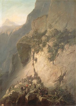
The Franco-Tahitian War or French–Tahitian War (1844–1847) was a conflict between the Kingdom of France and the Kingdom of Tahiti and its allies in the South Pacific archipelago of the Society Islands in modern-day French Polynesia.

