Mount Satima

Last updated
Mount Satima
Kenya relief location map.jpg
Red triangle with thick white border.svg
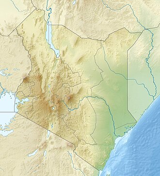
Mount Satima
Location in Kenya
Highest point
Elevation 4,001 m (13,127 ft) [1] [2]
Prominence 2,081 m (6,827 ft) [1]
Listing Ultra
Coordinates 0°20′59″S36°37′00″E / 0.34972°S 36.61667°E / -0.34972; 36.61667 Coordinates: 0°20′59″S36°37′00″E / 0.34972°S 36.61667°E / -0.34972; 36.61667
Geography
Location Kenya
Parent range Aberdare Range

Mount Satima, also known as Mount Lesatima and often abbreviated to Satima or Lesatima, is the third-highest mountain in Kenya and the highest in the Aberdare Range. The Maasai name is Oldoinyo Lesatima, which has a variety of alternative spellings, such as Ol Donyo Le Satima, and means "mountain of the bull calf". [3]

Contents

The peak lies at the northern end of the Aberdares, which themselves are along the eastern side of the Great Rift Valley, and is their highest point. Around it stand a number of sharp volcanic cones called "the Dragon's Teeth". [4] There are moraines between 3,600 metres (11,800 ft) and 3,800 metres (12,500 ft) on the north west of the mountain. [5] One book on Kenya has called the mountain itself "a craggy bluff of rock and tussock grass around which the clouds swirl". [6]

See also

Related Research Articles

<span class="mw-page-title-main">Aoraki / Mount Cook</span> Mountain in New Zealand

Aoraki / Mount Cook is the highest mountain in New Zealand. Its height, as of 2014, is listed as 3,724 metres. It sits in the Southern Alps, the mountain range that runs the length of the South Island. A popular tourist destination, it is also a favourite challenge for mountain climbers. Aoraki / Mount Cook consists of three summits: from south to north, the Low Peak, the Middle Peak and the High Peak. The summits lie slightly south and east of the main divide of the Southern Alps / Kā Tiritiri o te Moana, with the Tasman Glacier to the east and the Hooker Glacier to the southwest.

<span class="mw-page-title-main">Mountain</span> Large natural elevation of the Earths surface

A mountain is an elevated portion of the Earth's crust, generally with steep sides that show significant exposed bedrock. Although definitions vary, a mountain may differ from a plateau in having a limited summit area, and is usually higher than a hill, typically rising at least 300 metres above the surrounding land. A few mountains are isolated summits, but most occur in mountain ranges.

<span class="mw-page-title-main">Mount Kilimanjaro</span> Africas highest peak, located in Tanzania

Mount Kilimanjaro is a dormant volcano in Tanzania. It has three volcanic cones: Kibo, Mawenzi, and Shira. It is the highest mountain in Africa and the highest single free-standing mountain above sea level in the world: 5,895 metres (19,341 ft) above sea level and about 4,900 metres (16,100 ft) above its plateau base. It is the highest volcano in Africa and the Eastern Hemisphere.

<span class="mw-page-title-main">Mount Kenya</span> Highest mountain in Kenya

Mount Kenya is the highest mountain in Kenya and the second-highest in Africa, after Kilimanjaro. The highest peaks of the mountain are Batian, Nelion and Point Lenana. Mount Kenya is located in the former Eastern and Central provinces of Kenya; its peak is now the intersection of Meru, Embu, Laikipia, Kirinyaga, Nyeri and Tharaka Nithi counties, about 16.5 kilometres south of the equator, around 150 km (90 mi) north-northeast of the capital Nairobi. Mount Kenya is the source of the name of the Republic of Kenya.

<span class="mw-page-title-main">Mount Elgon</span> Volcano in Uganda and Kenya

Mount Elgon is an extinct shield volcano on the border of Uganda and Kenya, north of Kisumu and west of Kitale. The mountain's highest point, named "Wagagai", is located entirely within Uganda. Although there is no verifiable evidence of its earliest volcanic activity, geologists estimate that Mount Elgon is at least 24 million years old, making it the oldest extinct volcano in East Africa. The mountain's name originates from its Maasai name, Elgonyi.

<span class="mw-page-title-main">Nyeri</span> City in Nyeri County, Kenya

Nyeri is a town situated in the Central Highlands of Kenya. It is the county headquarters of Nyeri County. The town was the central administrative headquarters of the country's former Central Province. Following the dissolution of the former provinces by Kenya's new constitution on 26 August 2010, the city is situated about 150 km north of Kenya's capital Nairobi, in the country's densely populated and fertile Central Highlands, lying between the eastern base of the Aberdare (Nyandarua) Range, which forms part of the eastern end of the Great Rift Valley, and the western slopes of Mount Kenya.

<span class="mw-page-title-main">Nyahururu</span> Town in Laikipia County, Kenya

Nyahururu is a town in Kenya, lying north east of Nakuru. The town derives its name from the Maasai word e-naiwurruwurr, meaning waterfall and/or windy or place of storms. It is located in Laikipia County. Despite this, Nyahururu formerly functioned as the administrative capital of Nyandarua County, before it became a county, until the headquarters was shifted to Ol Kalou. There have been calls for a reversal. The town has an urban population of 36,450. The town still continues to be a central economic power of the immediate former district of Nyandarua. For that reason, the town has strong economic ties to the two counties.

<span class="mw-page-title-main">Aberdare Range</span> Mountain range in Kenya

The Aberdare Range is a 160 km long mountain range of upland, north of Kenya's capital Nairobi with an average elevation of 3,500 metres (11,480 ft). It straddles across the counties of Nyandarua, Nyeri, Muranga, Kiambu and Laikipia. The mountain range is located in west central Kenya, northeast of Naivasha and Gilgil and lies just south of the Equator. The mountain range is called Nyandarua among the Agikuyu people in whose territory this forest and mountain range is located. The name Nyandarua comes from the Kikuyu word rwandarua meaning a drying hide, due to the distinctive fold of its silhouette.

<span class="mw-page-title-main">Aberdare National Park</span>

The Aberdare National Park is a protected area in the Aberdare Mountain Range in central Kenya located east of the East African Rift Valley. It covers the higher areas and the Aberdare Salient to the east.

The East African mountains are a mountain region in the African Great Lakes, within Kenya, Uganda, Tanzania, Democratic Republic of the Congo, Rwanda and Burundi.

<span class="mw-page-title-main">Climate of Mount Kenya</span>

The climate of Mount Kenya has played a critical role in the development of the mountain, influencing the topography and ecology amongst other factors. The area around Mount Kenya is covered by a comparably large number of weather station data with long measurements series and thus the climate is well recorded. It has a typical equatorial mountain climate which Hedberg described as winter every night and summer every day.

<i>Dendrosenecio</i> Genus of flowering plants

Dendrosenecio is a genus of flowering plants in the sunflower family. It is a segregate of Senecio, in which it formed the subgenus Dendrosenecio. Its members, the giant groundsels, are native to the higher altitude zones of ten mountain groups in equatorial East Africa, where they form a conspicuous element of the flora.

<span class="mw-page-title-main">Ol Donyo Sabuk</span> National park in Kenya

Ol Donyo Sabuk, or Kyanzavi in Kamba, is both a mountain and a town in Kyanzavi Division, Machakos County. William Northrup McMillan was the first white man to settle here, who had a major influence in the area.

<span class="mw-page-title-main">Natural history of Mount Kenya</span>

The flora and fauna of Mount Kenya are diverse, due to the variation in altitude, rainfall, aspect and temperature. The mountain slopes can be divided into vegetation zones, with each zone having different dominant plant species. Although many plants on Mount Kenya have local names, here they are reported only with their English and scientific names.

<span class="mw-page-title-main">East African montane forests</span>

The East African montane forests is a montane tropical moist forest ecoregion of eastern Africa. The ecoregion comprises several separate areas above 2000 meters in the mountains of South Sudan, Uganda, Kenya, and Tanzania.

<span class="mw-page-title-main">East African montane moorlands</span>

The East African montane moorlands is a montane grasslands and shrublands ecoregion which occupies several high mountain peaks in Kenya, South Sudan, Tanzania, and Uganda.

<span class="mw-page-title-main">Great Rift Valley, Kenya</span> Part of an intra-continental ridge system that runs through Kenya

The Great Rift Valley is part of an intra-continental ridge system that runs through Kenya from north to south. It is part of the Gregory Rift, the eastern branch of the East African Rift, which starts in Tanzania to the south and continues northward into Ethiopia. It was formed on the "Kenyan Dome" a geographical upwelling created by the interactions of three major tectonics: the Arabian, Nubian, and Somalian plates. In the past, it was seen as part of a "Great Rift Valley" that ran from Madagascar to Syria. Most of the valley falls within the former Rift Valley Province.

<span class="mw-page-title-main">Gregory Rift</span>

The Gregory Rift is the eastern branch of the East African Rift fracture system. The rift is being caused by the separation of the Somali plate from the Nubian plate, driven by a thermal plume. Although the term is sometimes used in the narrow sense of the Kenyan Rift, the larger definition of the Gregory Rift is the set of faults and grabens extending southward from the Gulf of Aden through Ethiopia and Kenya into Northern Tanzania, passing over the local uplifts of the Ethiopian and Kenyan domes. Ancient fossils of early hominins, the ancestors of humans, have been found in the southern part of the Gregory Rift.

Mount Kinangop is a mountain in the southern Aberdare Range about 100 miles (160 km) north of Nairobi, Kenya. It is within the Aberdare National Park.

References

  1. 1 2 "Africa Ultra-Prominences" Peaklist.org. Listed as "Oldoinyo Lesatima". Retrieved 2012-01-10.
  2. New Encyclopædia Britannica vol. 1 (2005): "The range has an average elevation of 11000 feet (3350 m) and culminates in Oldoinyo Lesatima (13120 feet [3999 m]) and Ilkinangop (12815 feet [3906 m])."
  3. Mary Fitzpatrick, Matthew Fletcher, David Wenk, Trekking in East Africa (Lonely Planet Publications, 2003), p. 190
  4. Fodor's Kenya, Tanzania, Seychelles (Fodor's Travel Publications, 1990), p. 65
  5. S. Hastenrath, The glaciers of equatorial East Africa (1984), p. 58
  6. Mohamed Amin, Duncan Willetts, Brian Tetley, Kenya: the magic land (Bodley Head, 1988), p. 126