A volcano is a rupture in the crust of a planetary-mass object, such as Earth, that allows hot lava, volcanic ash, and gases to escape from a magma chamber below the surface.

Mount Ruapehu is an active stratovolcano at the southern end of the Taupō Volcanic Zone and North Island volcanic plateau in New Zealand. It is 23 km (14 mi) northeast of Ohakune and 23 km (14 mi) southwest of the southern shore of Lake Taupō, within the Tongariro National Park. The North Island's major ski resorts and only glaciers are on its slopes.

A stratovolcano, also known as a composite volcano, is a conical volcano built up by many layers (strata) of hardened lava and tephra. Unlike shield volcanoes, stratovolcanoes are characterized by a steep profile with a summit crater and periodic intervals of explosive eruptions and effusive eruptions, although some have collapsed summit craters called calderas. The lava flowing from stratovolcanoes typically cools and solidifies before spreading far, due to high viscosity. The magma forming this lava is often felsic, having high to intermediate levels of silica, with lesser amounts of less viscous mafic magma. Extensive felsic lava flows are uncommon, but have traveled as far as 15 km (9 mi).

The Ring of Fire is a tectonic belt of volcanoes and earthquakes.

Volcanic cones are among the simplest volcanic landforms. They are built by ejecta from a volcanic vent, piling up around the vent in the shape of a cone with a central crater. Volcanic cones are of different types, depending upon the nature and size of the fragments ejected during the eruption. Types of volcanic cones include stratocones, spatter cones, tuff cones, and cinder cones.

Nevado del Ruiz, also known as La Mesa de Herveo is a volcano on the border of the departments of Caldas and Tolima in Colombia, being the highest point of both. It is located about 130 km (81 mi) west of the capital city Bogotá. It is a stratovolcano composed of many layers of lava alternating with hardened volcanic ash and other pyroclastic rocks. Volcanic activity at Nevado del Ruiz began about two million years ago, during the Early Pleistocene or Late Pliocene, with three major eruptive periods. The current volcanic cone formed during the present eruptive period, which began 150,000 years ago.

The Lassen volcanic area presents a geological record of sedimentation and volcanic activity in and around Lassen Volcanic National Park in Northern California, U.S. The park is located in the southernmost part of the Cascade Mountain Range in the Pacific Northwest region of the United States. Pacific Oceanic tectonic plates have plunged below the North American Plate in this part of North America for hundreds of millions of years. Heat and molten rock from these subducting plates has fed scores of volcanoes in California, Oregon, Washington and British Columbia over at least the past 30 million years, including these in the Lassen volcanic areas.

Santa María Volcano is a large active volcano in the western highlands of Guatemala, in the Quetzaltenango Department near the city of Quetzaltenango. It is part of the mountain range of the Sierra Madre.

Mount Tehama is an eroded andesitic stratovolcano in the Cascade Volcanic Arc and the Cascade Range in Northern California. Part of the Lassen volcanic area, its tallest remnant, Brokeoff Mountain, is itself the second highest peak in Lassen Volcanic National Park and connects to the park's highest point, Lassen Peak. Located on the border of Tehama County and Shasta County, Brokeoff's peak is the highest point in the former. The hikers that summit this mountain each year are treated to "exceptional" views of Lassen Peak, the Central Valley of California, and many of the park's other features. On clear days, Mount Shasta can also be seen in the distance.

The Garibaldi Volcanic Belt is a northwest–southeast trending volcanic chain in the Pacific Ranges of the Coast Mountains that extends from Watts Point in the south to the Ha-Iltzuk Icefield in the north. This chain of volcanoes is located in southwestern British Columbia, Canada. It forms the northernmost segment of the Cascade Volcanic Arc, which includes Mount St. Helens and Mount Baker. Most volcanoes of the Garibaldi chain are dormant stratovolcanoes and subglacial volcanoes that have been eroded by glacial ice. Less common volcanic landforms include cinder cones, volcanic plugs, lava domes and calderas. These diverse formations were created by different styles of volcanic activity, including Peléan and Plinian eruptions.

Cerro Azul, sometimes referred to as Quizapu, is an active stratovolcano in the Maule Region of central Chile, immediately south of Descabezado Grande. Part of the South Volcanic Zone of the Andes, its summit is 3,788 meters (12,428 ft) above sea level, and is capped by a summit crater that is 500 meters (1,600 ft) wide and opens to the north. Beneath the summit, the volcano features numerous scoria cones and flank vents.

The Volcán Barú is an active stratovolcano and the tallest mountain in Panama, at 3,474 metres (11,398 ft) high. It lies about 35 km (22 mi) off the border of Costa Rica. It is also the twelfth highest peak in Central America.

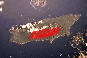
Taveuni is the third-largest island in Fiji, after Viti Levu and Vanua Levu, with a total land area of 434 square kilometres. The cigar-shaped island, a massive shield volcano which rises from the floor of the Pacific Ocean, is situated 6.5 kilometres east of Vanua Levu, across the Somosomo Strait. It belongs to the Vanua Levu Group of islands and is part of Fiji's Cakaudrove Province within the Northern Division.

Villarrica is one of Chile's most active volcanoes, rising above the lake and town of the same name, 750 km (470 mi) south of Santiago. It is also known as Rucapillán, a Mapuche word meaning "great spirit's house" or " the demon's house". It is the westernmost of three large stratovolcanoes that trend northwest to southeast obliquely perpendicular to the Andean chain along the Mocha-Villarrica Fault Zone, and along with Quetrupillán and the Chilean portion of Lanín, are protected within Villarrica National Park. Guided ascents are popular during summer months.

The Mount Meager massif is a group of volcanic peaks in the Pacific Ranges of the Coast Mountains in southwestern British Columbia, Canada. Part of the Cascade Volcanic Arc of western North America, it is located 150 km (93 mi) north of Vancouver at the northern end of the Pemberton Valley and reaches a maximum elevation of 2,680 m (8,790 ft). The massif is capped by several eroded volcanic edifices, including lava domes, volcanic plugs and overlapping piles of lava flows; these form at least six major summits including Mount Meager which is the second highest of the massif.

Several types of volcanic eruptions—during which material is expelled from a volcanic vent or fissure—have been distinguished by volcanologists. These are often named after famous volcanoes where that type of behavior has been observed. Some volcanoes may exhibit only one characteristic type of eruption during a period of activity, while others may display an entire sequence of types all in one eruptive series.

Mount Gareloi, or Gareloi Volcano, is a stratovolcano in the Aleutian Islands of Alaska, United States, about 1,259 miles (2,026 km) from Anchorage. Gareloi is located on Gareloi Island, and comprises most of its land mass. The island also has two small glaciers which protrude to the northwest and southeast.

A volcanic hazard is the probability a volcanic eruption or related geophysical event will occur in a given geographic area and within a specified window of time. The risk that can be associated with a volcanic hazard depends on the proximity and vulnerability of an asset or a population of people near to where a volcanic event might occur.

The Mount Cayley volcanic field (MCVF) is a remote volcanic zone on the South Coast of British Columbia, Canada, stretching 31 km (19 mi) from the Pemberton Icefield to the Squamish River. It forms a segment of the Garibaldi Volcanic Belt, the Canadian portion of the Cascade Volcanic Arc, which extends from Northern California to southwestern British Columbia. Most of the MCVF volcanoes were formed during periods of volcanism under sheets of glacial ice throughout the last glacial period. These subglacial eruptions formed steep, flat-topped volcanoes and subglacial lava domes, most of which have been entirely exposed by deglaciation. However, at least two volcanoes predate the last glacial period and both are highly eroded. The field gets its name from Mount Cayley, a volcanic peak located at the southern end of the Powder Mountain Icefield. This icefield covers much of the central portion of the volcanic field and is one of the several glacial fields in the Pacific Ranges of the Coast Mountains.