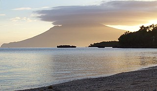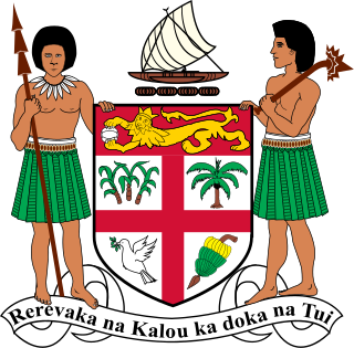
Fiji is a group of volcanic islands in the South Pacific, lying about 4,450 kilometres (2,765 mi) southwest of Honolulu and 1,770 km (1,100 mi) north of New Zealand. Of the 332 islands and 522 smaller islets making up the archipelago, about 106 are permanently inhabited. The total land size is 18,272 km2 (7,055 sq mi). It has the 26th largest Exclusive Economic Zone of 1,282,978 km2 (495,361 sq mi).

Vanua Levu, formerly known as Sandalwood Island, is the second largest island of Fiji. Located 64 kilometres to the north of the larger Viti Levu, the island has an area of 5,587.1 square kilometres (2,157.2 sq mi) and a population of 135,961 as of 2007.

Air Fiji was an airline based in Nausori, Fiji. It operated inter-island services to destinations within the Fijian Islands. Its main base was Nausori International Airport, Suva, with a base at Nadi International Airport.

Taveuni is the third-largest island in Fiji, after Viti Levu and Vanua Levu, with a total land area of 434 square kilometres. The cigar-shaped island, a massive shield volcano which rises from the floor of the Pacific Ocean, is situated 6.5 kilometres east of Vanua Levu, across the Somosomo Strait. It belongs to the Vanua Levu Group of islands and is part of Fiji's Cakaudrove Province within the Northern Division.

The Langeberg Range is a mountain range in the Western Cape province of South Africa. Its highest peak is Keeromsberg at 2,072 m that lies 15 km northeast of the town of Worcester. Some of the highest peaks of the range are located just to the north of Swellendam, in a subrange known as the Clock Peaks whose highest point is the 1,710 m high Misty Point. Local lore states one can tell the time by means of the shadows cast by the seven summits of the Clock Peaks.
Mount Popomanaseu is a volcanic mountain and the highest mountain in the Solomon Islands. It is located on Guadalcanal east of Mount Makarakomburu. At 2,335 metres (7,661 ft), it is the highest peak in the insular South Pacific, excluding New Guinea and its satellite islands. Panning east across the South Pacific, there is no higher mountain until reaching the Andes in South America. The summit is a saddle plateau and can be seen on the range above Honiara International Airport. It holds significant cultural importance for the indigenous people and supports vital habitat for many endemic and restricted range species on Guadalcanal.

Matei Airport, also known as Taveuni Airport or Taveuni Island Airport, is an airport located in Matei on the northern end of Taveuni, an island of the Vanua Levu Group in Fiji. It is operated by Airports Fiji Limited.
Mount Nasorolevu is the highest mountain on the island of Vanua Levu in Fiji. At 3,385 feet or 1,032 meters, it is the fourth highest peak of Fiji. It is located at Latitude: -16.6167 and Longitude: 179.4. Sharon Wild is the first woman to reach the peak.

The Fijian monkey-faced bat, also known as the Fijian flying fox or Fijian flying monkey, is a megabat endemic to Fiji. It was discovered in old-growth cloud forest on Des Vœux Peak, the second highest mountain peak on the island of Taveuni by William and Ruth Beckon in 1976, and is Fiji's only endemic mammal. It has recently been transferred from Pteralopex to its own monotypic genus Mirimiri.
Sugar cane grew wild in Fiji and was used as thatch by the Fijians for their houses (bures). The first attempt to make sugar in Fiji was on Wakaya Island in 1862 but this was a financial failure. With the cotton boom of the 1860s there was little incentive to plant a crop that required high capital outlay but after a slump in cotton prices in 1870, the planters turned to sugar. In an effort to promote the production of sugar in Fiji, the Cakobau Government, in December 1871, offered a 500-pound reward for the first and best crop of twenty of sugar from canes planted before January 1873.
Fiji only began producing its own feature films in 2004, and has produced just one to date. Vilsoni Hereniko's The Land Has Eyes (2004) is set in Rotuma and stars indigenous Rotuman actress Sapeta Taito in her début role, alongside New Zealand actress Rena Owen.

Mount Malindig is a large potentially active stratovolcano on the island of Marinduque in the Philippines. It is the highest peak in the island having an elevation of 1,157 metres (3,796 ft) above sea level.
This is a list of the extreme points of the Commonwealth of Nations — the points that are farther north, south, east or west, or higher or lower in elevation than any other location.

A Ribu is a mountain with a topographic prominence of at least 1,000 metres (3,281 ft). "Ribu" is a Malay and Indonesian word meaning "thousand".

Mount Guiwan is a mountain in the Sierra Madre range in Alfonso Castañeda, Nueva Vizcaya, Philippines. It is probably the highest peak of Sierra Madre mountain range with a height of at least 1,915 metres (6,283 ft) above sea level according to NAMRIA topographic map and perhaps as high as 1,950 metres (6,400 ft). Bugkalots have long established trails which they use when hunting.

Lānaihale is a mountain peak in Hawaiʻi. It is the highest point of the island of Lanai.

Mount Gorongosa is an inselberg in Sofala Province of central Mozambique. Its highest peak, Gogogo, reaches an elevation of 1,863 meters. It was created by Karoo Volcanism.

General elections were held in Fiji in July, August and September 1920.
The Fiji Senior League, or the Digicel Senior League for sponsorship reasons, is the second-highest division within the Fijian football league system after the Fiji Premier League. It is contested by ten teams with two groups, one of six teams and the other of four teams. The league is run and overseen by the Fiji Football Association in Fiji.

The Fiji tropical moist forests is a tropical moist forest ecoregion in Fiji and Wallis and Futuna. It covers the windward sides of Viti Levu and Vanua Levu, Fiji's largest islands, as well as the smaller Fijian islands and the three islands that make up Wallis and Futuna, an overseas territory of France. The drier leeward sides of Viti Levu and Vanua Levu are home to the distinct Fiji tropical dry forests ecoregion.


