Norah Head, originally known as Bungaree Noragh Point, is a headland on the Central Coast, New South Wales, Australia, south of Newcastle and north of Sydney. The nearest suburbs are Noraville, Canton Beach and Toukley. Soldiers Beach is located in Norah Head. The suburb is home to a lighthouse with scenic views, which is also considered a venue for weddings. The Norah Head tidal rock pool next to the Cabbage Tree harbour is a popular destination for families with young children due to its sheltered location.

Mount Duval, a large forested mountain of the New England Range, part of the Great Dividing Range, is located on the Northern Tablelands in the New England region of New South Wales, Australia.

Mount Tilga, a hill located near Condobolin in the Central West region of New South Wales, Australia, was said to be the exact centre of New South Wales.

Mount Twynam is a mountain located on the Main Range, part of the Great Dividing Range, in the Snowy Mountains in New South Wales, Australia. The mountain is located close the border between New South Wales and Victoria.

Mount Tate is a prominent rocky mountain on the Main Range of the Snowy Mountains located in southeastern New South Wales, Australia.

Carruthers Peak, formerly Curruthers Peak, a mountain in the Main Range of the Great Dividing Range, is located in Snowy Mountains region in southeast New South Wales, Australia. The peak is situated between Mount Lee and Mount Twynam within the Kosciuszko National Park.
Mount Lindesay, sometimes incorrectly recorded as Mount Lindsay, a mountain located within the Nandewar Range, is situated within the North West Slopes region of New South Wales, Australia. The mountain was formed by the Nandewar extinct volcano which ceased activity about 17 million years ago after 4 million years of activity.

Mount Ningadhun, also Castle Rock, Ningadoon (Hunt), and Ningadhun, a mountain on the Nandewar Range, a spur off the Great Dividing Range, is located in the North West Slopes region of New South Wales, Australia. Mount Ningadhun is situated east of Narrabri within the Mount Kaputar National Park.

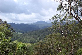
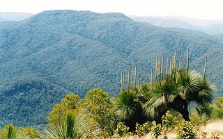
Mount Banda Banda, a mountain of the Mid North Coast region of New South Wales, Australia, is situated 320 kilometres (200 mi) from Sydney within the Willi Willi National Park. Banda Banda can be seen on the north western horizon from Port Macquarie. And seen on the south western horizon 39 km from the town of Kempsey. At 1,258 metres (4,127 ft) AHD it is the highest mountain in the region.
The Merrica River is an intermediate intermittently closed saline coastal lagoon or perennial river located in the South Coast region of New South Wales, Australia.
The Nadgee River is a mature intermittently closed saline coastal lagoon; or perennial river located in the South Coast region of New South Wales, Australia.
The Towamba River is an open mature wave dominated barrier estuary or perennial river, located in the South Coast region of New South Wales, Australia.

The Wadbilliga River is a perennial stream of the Tuross River catchment that is located in the South Coast region of New South Wales, Australia.
Mount Allyn is a mountain with an elevation of 1,125 metres (3,691 ft) AHD that is part of the Allyn Range, located within the Chichester State Forest, in the Upper Hunter region of New South Wales, Australia. Mount Allyn is located about 8 kilometres (5.0 mi) south southwest of Careys Peak and about 50 kilometres (31 mi) northeast of Muswellbrook.

Mount Barrington, a mountain that is part of the Mount Royal Range, is located on the Barrington Tops plateau in the Mid-Coast Council within New South Wales, Australia and has an elevation of 1,555 metres (5,102 ft) above sea level.

Grundy Mountain or Mount Grundy, a mountain of the Great Dividing Range, is located on the Northern Tablelands of New South Wales, Australia.
The Imlay Creek is a perennial river of the Genoa River catchment, with its headwaters and lower reaches located in the South Coast region of New South Wales, Australia.
The Du Faur Creek, a perennial stream of the Hawkesbury-Nepean catchment, is located in the Blue Mountains region of New South Wales, Australia.
The Cadiangullong Creek, a mostly–perennial river that is part of the Lachlan sub-catchment of the Murrumbidgee catchment within the Murray–Darling basin, is located in the Central West region of New South Wales, Australia.
The Flyers Creek, a mostly–perennial river that is part of the Lachlan sub-catchment of the Murrumbidgee catchment within the Murray–Darling basin, is located in the Central West region of New South Wales, Australia.