
The history of the Falkland Islands goes back at least five hundred years, with active exploration and colonisation only taking place in the 18th century. Nonetheless, the Falkland Islands have been a matter of controversy, as they have been claimed by the French, British, Spaniards and Argentines at various points.

The Falkland Islands are located in the South Atlantic Ocean between 51°S and 53°S on a projection of the Patagonian Shelf, part of the South American continental shelf. In ancient geological time this shelf was part of Gondwana, and around 400 million years ago split from what is now Africa and drifted westwards from it. Today the islands are subjected to the Roaring Forties, winds that shape both their geography and climate.

The Falklands War was a 10-week undeclared war between Argentina and the United Kingdom in 1982 over two British dependent territories in the South Atlantic: the Falkland Islands and its territorial dependency, South Georgia and the South Sandwich Islands. The result of the war was a British victory.

Stanley is the capital of the Falkland Islands. It is located on the island of East Falkland, on a north-facing slope in one of the wettest parts of the islands. At the 2016 census, the town had a population of 2,460. The entire population of the Falkland Islands was 3,398 on Census Day on 9 October 2016.

East Falkland is the largest island of the Falklands in the South Atlantic, having an area of 6,605 km2 or 54% of the total area of the Falklands. The island consists of two main land masses, of which the more southerly is known as Lafonia; it is joined by a narrow isthmus that was the scene of the Battle of Goose Green during the Falklands War.

Weddell Island is one of the Falkland Islands in the South Atlantic, lying off the southwest extremity of West Falkland. It is situated 1,545 km (960 mi) west-northwest of South Georgia Island, 1,165 km (724 mi) north of Livingston Island, 606 km (377 mi) northeast of Cape Horn, 358 km (222 mi) northeast of Isla de los Estados, and 510 km (320 mi) east of the Atlantic entrance to Magellan Strait.
The Pound is the currency of the Falkland Islands, a British Overseas Territory in the South Atlantic Ocean. The symbol is the pound sign, £, or alternatively FK£, to distinguish it from other pound-denominated currencies. The ISO 4217 currency code is FKP.

John Clements Wickham was a Scottish explorer, naval officer, magistrate and administrator. He was first officer on HMS Beagle during its second survey mission, 1831–1836, under captain Robert FitzRoy. The young naturalist and geologist Charles Darwin was a supernumerary on the ship, and his journal was published as The Voyage of the Beagle. After that expedition, Wickham was promoted to Commander and made captain of the Beagle on its third voyage, from 1837 and conducted various maritime expeditions and hydrographic surveys along the Australian coastline.
Sovereignty over the Falkland Islands is disputed by Argentina and the United Kingdom.

The geology of the Falkland Islands is described in several publications. The Falkland Islands are located on a projection of the Patagonian continental shelf. In ancient geological time this shelf was part of Gondwana, which around 400 million years ago broke from what is now Africa and drifted westwards relative to Africa. Studies of the seabed surrounding the islands indicated the possibility of oil. Intensive exploration began in 1996, although there had been some earlier seismic surveys in the region.
The Wickham Heights are a rugged chain of mountains on East Falkland in the Falkland Islands. They include the island group's highest peak, Mount Usborne, Mount Wickham and are partly contiguous with No Man's Land. The slopes of Wickham Heights feature numerous stone runs, some of them extending up to 5 km.

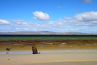
The Falkland Islands is an archipelago in the South Atlantic Ocean on the Patagonian Shelf. The principal islands are about 300 miles east of South America's southern Patagonian coast and about 752 miles from the northern tip of the Antarctic Peninsula, at a latitude of about 52°S. The archipelago, with an area of 4,700 square miles, comprises East Falkland, West Falkland, and 776 smaller islands. As a British overseas territory, the Falklands have internal self-governance, and the United Kingdom takes responsibility for their defence and foreign affairs. The Falkland Islands' capital is Stanley on East Falkland.
No Man's Land is an area on East Falkland island, in the Falkland Islands. It probably derives its name from its extremely rough ground, and is partly co-extensive with the Wickham Heights. It lies to the north-west of RAF Mount Pleasant, on the northern half of East Falkland.
San Carlos River is one of the larger rivers on East Falkland, in the Falkland Islands. It flows westwards, into San Carlos Water, near Port San Carlos. It begins in the Wickham Heights, with tributaries running off Jack's Mountain
The Malo River, is a river in East Falkland, Falkland Islands. Its name is derived from the Breton port of St Malo, due to the French settlement established at Port Louis in 1764.

Mount Simon is a mountain on East Falkland, Falkland Islands. It is south of Teal Inlet and north of Mount Wickham.

Duplicate: List of Falkland Islands-related topics

The COVID-19 pandemic was confirmed to have reached to the Falkland Islands on 3 April 2020. The number of cases peaked at 13, and all were from the military base at Mount Pleasant. There were no confirmed cases amongst the general population of the Falkland Islands. All patients have recovered. On 10 November, a new case was discovered.
