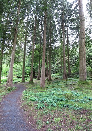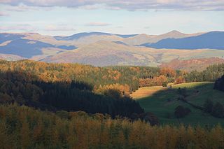
Trail riding is riding outdoors on trails, bridle paths, and forest roads, but not on roads regularly used by motorised traffic. A trail ride can be of any length, including a long distance, multi-day trip. It originated with horse riding, and in North America, the equestrian form is usually called "trail riding," or, less often "hacking." In the UK and Europe, the practice is usually called horse or pony trekking.

Snowdonia, or Eryri, is a mountainous region and national park in North Wales. It contains all 15 mountains in Wales over 3000 feet high, including the country's highest, Snowdon, which is 1,085 metres (3,560 ft) tall. These peaks are all part of the Snowdon, Glyderau, and Carneddau ranges in the north of the region. The shorter Moelwynion and Moel Hebog ranges lie immediately to the south.

A trail, also known as a path or track, is an unpaved lane or a small paved road not intended for usage by motorized vehicles, usually passing through a natural area. In the United Kingdom and Ireland, a path or footpath is the preferred term for a pedestrian or hiking trail. The term is also applied in North America to accompanying routes along rivers, and sometimes to highways. In the US, the term was historically used for a route into or through wild territory used by explorers and migrants. In the United States, "trace" is a synonym for trail, as in Natchez Trace.

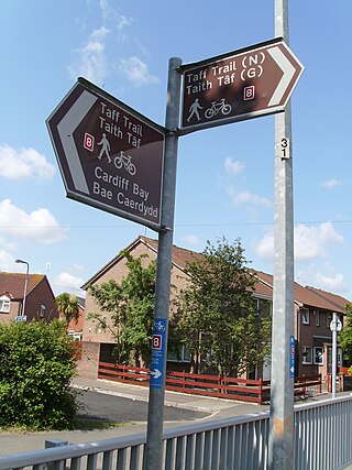
The Taff Trail is a walking and cycle path that runs for 55 miles (89 km) between Cardiff Bay and Brecon in Wales. It is so named because it follows the course of the River Taff. Along much of its length, it follows the National Cycle Network Route 8 that continues to Holyhead, and is substantially off-road.

Downhill mountain biking (DH) is a style of mountain biking practiced on steep, rough terrain that often features jumps, drops, rock gardens and other obstacles. Jumps can be up to and including 12 meters, and drops can be greater than 3 meters.
The Mawson Trail is a long-distance cycling and walking trail in South Australia starting just east of Adelaide in the Adelaide Hills and extending almost 900 kilometres (560 mi) to Blinman in the Flinders Ranges. It is suitable for mountain bikes.

Coed y Brenin is a forest in the Snowdonia National Park, North Wales near Dolgellau at grid reference SH7127. It is popular for its mountain bike trails and hiking paths. It has several man-made mountain bike singletrack courses in a woodland setting, varying in length from 12 to 38 km, and one dual slalom course.
A grading system for way-marked off-road cycling trails has been adopted in the UK, and is used by official bodies such as Forestry England and IMBA-UK. It was originally developed by Cyclists' Touring Club (CTC) employee Colin Palmer in June 1999, based on a system widely used for grading cross-country skiing routes.

The 7stanes are seven mountain biking centres spanning the south of Scotland, from the heart of the Scottish Borders to Dumfries and Galloway. They are all in Forestry and Land Scotland forests and are known as the 7stanes because each venue features a 'stane', created by artist Gordon Young, somewhere along the forest trails.

A bridle path, also bridleway, equestrian trail, horse riding path, ride, bridle road, or horse trail, is a trail or a thoroughfare that is used by people riding on horses. Trails originally created for use by horses often now serve a wider range of users, including equestrians, hikers, and cyclists. Such paths are either impassable for motorized vehicles, or vehicles are banned. The laws relating to allowable uses vary from country to country.

Grizedale Forest is a 24.47 km2 area of woodland in the Lake District of North West England, located to the east of Coniston Water and to the south of Hawkshead. It is made up of a number of hills, small tarns and the settlements of Grizedale and Satterthwaite. It is owned and managed by Forestry England and is a popular tourist destination with waymarked footpaths, mountain biking, an aerial assault course, a 16-bed hostel, and a visitor centre with a children's playground, education centre, café and shop. The car-parking of Grizedale Forest Visitors Centre is situated on the site of the former Grizedale Hall where its remains can be still seen.

Llandegla or Llandegla-yn-Iâl is a village and community in the county of Denbighshire in Wales. In the 2011 census, the community had a population of 567.

Swinley Forest is a large expanse of Crown Estate woodland managed by Forestry England mainly within the civil parishes of Windlesham in Surrey and Winkfield and Crowthorne in Berkshire, England.

Grizedale is a hamlet in the Lake District of North West England, in the middle of the Grizedale Forest, located north of Satterthwaite and south of Hawkshead. It is part of the civil parish of Satterthwaite.

Tegg's Nose is a hill east of Macclesfield in Cheshire, England. It has a short ridge with a high point of 380 metres (1,250 ft) at SJ947725, terminating in a promontory at the southern end. It lies on the western edge of the Peak District, although outside the boundary of the national park. Much of the hill's area falls within the Tegg's Nose Country Park, managed by Cheshire East Council Countryside Management Service; Tegg's Nose is also part of the Environmentally Sensitive Area Scheme.

Cycling in Cardiff, capital of Wales, is facilitated by its easy gradients and large parks. In the mid-2000s between 2.7% and 4.3% of people commuted to work by cycling in the city. In 2017 12.4% of workers cycled to work at least 5 days a week. However, cyclists in the city are deterred from cycling by poor facilities and aggressive traffic, according to research by Cardiff University.
Eastridge Mountain Bike Trail Centre is a free mountain biking venue in Shropshire, UK. The venue is developed and maintained by volunteers, and features a mixture of blue, red and black graded trails. There are also a number of steep, technical off-piste trails. Since 1991 Eastridge Woods have been used to host Downhill and XC mountain biking events since the 90's hosted the British National Mountain biking Championships in 1993,1994,1995,1996 and 1999.

Sherwood Pines Forest Park is a forest park located near the village of Kings Clipstone, Nottinghamshire, England. Originally called Clipstone Heath, it was acquired by Forestry England in 1925 and planted with trees in response to a wood shortage after World War I. The park offers activities such as walking, bushcraft, mountain biking and there is a visitor centre. It is the largest park in the East Midlands of England. The forest is also home to the average point between the geographical centres and population centres of Great Britain.


