In the United Kingdom, a listed building is a structure of particular architectural or historic interest deserving of special protection. Such buildings are placed on one of the four statutory lists maintained by Historic England in England, Historic Environment Scotland in Scotland, Cadw in Wales, and the Historic Environment Division of the Department for Communities in Northern Ireland. The classification schemes differ between England and Wales, Scotland, and Northern Ireland. The term has also been used in the Republic of Ireland, where buildings are protected under the Planning and Development Act 2000, although the statutory term in Ireland is "protected structure".

Inverurie railway station is a railway station serving the town of Inverurie, Aberdeenshire, Scotland. It is managed by ScotRail and is on the Aberdeen to Inverness Line, which is mostly single track north of this point, between Kintore and Insch. It is measured 16 miles 72 chains from Aberdeen.

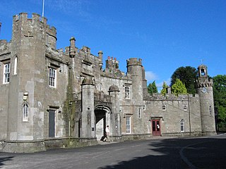
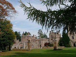
Balloch Castle is an early 19th-century country house situated at the southern tip of Loch Lomond, in West Dunbartonshire, Scotland. Balloch was a property of the Lennox family from the 11th century, and the old castle was built in the 13th century. In the 19th century the estate was purchased by John Buchanan of Ardoch, who demolished the ruins of the old castle and erected the present building. The Tudor Gothic architecture is the work of Robert Lugar. In 1915 Balloch was bought by Glasgow City Corporation, and has been leased by West Dunbartonshire Council since 1975. The estate was designated as a country park in 1980, and since 2002 has been part of Loch Lomond and The Trossachs National Park. Although the house has been periodically used for visitor facilities and council offices, it is now included on the Buildings at Risk Register. Balloch Castle is a category A listed building, and the estate is included on the Inventory of Gardens and Designed Landscapes in Scotland.

Auld Bourtreebush is a large Neolithic stone circle near Portlethen in Aberdeenshire, Scotland. It is also known as Old Bourtree Bush or Old Bourtreebush. This megalithic construction is situated very close to the recumbent stone circle at Aquhorthies and near the Causey Mounth, an ancient trackway which connects the Scottish Lowlands to the highlands. It is a scheduled monument.

Neidpath Viaduct, occasionally known as the Queen's Bridge, consists of eight stone skew arches and was built to carry the Symington to Peebles branch line of the Caledonian Railway over the River Tweed to the south-west of Neidpath Castle. Now closed to rail traffic the bridge is used as a footpath.

St. Magdalene distillery was Lowland single malt Scotch whisky distillery in Linlithgow, Scotland.

Dairsie Bridge is a 16th-century stone bridge, located 1.2 kilometres (0.75 mi) south of Dairsie, in north-east Fife, Scotland. It carries a minor road across the River Eden, linking the parishes of Dairsie to the north and Kemback to the south. The bridge is protected as a Category A listed building.

Peter Womersley was a British architect, best known for his work in the modernist style. He lived in the Scottish Borders, where a number of his buildings are located, although he worked on projects throughout the UK. Influenced principally by the work of Frank Lloyd Wright, and by the American Case Study Houses, Womersley's buildings employ such typical modernist elements as in-situ concrete and strong geometric forms, although he introduced a wider palette of materials than was typically used by Le Corbusier and his followers.

Hoddom Castle is a large tower house in Dumfries and Galloway, south Scotland. It is located by the River Annan, 4 kilometres (2.5 mi) south-west of Ecclefechan and the same distance north-west of Brydekirk in the parish of Cummertrees. The castle is protected as a category A listed building.

Bernera Barracks is in Glenelg in the West Highlands of Scotland. The barracks were constructed between 1717 and 1723 as part of a campaign by the British government to subdue the local population which had risen up in arms in the Jacobite Rising of 1715, and which would do so again in 1745. The barracks were designed by Andrews Jelfe and John Lambertus Romer of the Board of Ordnance, or possibly their predecessor James Smith, and built by Sir Patrick Strachan. Some of the stone used in the construction was taken from Dun Telve and Dun Troddan, nearby iron-age brochs. The Government troops who were garrisoned here during the Jacobite uprisings were also intended to control the crossing to Skye. Following the 1715 rising, Glenelg was chosen along with Fort George, Fort Augustus and Fort William as one of four sites in the Highlands for military barracks.

The Laxford Bridge is a stone arch bridge in Sutherland, Scotland which carries the A838 across the River Laxford north to Rhiconich and Durness.

Cartland Bridge is a road bridge on the A73 north-west of Lanark, South Lanarkshire which spans the Mouse Water, a tributary of the River Clyde. The three-span bridge was built in 1822, to designs by the engineer Thomas Telford. It is notable for being the highest bridge over inland water in Scotland. It is a category B listed building.

Fowlis Wester, also spelt Fowlis-Wester, is a small village in Perth and Kinross, Scotland. It is around 6 kilometres (3.7 mi) east of Crieff and 19 kilometres (12 mi) west of Perth. The parish of Fowlis Wester includes the Abercairny estate to the south-west.

The Victoria Swing Bridge is a swing bridge in Leith docks, Edinburgh, Scotland, which carries a dock road across the Water of Leith at a point where it is canalised as the Inner Harbour.

Historic Environment Scotland (HES) is an executive non-departmental public body responsible for investigating, caring for and promoting Scotland's historic environment. HES was formed in 2015 from the merger of government agency Historic Scotland with the Royal Commission on the Ancient and Historical Monuments of Scotland (RCAHMS). Among other duties, Historic Environment Scotland maintains more than 300 properties of national importance including Edinburgh Castle, Skara Brae and Fort George.

Aray Bridge, also known as Inveraray Bridge, is a stone two-arch public road bridge on the Inveraray Castle estate near Inveraray in Argyll and Bute, Scotland, carrying the A83 road over the mouth of the River Aray where it flows into Loch Fyne.

Stirling Old Bridge is a stone bridge which crosses the River Forth. For over 300 years it provided the lowest crossing point of the Forth and so had strategic importance.


