Langfang is a prefecture-level city of Hebei Province, which was known as Tianjin Prefecture until 1973. It was renamed Langfang Prefecture after Tianjin became a municipality and finally upgraded into a prefecture-level city in 1988. Langfang is located approximately midway between Beijing and Tianjin. At the 2020 census, the population of Langfang was 5,464,087, of whom 1,147,591 lived in the built-up area made of Guangyang and Anci districts; its total area is around 6,417.28 km2 (2,477.73 sq mi). Langfang borders Baoding to the southwest, Cangzhou to the south, Beijing to the north and Tianjin to the east. Sanhe City and Dachang Hui County are now conurbated with Beijing, so that they form part of the same built-up area. Langfang is the smallest prefecture-level city of Hebei Province by land area.

Xai-Xai is a city in the south of Mozambique. Until 1975, the city was named João Belo. It is the capital of Gaza Province. As of 2007 it has a population of 116,343.

Kilwa District is one of six administrative districts of Lindi Region in Tanzania. The District covers an area of 15,000 km2 (5,800 sq mi). The district is comparable in size to the land area of the nation state of East Timor. Kilwa district is bordered to the north by Rufiji District in Pwani Region, to the east by the Indian Ocean, to the south by the Lindi District, Nachingwea District together with Ruangwa District, and to the west by the Liwale District. The district borders every other district in Lindi Region except Lindi Municipal District. The district seat (capital) is the town of Kilwa Masoko. The district is named after the medieval Swahili city state of Kilwa Kisiwani. According to the 2012 census, the district has a total population of 190,744.
Castleridge is a residential neighbourhood in the northeast quadrant of Calgary, Alberta. It is located east of the Calgary International Airport and is bounded by 64 Avenue NE to the north, Métis Trail to the west, McKnight Boulevard to the south and Falconridge Boulevard to the east.
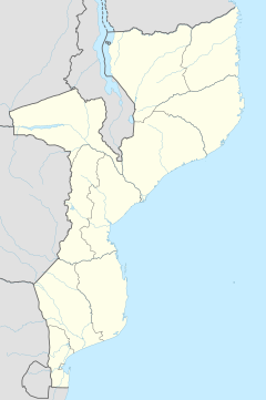
Ancuabe is a town in eastern Mozambique in Ancuabe District, Cabo Delgado Province. It is the seat of the district. According to the 1997 census it has a population of 12,561.

Viluppuram, Villupuram, or Vizhuppuram is a Municipality and the administrative headquarters of Viluppuram district.
Aliti is a village in Ancuabe District in Cabo Delgado Province in northeastern Mozambique.
Ntete is a village in Ancuabe District in Cabo Delgado Province in northeastern Mozambique.
Manocha is a village in Ancuabe District in Cabo Delgado Province in northeastern Mozambique.
Muigima is a village in Ancuabe District in Cabo Delgado Province in northeastern Mozambique.
Reva is a village in Ancuabe District in Cabo Delgado Province in northeastern Mozambique.

Manathana is a village in Peravoor Grama Panchayat of Kannur district, Kerala, India.
Alexandrovsky is a rural locality in Bolshezhirovsky Selsoviet Rural Settlement, Fatezhsky District, Kursk Oblast, Russia. Population: 6 (2010 Census); 11 (2002 Census);
2nd Pereverzevka or Vtoraya Pereverzevka is a rural locality in Vysoksky Selsoviet Rural Settlement, Medvensky District, Kursk Oblast, Russia. Population: 14 (2010 Census); 22 (2002 Census);
Kondratyevskiye Vyselki is a rural locality in Vysoksky Selsoviet Rural Settlement, Medvensky District, Kursk Oblast, Russia. Population: 22 (2010 Census); 25 (2002 Census);
Spasskiye Vyselki is a rural locality in Vysoksky Selsoviet Rural Settlement, Medvensky District, Kursk Oblast, Russia. Population: 73 (2010 Census); 98 (2002 Census);
Zvyagintsevo is a rural locality in Vysoksky Selsoviet Rural Settlement, Medvensky District, Kursk Oblast, Russia. Population: 120 (2010 Census); 145 (2002 Census);
1st Gostomlya or Pervaya Gostomlya is a rural locality and the administrative center of Gostomlyansky Selsoviet Rural Settlement, Medvensky District, Kursk Oblast, Russia. Population: 290 (2010 Census); 354 (2002 Census);
Zybovka is a rural locality in Kitayevsky Selsoviet Rural Settlement, Medvensky District, Kursk Oblast, Russia. Population: 59 (2010 Census); 83 (2002 Census);
Maslovka is a rural locality in Kitayevsky Selsoviet Rural Settlement, Medvensky District, Kursk Oblast, Russia. Population: 59 (2010 Census); 76 (2002 Census);