Verila Glacier on Livingston Island in the South Shetland Islands, Antarctica is situated southeast of southern Etar Snowfield, southwest of Berkovitsa and Tundzha Glaciers, and west of Kamchiya Glacier. It is bounded by Rotch Dome to the west, Casanovas Peak and Snow Peak to the north, and Ustra Peak to the southeast. The glacier is roughly crescent-shaped, extending 7 nautical miles in an east-west direction and 2 nautical miles in a north-south direction, and drains southwards into Walker Bay, Bransfield Strait between John Beach and Liverpool Beach at Hannah Point. The glacier's bedrock is connected to Kaliman Island in Walker Bay by a 600 m long moraine tombolo. The area was visited by 19th century British and American sealers.

Rogozen Island is a conspicuous island off the northwest coast of Robert Island, South Shetland Islands situated 920 m (1,010 yd) north-northeast of Cornwall Island, 470 m (510 yd) south-southwest of Heywood Island, and 1.74 km (1.08 mi) northwest of Svetulka Island in the Onogur group. Extending 760 m (830 yd) in east-west direction and 260 m (280 yd) wide. Surface area 16 hectares.

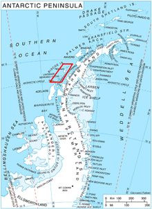
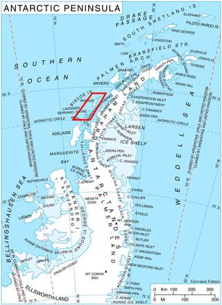
Kyiv Peninsula is the predominantly ice-covered, oval shaped peninsula projecting 35 km in northwest direction from the west side of Graham Land, Antarctic Peninsula. It is bounded by Flandres Bay to the northeast and Beascochea Bay to the southwest, and separated from Wilhelm Archipelago to the northwest by Lemaire Channel and Penola Strait. The peninsula's north extremity Cape Renard divides Graham Coast to the southwest from Danco Coast to the northeast. Mount Tranchant and Mount Demaria are found on the west coast of the peninsula.

Butamya Glacier is the 6.9 km long and 2.5 km wide glacier on Barison Peninsula, Graham Coast on the west side of Antarctic Peninsula, situated northwest of Talev Glacier and north-northeast of Chernomen Glacier. It drains northwards, and flows into Beascochea Bay.

Velingrad Peninsula is the ice-covered peninsula projecting 22.5 km in northwest direction from Graham Coast on the west side of Antarctic Peninsula. Bounded by Barilari Bay to the northeast and Holtedahl Bay to the southwest, and separated from Biscoe Islands to the northwest by Grandidier Channel. Its base is surmounted by Chiren Heights. The UK station Prospect Point operated at the west extremity of the peninsula in 1957–59.
Pickwick Island is the largest of the Pitt Islands, in the Biscoe Islands, Antarctica. It is 9.45 km long in southwest–northeast direction, separated from Renaud Island on the southwest by Mraka Sound, and has its northeast coast indented by Misionis Bay.

Rudozem Heights are the heights rising to 1504 m at the base and in the interior of German Peninsula on Fallières Coast in Graham Land, Antarctica, extending 18.5 km in northeast-southwest direction and 13.7 km in east-west direction. The heights are bounded by Bourgeois Fjord to the north and west, Dogs Leg Fjord to the south, and to the east by a glacier draining both northwards into Bourgeois Fjord and southwards into Dogs Leg Fjord.

Vrachesh Glacier is the 10.3 km long and 2.7 km wide glacier on Nordenskjöld Coast in Graham Land situated southwest of Kladorub Glacier and northeast of Enravota Glacier. It drains the southeast slopes of Detroit Plateau, flows southeastwards, and south of Papiya Nunatak turns east to enter Desislava Cove in Weddell Sea northeast of Richard Knoll. The feature is named after the settlement of Vrachesh in Western Bulgaria.

Kotev Cove is the 1.81 km wide cove indenting for 1.8 km the northeast coast of Two Hummock Island in the Palmer Archipelago, Antarctica. It is entered northwest of Butrointsi Point.
Ribnik Island is a mostly ice-covered island in the Pitt group of Biscoe Islands, Antarctica. The feature is 1 km long in southwest-northeast direction and 500 m wide.
Tambra Island is a mostly ice-covered island in the Pitt group of Biscoe Islands, Antarctica. The feature is 1.17 km long in southwest-northeast direction and 700 m wide, and is separated from the adjacent Jingle Island to the northeast by a 60 m wide passage.
Arrowsmith Island is a mostly ice-covered island in the Pitt group of Biscoe Islands, Antarctica. It is 2.53 km long in west-southwest to east-northeast direction and 900 m wide.

Rotalia Island is the rocky island off the north coast of Nelson Island in the South Shetland Islands, Antarctica extending 310 m in southeast-northwest direction and 250 m in southwest-northeast direction.
Akin Island is a wide, rocky island 280 m long in southeast-northwest direction and 100 m lying off the north coast of Nelson Island in the South Shetland Islands, Antarctica. It is “named after Akin Point on the Bulgarian Black Sea Coast.”
Padpadak Island is the mostly ice-free island extending 442 m in southwest–northeast direction and 390 m in southeast–northwest direction in the Dannebrog Islands group of Wilhelm Archipelago in the Antarctic Peninsula region. Its surface area is 8.35 ha.
Revolver Island is the partly ice-free island 645 m long in southwest–northeast direction and 284 m wide in the Dannebrog Islands group of Wilhelm Archipelago in the Antarctic Peninsula region. Its surface area is 8.77 ha.
Tyulen Island is the mostly ice-covered island 1 km long in west-southwest to east-northeast direction and 530 m wide in the Dannebrog Islands group of Wilhelm Archipelago in the Antarctic Peninsula region. Its surface area is 26.78 ha.
Meduza Island is the partly ice-covered island extending 670 m in southwest–northeast direction and 434 m in north–south direction in the Dannebrog Islands group of Wilhelm Archipelago in the Antarctic Peninsula region. Its surface area is 11.9 ha.
Mechka Island is the mostly ice-covered island extending 875 m in southwest–northeast direction and 350 m in south–north direction in the Dannebrog Islands group of Wilhelm Archipelago in the Antarctic Peninsula region. Its surface area is 15.9 ha.
Mihaylovski Cove is the 5 km wide cove indenting for 1.3 km the northwest coast of South Bay in Livingston Island, Antarctica that is entered west of Ereby Point and east of Lukovo Point, and has its head fed by Kamchiya Glacier. The area was known to early 19th century sealers who operated from nearby Johnsons Dock. The feature is named after the brothers Petar Mihaylovski, physician at St. Kliment Ohridski base during the 2007/08 and subsequent seasons, and Hristo Mihaylovski, engineer in the national Antarctic campaign during 2015/16 and subsequent seasons.