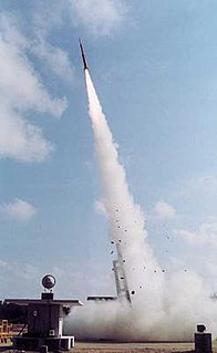
The Thumba Equatorial Rocket Launching Station (TERLS) is an Indian spaceport established on 21st November 1963, operated by the Indian Space Research Organisation (ISRO). It is located in Thumba, Thiruvananthapuram which is near the southern tip of mainland India, very close to earth's magnetic equator. It is currently used by ISRO for launching sounding rockets.

Polkovnik Zhelyazovo is a village in Krumovgrad municipality, Kardzhali Province, located in the Eastern Rhodope Mountains of southern Bulgaria.

Nork, sometimes called as Hin Nork, is a neighbourhood in the Armenian capital Yerevan. It is located in the Nork-Marash District.

Raciąski Młyn is a village in the administrative district of Gmina Tuchola, within Tuchola County, Kuyavian-Pomeranian Voivodeship, in north-central Poland. It lies approximately 10 kilometres (6 mi) north-west of Tuchola and 64 km (40 mi) north of Bydgoszcz.
Szymki is a village in the administrative district of Gmina Michałowo, within Białystok County, Podlaskie Voivodeship, in north-eastern Poland, close to the border with Belarus.

Wygoda is a village in the administrative district of Gmina Hajnówka, within Hajnówka County, Podlaskie Voivodeship, in north-eastern Poland, close to the border with Belarus. It lies approximately 3 kilometres (2 mi) north-west of Hajnówka and 48 km (30 mi) south-east of the regional capital Białystok.

Klementynów is a village in the administrative district of Gmina Niedźwiada, within Lubartów County, Lublin Voivodeship, in eastern Poland. It lies approximately 8 kilometres (5 mi) north-east of Lubartów and 31 km (19 mi) north of the regional capital Lublin.
Andrzejewo is a village in the administrative district of Gmina Sidra, within Sokółka County, Podlaskie Voivodeship, in north-eastern Poland.

Międzygórze is a village in the administrative district of Gmina Bytów, within Bytów County, Pomeranian Voivodeship, in northern Poland. It lies approximately 12 kilometres (7 mi) north of Bytów and 73 km (45 mi) west of the regional capital Gdańsk.

Osowskie is a village in the administrative district of Gmina Czarna Dąbrówka, within Bytów County, Pomeranian Voivodeship, in northern Poland. It lies approximately 5 kilometres (3 mi) south of Czarna Dąbrówka, 21 km (13 mi) north of Bytów, and 71 km (44 mi) west of the regional capital Gdańsk.

Garbówek is a village in the administrative district of Gmina Tuszyn, within Łódź East County, Łódź Voivodeship, in central Poland. It lies approximately 4 kilometres (2 mi) south of Tuszyn and 24 km (15 mi) south of the regional capital Łódź.

Anbabu is a village in the Astara Rayon of Azerbaijan. The village forms part of the municipality of Motolayataq.

Qımır is a village in the Zaqatala Rayon of Azerbaijan. The village forms part of the municipality of Çobankol.

Dimitrovka is a village in the Ismailli Rayon of Azerbaijan.

Sobótka is a village in the administrative district of Gmina Ożarów, within Opatów County, Świętokrzyskie Voivodeship, in south-central Poland. It lies approximately 11 kilometres (7 mi) south of Ożarów, 18 km (11 mi) east of Opatów, and 76 km (47 mi) east of the regional capital Kielce.

Azure Mountain is a 2,518-foot (767 m) mountain near Blue Mountain Road in the Town of Waverly, Franklin County, New York, in the Adirondack Park in the US.
Znamiączki is a village in the administrative district of Gmina Długosiodło, within Wyszków County, Masovian Voivodeship, in east-central Poland.
Stary Białcz is a village in the administrative district of Gmina Śmigiel, within Kościan County, Greater Poland Voivodeship, in west-central Poland.

Lipovac is a village in the municipality of Čelinac, Republika Srpska, Bosnia and Herzegovina.

Rockwood is a village in Somerset County, Maine, United States. The village is centered on the west end of Moosehead Lake, the largest body of fresh water in the state. Rockwood is a gateway to the north country and is located near Mount Kineo.


