Muirfield Seamount

Last updated
Muirfield Seamount
Summit depth16–18  m (52–59  ft)
Height~5,000 m (16,404 ft)
Location
Location Indian Ocean
Coordinates 13°13′30″S96°7′30″E / 13.22500°S 96.12500°E / -13.22500; 96.12500 Coordinates: 13°13′30″S96°7′30″E / 13.22500°S 96.12500°E / -13.22500; 96.12500
Country Australia (EEZ)
History
Discovery date1973

The Muirfield Seamount is a submarine mountain located in the Indian Ocean approximately 130 kilometres (70 nautical miles) southwest of the Cocos (Keeling) Islands. The Cocos Islands are an Australian territory, and therefore the Muirfield Seamount is within Australia's Exclusive Economic Zone (EEZ). The Muirfield Seamount is a submerged archipelago, approximately 2.5 kilometres (1.6 miles) in diameter and 16–18 metre s (52–59 feet ) below the surface of the sea. A 1999 biological survey of the seamount performed by the Australian Commonwealth Scientific and Industrial Research Organisation (CSIRO) revealed that the area is depauperate.

Seamount A mountain rising from the ocean seafloor that does not reach to the waters surface

A seamount is a mountain rising from the ocean floor that does not reach to the water's surface, and thus is not an island, islet or cliff-rock. Seamounts are typically formed from extinct volcanoes that rise abruptly and are usually found rising from the seafloor to 1,000–4,000 m (3,300–13,100 ft) in height. They are defined by oceanographers as independent features that rise to at least 1,000 m (3,281 ft) above the seafloor, characteristically of conical form. The peaks are often found hundreds to thousands of meters below the surface, and are therefore considered to be within the deep sea. During their evolution over geologic time, the largest seamounts may reach the sea surface where wave action erodes the summit to form a flat surface. After they have subsided and sunk below the sea surface such flat-top seamounts are called "guyots" or "tablemounts".

Indian Ocean The ocean between Africa, Asia, Australia and Antarctica (or the Southern Ocean)

The Indian Ocean is the third-largest of the world's oceanic divisions, covering 70,560,000 km2 (27,240,000 sq mi). It is bounded by Asia on the north, on the west by Africa, on the east by Australia, and on the south by the Southern Ocean or, depending on definition, by Antarctica.

Cocos (Keeling) Islands Australian external territory

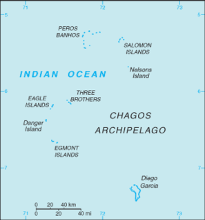
The Territory of Cocos (Keeling) Islands is an Australian external territory in the Indian Ocean, comprising a small archipelago approximately midway between Australia and Sri Lanka and closer to the Indonesian island of Sumatra. It is part of Southeast Asia and is in the Southern Hemisphere. The territory's dual name reflects that the islands have historically been known as either the Cocos Islands or the Keeling Islands.

Contents

The Muirfield Seamount was discovered accidentally in 1973 when the cargo ship MV Muirfield (a merchant vessel named after Muirfield, Scotland) was motoring in waters charted at a depth of greater than 5,000 metres (16,000 ft), when she suddenly struck an unknown object, resulting in extensive damage to her keel. [1] In 1983, HMAS Moresby, a Royal Australian Navy survey ship, surveyed the area where Muirfield was damaged, and charted in detail this previously unsuspected hazard to navigation.

Muirfield golf club in Gullane, East Lothian, Scotland

Muirfield is a privately owned links which is the home of The Honourable Company of Edinburgh Golfers. Located in Gullane, East Lothian, Scotland, overlooking the Firth of Forth, Muirfield is one of the golf courses used in rotation for The Open Championship.

Scotland Country in Northwest Europe, part of the United Kingdom

Scotland is a country that is part of the United Kingdom. It covers the northern third of the island of Great Britain, with a border with England to the southeast, and is surrounded by the Atlantic Ocean to the north and west, the North Sea to the northeast, the Irish Sea to the south, and more than 790 islands, including the Northern Isles and the Hebrides.

Keel Lower centreline structural element of a ship or boat hull

The keel is the bottom-most longitudinal structural element on a vessel. On some sailboats, it may be have a hydrodynamic and counterbalancing purpose, as well. As the laying down of the keel is the initial step in the construction of a ship, in British and American shipbuilding traditions the construction is dated from this event.

The dramatic accidental discovery of the Muirfield Seamount is often cited as an example of limitations in the vertical datum accuracy of some offshore areas as represented on nautical charts, especially on small-scale charts. More recently, in 2005 the submarine USS San Francisco (SSN-711) ran into an uncharted seamount about 560 kilometers (350 statute miles) south of Guam at a speed of 35 knots (40.3 mph; 64.8 km/h), sustaining serious damage and killing one seaman.

Nautical chart topographic map of a maritime area and adjacent coastal regions

A nautical chart is a graphic representation of a sea area and adjacent coastal regions. Depending on the scale of the chart, it may show depths of water and heights of land, natural features of the seabed, details of the coastline, navigational hazards, locations of natural and human-made aids to navigation, information on tides and currents, local details of the Earth's magnetic field, and human-made structures such as harbours, buildings and bridges. Nautical charts are essential tools for marine navigation; many countries require vessels, especially commercial ships, to carry them. Nautical charting may take the form of charts printed on paper or computerized electronic navigational charts. Recent technologies have made available paper charts which are printed "on demand" with cartographic data that has been downloaded to the commercial printing company as recently as the night before printing. With each daily download, critical data such as Local Notices to Mariners are added to the on-demand chart files so that these charts are up to date at the time of printing.

Level of measurement or scale of measure is a classification that describes the nature of information within the values assigned to variables. Psychologist Stanley Smith Stevens developed the best-known classification with four levels, or scales, of measurement: nominal, ordinal, interval, and ratio. This framework of distinguishing levels of measurement originated in psychology and is widely criticized by scholars in other disciplines. Other classifications include those by Mosteller and Tukey, and by Chrisman.

USS <i>San Francisco</i> (SSN-711) Attack submarine

USS San Francisco (SSN-711) is a Los Angeles-class nuclear submarine, the third ship or boat of the United States Navy to be named for San Francisco, California.

See also

Graveyard Seamounts A series of 28 small underwater volcanoes on the Chatham Rise, east of New Zealand

The Graveyard Seamounts is the informal name for the Graveyard Knolls. These are a series of 28 small seamounts and edifices located on the Chatham Rise, east of New Zealand. They cover about 140 km2 (54 sq mi) and stand out from the surrounding oceanic plateau that measures several hundred kilometers. They are named after various morose figures following the naming of the largest of the knolls as "the Graveyard" as it was a graveyard of fishing gear that became stuck on it. The most prominent among the group of knolls are Ghoul, Diabolical, Voodoo, Scroll, Hartless, Pyre, Gothic, Zombie, Mummy, Headstone, Morgue and Graveyard.

Jasper Seamount Underwater volcano in the Fieberling-Guadalupe seamount track, west of Baja California, Mexico

Jasper Seamount is a seamount located in the Fieberling-Guadalupe seamount track, west of Baja California, Mexico. Jasper is the site of detailed geophysical geological and geochemical studies which suggest that many seamounts, big and small, follow the same pattern of growth and death that was originally used to describe the Hawaiian - Emperor seamount chain.

Muirfield Reef is a small reef located southwest of the Cocos (Keeling) Islands in the Indian Ocean. It is about 77 nautical miles (143 km) from these islands and is part of Australia 's exclusive economic zone.

Related Research Articles

Geography of Nauru

Nauru is a tiny phosphate rock island nation located in the South Pacific Ocean south of the Marshall Islands in Oceania. It is only 53 kilometres (33 mi) south of the Equator at coordinates 0°32′S166°55′E. Nauru is one of the three great phosphate rock islands in the Pacific Ocean—the others are Banaba in Kiribati and Makatea in French Polynesia.

Hydrography Applied science of measurement and description of physical features of bodies of water

Hydrography is the branch of applied sciences which deals with the measurement and description of the physical features of oceans, seas, coastal areas, lakes and rivers, as well as with the prediction of their change over time, for the primary purpose of safety of navigation and in support of all other marine activities, including economic development, security and defence, scientific research, and environmental protection.

Pratas Islands island group in the north of the South China Sea

The Pratas Islands, also known as the Dongsha Islands and Tungsha Islands, are three atolls in the north of the South China Sea. They consist of one island, two coral reefs and two banks, and are located about 170 nautical miles southeast of Hong Kong. The Republic of China (Taiwan) controls them and has declared part of them the Dongsha Atoll National Park. The People's Republic of China claims them as part of China.

Balls Pyramid an island and an erosional remnant of a shield volcano, 562 m tall and 1100 m×300 m in length and breadth, 20 km southeast of Lord Howe Island in the Pacific; part of the Lord Howe Island Marine Park in Australia

Ball's Pyramid is an erosional remnant of a shield volcano and caldera lying 20 kilometres (12 mi) southeast of Lord Howe Island in the Pacific Ocean. It is 562 metres (1,844 ft) high, while measuring only 1,100 metres (3,600 ft) in length and 300 metres (980 ft) across, making it the tallest volcanic stack in the world. Ball's Pyramid is part of the Lord Howe Island Marine Park in Australia and is over 643 kilometres (400 mi) northeast of Sydney, New South Wales.

Geography of the British Indian Ocean Territory

The British Indian Ocean Territory (BIOT) is an archipelago of 55 islands in the Indian Ocean, located south of India. It is situated approximately halfway between Africa and Indonesia. The islands form a semicircular group with an open sea towards the east. The largest, Diego Garcia, is located at the southern extreme end. It measures 60 square kilometres (23 sq mi) and accounts for almost three-quarters of the total land area of the territory. Diego Garcia is the only inhabited island and is home to the joint UK-US naval support facility. Other islands within the archipelago include Danger Island, Three Brothers Islands, Nelson Island, and Peros Banhos, as well as the island groups of the Egmont Islands, Eagle Islands, and the Salomon Islands.

Shire of Cocos Local government area in Australia

The Shire of Cocos (Keeling) Islands is a local government area which manages local affairs on the Australian external territory of Cocos (Keeling) Islands. The island is grouped with Western Australia but is administered by the Department of Infrastructure, Regional Development and Cities and an Administrator.

North Keeling island

North Keeling is a small, uninhabited coral atoll, approximately 1.2 square kilometres (0.46 sq mi) in area, about 25 kilometres (16 mi) north of Horsburgh Island. It is the northernmost atoll and island of the Australian territory of the Cocos (Keeling) Islands. It consists of just one C-shaped island, a nearly closed atoll ring with a small opening into the lagoon, about 50 metres (160 ft) wide, on the east side. The lagoon is about 0.5 square kilometres (0.19 sq mi) in area. The island is home to the only surviving population of the endemic, and endangered, Cocos buff-banded rail, as well as large breeding colonies of seabirds. Since 1995, North Keeling Island and the surrounding sea to 1.5 kilometres (0.93 mi) from shore have been within the Pulu Keeling National Park.

The Australian Hydrographic Service is the Australian Commonwealth Government agency responsible for providing hydrographic services that meet Australia's obligations under the SOLAS convention and the national interest; enabling safe navigation, maritime trade and supporting protection of the marine environment. The agency, headquartered at the Australian Hydrographic Office in Wollongong, New South Wales, is an element of the Royal Australian Navy (RAN), and serves both military and civilian functions. The names Australian Hydrographic Service and the Australian Hydrographic Office are commonly abbreviated as AHS or AHO respectively.

Bowie Seamount Submarine volcano in the northeastern Pacific Ocean

Bowie Seamount is a large submarine volcano in the northeastern Pacific Ocean, located 180 km (110 mi) west of Haida Gwaii, British Columbia, Canada.

Frederick Reefs Reef in Queensland, Australia

Frederick Reef is in the Coral Sea Islands, over 220 nautical miles (410 km) northeast of Gladstone, Queensland. The reef gets its name from Frederick, which first reported sighting the reef.

Creal Reef Light lighthouse in Queensland, Australia

Creal Reef Light is an active lighthouse located at Creal Reef, a planar reef about 150 kilometres (93 mi) east of Mackay, Queensland, Australia. It guides ships outgoing from Mackay into Hydrographers Passage, a deep water channel east of Mackay. The structure is a stainless steel tower, which also serves as a daymark and carries a racon.

2012 Kermadec Islands eruption A major undersea volcanic eruption in the Kermadec Islands of New Zealand

The 2012 Kermadec Islands eruption was a major undersea volcanic eruption that was produced by the previously little-known Havre Seamount near the L'Esperance and L'Havre Rocks in the Kermadec Islands of New Zealand. The large volume of low density pumice produced by the eruption accumulated as a large area of floating pumice, a pumice raft, that was originally covering a surface of 400 square kilometres, spread to a continuous float of between 19,000 and 26,000 square kilometres and within three months dispersed to an area of more than twice the size of New Zealand.

Beagle Gulf is a gulf in the Northern Territory of Australia which opens on its west side to the Timor Sea. The gulf is bounded to the south by the mainland and to the north by Bathurst and Melville Islands. It is connected to Van Diemen Gulf in the east by Clarence Strait. Its south coast includes the natural harbours of Darwin and Bynoe. It is approximately 100 km long and 50 km wide. It surrounds the Quail Island Group.

Hertford was a freighter which was built in Germany in 1917 and served with both the Hamburg-Amerika Linie and Federal Steam Navigation Co Ltd before being lost after torpedoing by the German submarine U-571 off the coast of Massachusetts in 1942. She was also extensively damaged after striking a German mine off the Australian coast in 1940.

Point Marsden South Australia

Point Marsden is a headland located on the north coast of Kangaroo Island in South Australia. It was named after William Marsden, Second Secretary to the Admiralty by Matthew Flinders in 1802. It is the western extremity of Nepean Bay and has been the site of a navigation aid since 1915.

References

  1. Calder, Nigel. How to Read a Navigational Chart: A Complete Guide to the Symbols, Abbreviations, and Data Displayed on Nautical Charts. International Marine/Ragged Mountain Press, 2002.