Wangla is a Market Center in Sandhikharka Municipality of Arghakhanchi District in the Lumbini Zone of southern Nepal. The former village development committee (VDC) was converted into a municipality on 18 May 2014 by merging the existing Sandhikharka, Wangla, Narapani, Khanchikot, Keemadada, Argha and Dibharna VDCs. At the time of the 1991 Nepal census, the town had a population of 5,142 living in 1,033 houses. At the time of the 2001 Nepal census, the population was 5,380, of which 66% was literate.
Dibharna is a market center in Sandhikharka Municipality of Arghakhanchi District in the Lumbini Zone of Western Nepal. The former village development committee (VDC) was converted into a municipality on 18 May 2014 by merging the existing Sandhikharka, Bangla, Narapani, Khanchikot, Keemadada, Argha and Dibharna VDCs. At the time of the 1991 Nepal census, the town had a population of 4,490 living in 841 houses. At the time of the 2001 Nepal census, the population was 6,990, of which 56% was literate.
Kimadanda is a market center in Sandhikharka Municipality of Arghakhanchi District in the Lumbini Zone of Western Nepal. The former village development committee (VDC) was converted into municipality on 18 May 2014 by merging the existing Sandhikharka, Bangla, Narapani, Khanchikot, Kimadada, Argha and Dibharna VDCs. At the time of the 1991 Nepal census, the town had a population of 5,430 living in 1,085 houses. At the time of the 2001 Nepal census, the population was 3,514, of which 53% was literate.

Budhanilkantha is a city in Kathmandu district of Bagmati province of Nepal. It is the 3rd largest city in the Kathmandu Valley after Kathmandu and Lalitpur. As per 2021 Nepal census, the city population was 179,688 and 26,678 households. It was established on 2 December 2014 by merging the former Village development committees Hattigauda, Khadka Bhadrakali, Chapali Bhadrakali, Mahankal, Bishnu, Chunikhel and Kapan. The city is situated at the foot of Shivapuri hill. At the time of the 2011 Nepal census, it had a population of 15,421.
Manpur Tapara is a town and marketplace in Rajapur Municipality in Bardiya District in the Bheri Zone of south-western Nepal. The former village development committee (VDC) was merged with Daulatpur, Naya Gaun, Badalpur, Bhimapur and Rajapur VDCs to form the new municipality on 18 May 2014. It is almost at the centre of river island called Bhawara Tappu of Karnali River.

Chandannath is a municipality in Jumla District in the Karnali Province of Nepal. The municipality was established on 18 May 2014 by merging the existing Mahat Gaun, Talium, Kartik Swami (Jumla), and Chandannath village development committees (VDCs). At the time of the 1991 Nepal census it had a population of 5,842 persons living in 1,000 individual households.
Agryouli is a town in Kawaswati Municipality in Nawalparasi District in the Lumbini Zone of southern Nepal. The municipality was formed by merging the existing Kawaswati, Shivamandir, Pithauli, Agryouli VDCs. At the time of the 1991 Nepal census it had a population of 8820 people living in 1398 individual households.
Amarapuri is a town in Gaidakot Municipality in Nawalparasi District in the Lumbini Zone of southern Nepal. It became a municipality in May 2014 by merging the existing Mukundapur, Amarapuri, Gaidakot, Nawalparasi, VDCs. At the time of the 1991 Nepal census it had a population of 5,451 living in 967 households. Amarapuri has three high schools, the Shree Laxmi Higher Secondary School, Amar Jyoti Higher Secondary School and Amar English Higher Secondary Boarding School.
Kawasoti is a Municipality in Nawalparasi District in the Lumbini Zone of southern Nepal. The municipality was formed by merging the existing Kawasoti, Shivamandir, Pithauli, Agryouli VDCs. At the time of the 1991 Nepal census it had a population of 6886 people living in 1169 individual households.
Kolhuwa is a village development committee in Nawalparasi District in the Lumbini Zone of southern Nepal. At the time of the 1991 Nepal census it had a population of 6292 people living in 1025 individual households. .This VDC was merged in the Madhyabindu municipality on 19 September 2015 along with Tamasariya and Narayani Village development committees (VDCs). The center of the municipality is established in the former Tamasariya VDC of Chormara Bazaar. After merging the three VDCs population it had a total population of 28,224 according to 2011 Nepal census.
Makar is a town in Bardaghat Municipality in Nawalparasi District in the Lumbini Zone of southern Nepal. The municipality was established on 18 May 2014 by merging existing Makar and Panchanagar VDCs. At the time of the 1991 Nepal census it had a population of 16,206 people living in 2780 individual households.
'Panchanagar' is a town in Bardaghat Municipality in Nawalparasi District in the Lumbini Zone of southern Nepal. The municipality was established on 18 May 2014 by merging existing Makar and Panchanagar VDCs. At the time of the 1991 Nepal census it had a population of 6238 people living in 1023 individual households. This VDC lies near the Churya Hilly Range.The inhabitants people who live here are mostly Chhetri, Brahmin, Tharu, Magar, Newar, Dalits and Adhibasi. Most Youngest Nepali Football Team Star Bimal Magar was Born in Panchanagar VDC.
Pithauli is a town in Kawaswati Municipality in Nawalparasi District in the Lumbini Zone of southern Nepal. The municipality was formed by merging the existing Kawaswati, Shivamandir, Pithauli, Agryouli VDCs. At the time of the 1991 Nepal census it had a population of 5957 people living in 1084 individual households.
Pragatinagar is a town in Devachuli Municipality in Nawalparasi District in the Lumbini Zone of southern Nepal. The municipality was established on 18 May 2014 by merging existing Devachuli, Dibyapuri, Pragatinagar VDCs. At the time of the 2001 Nepal census it had a population of 11,771 people living in the VDC. There are 2690 households as of June 2010 in the VDC with 100 per cent school enrollment, and birth registration. It also has the lowest level of malnutrition and one of the highest level of adult literacy (86%) in Nepal.
Shivamandir is a town in Kawaswati Municipality in Nawalparasi District in the Lumbini Zone of southern Nepal. The municipality was formed by merging the existing Kawaswati, Shivamandir, Pithauli, Agryouli VDCs. At the time of the 1991 Nepal census it had a population of 12,948 people living in 2362 individual households.
{{Infobox settlement |name = Sunwal |other_name = |native_name = सुनवल नगरपालिका |nickname = |settlement_type = Municipality |motto = |image_skyline = |image_caption = |image_flag = |image_seal = |image_map = |mapsize = 300px |map_caption = Map of the village development committees in Nawalparasi District |pushpin_map = Nepal |pushpin_label_position = bottom |pushpin_mapsize = 300 |pushpin_map_caption = Location in Nepal |subdivision_type = Country |subdivision_name = Nepal |subdivision_type2 = District |subdivision_name2 = Parasi |subdivision_type3 = Development Region |subdivison_name3 = Western Development Region | |government_footnotes = |government_type = |leader_title = Mayor |leader_name = Bimala Aryal [[CPN- UML |leader_title1 = Deputy Mayor |leader_name1 = Surya Prasad Dube (CPN-UML |established_title = |established_date = |unit_pref = |area_footnotes = |area_total_km2 = |population_as_of = 2011 |population_footnotes = |population_note = |population_total = 39850 |population_density_km2 = auto |population_blank1_title = Ethnicities |timezone = NST |utc_offset = +5:45 |timezone_DST = |utc_offset_DST = |coordinates = 27.63°N 83.65°E |elevation_footnotes = |elevation_m = |postal_code_type = |postal_code = |area_code =33000 |blank_name = |blank_info = |website = www.sunwalmun.gov.np |footnotes = }}Sunwal is a municipality in the Parasi District of Nepal. It is in the Western Development Region, Lumbini Zone. It was announced as a municipality in 2011, where three neighboring Village Development Committees were combined—Sunwal, Swathi, and Ramnagar. It is the urban core of a rapidly growing urban agglomerate in Nepal and it belongs to the Lumbini province under the new constitution. Sunwal is the first child friendly local government of Nepal.
Gaindakot is a municipality in Nawalpur District in the Lumbini Zone of southern Nepal. It became a municipality in May 2014 by merging the existing Mukundapur, Amarapuri, and Gaindakot VDCs. It was again expanded by merging Ratanpur VDC. It is situated on the shore of Narayani River in the lap of Maula Kalika temple. So this place has a great possibility of tourism development. At the time of the 2011 Nepal census, it had a population of 58,841 and 13,623 individual households according to 2011 Nepal census. Contributed in the article by Prashant Subedi

Madhyabindu is a municipality of Nawalpur District in Lumbini Zone of Southern Nepal. The municipality was established on 19 September 2015 by merging the existing Tamasariya, Naya Belahani and Kolhuwa Village development committees (Nepal)|Village development committee]]s (VDCs). The center of the municipality is established in the former Tamasariya VDC of Chormara Bazaar. After merging the three VDCs population it had a total population of 28,224 according to 2011 Nepal census. After the government decision the number of Sub Metropolitan cities and municipalities has reached 12 and 217 respectively in Nepal.
Sundar Haraicha is a municipality in Morang District of Province No. 1 in Nepal. It is centered around Biratchowk town which is the gateway to Biratnagar. It borders Itahari Sub- Metropolitan city to the West, Dharan Sub- Metropolitan city to the Northwest and Belbari municipality to the East and is connected by the Mahendra Highway. It is one of the fastest growing cities in the Eastern Nepal and the second largest city of Morang district after Biratnagar with 121,305 inhabitants living in 26,677 households. It consists the town centres of Biratchowk and Gothgaun which are parts of the Greater Birat Development Area which incorporates the cities of Biratnagar-Itahari-Gothgau-Biratchowk-Dharan primarily located on the Koshi Highway in Eastern Nepal, with an estimated total urban agglomerated population of 804,300 people living in 159,332 households.
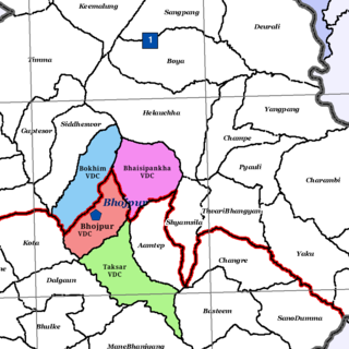
Bhojpur is a neighborhood in Bhojpur Municipality which is located in Bhojpur District in Province No. 1 of Nepal. The Bhojpur Village Panchayat was established in 1962 and was renamed as Bhojpur Village development committee in 1990.

