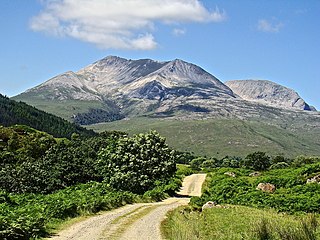
Beinn Eighe is a mountain massif in the Torridon area of Wester Ross in the Northwest Highlands of Scotland. Lying south of Loch Maree, it forms a long ridge with many spurs and summits, two of which are classified as Munros: Ruadh-stac Mòr at 1,010 m (3,314 ft) and Spidean Coire nan Clach at 993 m (3,258 ft). Unlike most other hills in the area it has a cap of Cambrian basal quartzite which gives the peaks of Beinn Eighe a distinctive light colour. Its complex topography has made it popular with both hillwalkers and climbers and the national nature reserve on its northern side makes it an accessible mountain for all visitors.

Beinn Dearg is the fourth highest of the Torridon Hills in the highlands of Scotland. Beinn Dearg offers all the typical features of a Torridon hill, with steeply terraced rocky sides dissected by near vertical gullies. The summit ridge is an airy crest that offers some easy scrambling; alternatively this can be avoided by following a path that traverses the terraces on the southern side.
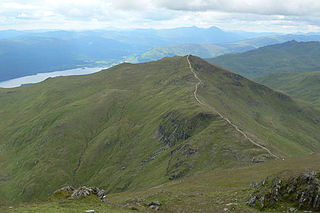
Beinn Ghlas is a mountain in the Breadalbane region of the Scottish Highlands. It lies on the north shore of Loch Tay and is part of the Ben Lawers Range. It is a Munro with a height of 1,103 metres (3,619 ft).
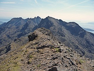
Sgùrr na Banachdaich, also spelt Sgurr na Banachdich in English, is a peak in the Cuillin mountains on the Isle of Skye, Scotland. It reaches a height of 965 metres (3,166 ft), making it a Munro.

Mam Sodhail or Màm Sabhail (Gaelic), sometimes anglicised "Mam Soul", is a mountain with a height of 1,181 metres (3,875 ft) in the Northwest Highlands of Scotland. Classed as a Munro, it is beside Carn Eige in the secluded country on the northern side of Glen Affric, some 30 kilometres east of Kyle of Lochalsh.

Stob Bàn is a Scottish mountain situated at the western end of the Mamores ridge, five and a half kilometres north-west of Kinlochleven. With a height of 999 metres it qualifies as a Munro. Stob Bàn is a distinctive sight when viewed from lower Glen Nevis with its sharp peak and capping of white quartzite rocks which are often mistaken for snow; its Gaelic name translates as White Peak or Light Coloured Peak.

A' Chralaig is a mountain in the Northwest Highlands of Scotland, north of Loch Cluanie and south of Glen Affric. It is a Munro with a height of 1,120 metres (3,670 ft). It is the highest peak along Glen Shiel and can be easily climbed from the Cluanie Inn on the A87. The eastern slopes of the mountain, are owned by the Forestry Commission and are part of the Kintail National Scenic Area.

Mullach nan Coirean or Sgùrr a' Chaorainn is one of the Mamores mountains in the Scottish Highlands. It reaches a height of 939 metres (3081 feet) and is the most westerly of the ten Munros in the Mamores. It has a lower peak to the west, Meall a' Chaorainn. To the east, it is linked to the neighbouring mountain Stob Bàn by a bealach at a height of 846 metres; these two Munros are often climbed together from Glen Nevis.
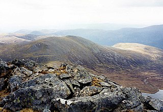
Càrn nan Gobhar is a mountain rising to 993 metres (3,258 ft) in the Northwest Highlands of Scotland. It stands on the northern side of Loch Mullardoch in the upper part of Glen Cannich, in a remote group of four Munros informally known as "The Mullardochs" which form the high ground between Loch Mullardoch and Loch Monar.

A' Bhuidheanach Bheag is a Scottish mountain situated on the eastern side of the Pass of Drumochter, some 24 km WNW of Blair Atholl. The mountain straddles the border between Highland and Perth and Kinross council areas although the actual summit is in the latter.
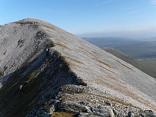
Stob Coire an Laoigh is a Scottish mountain in The Grey Corries Range, 15 kilometres north east of Kinlochleven.
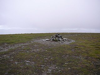
Mullach Clach a' Bhlàir or Meall Tional is a Munro in the Cairngorm mountain range of Scotland.

Sgùrr nan Conbhairean is a mountain in the Northwest Highlands of Scotland, lying north of Loch Cluanie and south of Glen Affric. A dome-shaped mountain with a height of 1,109 metres (3,638 ft), it is part of a group of three Munros, the other two being A' Chràlaig and Mullach Fraoch-choire.
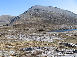
Meallan Liath Coire Mhic Dhughaill is a mountain in the Northwest Highlands, Scotland. It lies in the far north of Scotland between Lairg and Durness in Sutherland.

Sgurr Mhic Bharraich is a mountain in the Northwest Highlands, Scotland, at the head of Loch Duich in Ross-shire.

Stob Coire a' Chearcaill is a mountain in the Northwest Highlands, Scotland. It lies west of Loch Linnhe in Lochaber.

Beinn Mhic-Mhonaidh is a mountain in the Grampian Mountains of Scotland, west of Glen Orchy in Argyll and Bute.
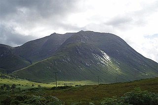
Beinn Mhic Chasgaig is a mountain in the Grampian Mountains of Scotland. It lies near the head of Glen Etive in Highland.

Beinn Bharrain is a mountain on the Isle of Arran, Scotland, located in the far northwest of the Island.


