Hertfordshire is a ceremonial county in the East of England and one of the home counties. It borders Bedfordshire to the north-west, Cambridgeshire to the north-east, Essex to the east, Greater London to the south and Buckinghamshire to the west. The largest settlement is Watford, and the county town is Hertford.

Bricket Wood is a village in the county of Hertfordshire, England, 4.2 miles (6.8 km) south of St Albans city centre and 4.2 miles (6.8 km) north-northeast of Watford.

Watford is a town and non-metropolitan district with borough status in Hertfordshire, England, 15 miles (24 km) northwest of Central London, on the banks of the River Colne.

St Albans, also known as the City and District of St Albans, is a non-metropolitan district with both borough and city status in Hertfordshire, England. Its council is based in St Albans, the largest settlement in the district. The district also includes the town of Harpenden and several villages. The district borders North Hertfordshire, Welwyn Hatfield, Hertsmere, Watford, Three Rivers, Dacorum, and Central Bedfordshire.

The Ver is a 28 km (17 mi) long chalk stream in Hertfordshire, England. It is a tributary of the River Colne.
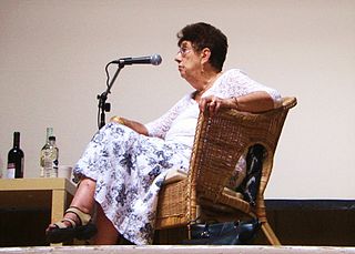
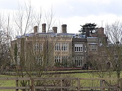
Lois Bourne who also went under the craft name Tanith, was an influential figure in the Neopagan religion of Wicca, having been involved in it from the early 1960s, and wrote a number of books on the subject. Originally initiated into Gardnerian Wicca by Gerald Gardner, she rose to become the high priestess of the Bricket Wood coven, the first Wiccan coven started by Gerald Gardner, which was based in Bricket Wood in Hertfordshire, working alongside the high priest Jack Bracelin.

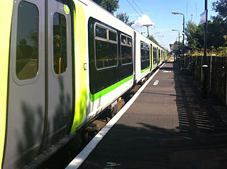
The Abbey Line, also known as the St Albans Abbey branch line, is a railway line from Watford Junction to St Albans Abbey. The 6.5-mile (10.5 km) route passes through town and countryside in the county of Hertfordshire, just outside the boundaries of the Oyster Card and London fare zones. Its northern terminus, St Albans Abbey, is located in the south of the city, around 0.75 miles (1.21 km) away from the larger St Albans City station on the Midland Main Line. It is a semi-rural line and, due to its single-track operation, service frequencies are limited. The service is sometimes referred to locally as the Abbey Flyer.

Watford is a UK parliamentary constituency represented in the House of Commons since 2024 by Matt Turmaine, a member of the Labour Party.
St Stephen is a civil parish in the St Albans City and District in Hertfordshire, England. It is located approximately 17 miles (27 km) north-northwest of central London, straddling the M25 motorway and immediately adjacent to the southern boundary of St Albans. St Stephen is a partly urbanised parish with multiple centres of activity and open land that forms part of the Metropolitan Green Belt. The local council is St Stephen Parish Council. The parish covers Bricket Wood, Chiswell Green, Frogmore, Colney Street, How Wood and Park Street. It is an ancient parish, and sections of it were transferred to St Albans progressively up to 1935. At the 2011 census it had a population of 13,865.

Park Street is a small village in Hertfordshire, England. It is on the southern outskirts of St Albans, around 2 miles (3.2 km) south of the city centre, and is separated from the rest of the city's contiguous built-up area by a buffer to the north.

Cassiobury Park is the principal public park in Watford, Hertfordshire, in England. It was created in 1909 from the purchase by Watford Borough Council of part of the estate of the Earls of Essex around Cassiobury House which was subsequently demolished in 1927. It comprises over 190 acres (77 ha) and extends from the A412 Rickmansworth Road in the east to the Grand Union Canal in the west, and lies to the south of the Watford suburb of Cassiobury, which was also created from the estate. The western part is a 62-acre (25.1 ha) Local Nature Reserve managed by the Herts and Middlesex Wildlife Trust. The park hosts the free, weekly timed parkrun 5 km event every Saturday morning at 9 am, starting on the field near the Shepherds Road entrance to the park, and finishing by the bandstand.

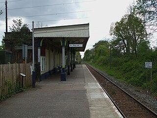
Park Street railway station serves the village of Park Street, Hertfordshire, England. It is the penultimate station on the Abbey Line. The station and all trains serving it are operated by London Northwestern Railway.
Watford North railway station is a National Rail station which serves the North Watford area in Hertfordshire, England in the United Kingdom. It is the first station on the Abbey Line, a single-track branch line which runs from Watford Junction to St Albans Abbey and is located approximately 3⁄4 mile (1.2 km) north east of Watford Junction. It is adjacent to a level crossing where the Abbey Line crosses Bushey Mill Lane.

Garston railway station serves the Garston area of Watford in Hertfordshire, England. It is the third station on the Abbey Line after Watford Junction and Watford North. The station and all trains serving it are operated by London Northwestern Railway.
Bricket Wood railway station is in the village of Bricket Wood, Hertfordshire, England, on the Abbey Line 31⁄4 miles (5 km) east of Watford Junction. The station and all trains serving it are operated by London Northwestern Railway.

How Wood railway station is in the village of How Wood, Hertfordshire, England. It is the fourth station on the Abbey Line, 4+1⁄2 miles (7.2 km) from Watford Junction. Like all the other stations on the branch, it is a simple unstaffed halt. It was opened by British Rail in October 1988 to coincide with the overhead electrification of the line.

How Wood is a residential village, south of Park Street village between the centres of Watford and St Albans in St Stephen civil parish, Hertfordshire, England.

Bricket Wood Common is a 70 hectare open space and biological Site of Special Scientific Interest in Bricket Wood in Hertfordshire. It is managed by St Albans City and District Council together with the Countryside Management Service and Bricket Wood Joint Management Committee.
National Cycle Route 61 is part of the National Cycle Network managed by the charity Sustrans. It runs for 34 miles from Maidenhead (Berkshire) to Rye House (Hertfordshire) via Uxbridge, Watford, St Albans, Hatfield, Welwyn Garden City and Hertford in the United Kingdom.