Related Research Articles
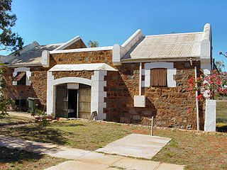
Roebourne is a former gold rush town in Western Australia's Pilbara region. It is 202 km from Port Hedland and 1,563 km from Perth, the state's capital. It prospered during its gold boom of the late 19th century and was once the largest settlement between Darwin and Perth. At the 2016 census, Roebourne and the surrounding area had a population of 981.

The City of Canterbury was a local government area in the south–west region of Sydney, New South Wales, Australia. The city was primarily residential and light industrial in character, and was home to over 130 nationalities. With a majority of its residents being born overseas, the council marketed itself as the "City of Cultural Diversity." First incorporated as the Municipality of Canterbury in 1879, the council became known as the City of Canterbury in 1993.
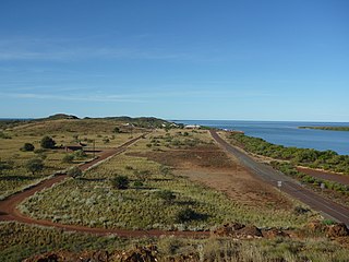
Cossack is an historic ghost town located 1,480 km north of Perth and 15 km from Roebourne in the Pilbara region of Western Australia. The nearest town to Cossack is Wickham.

Civil disturbances in Western Australia include race riots, prison riots, and religious conflicts – often Protestant versus Catholic groups.

Edward Timothy Hooley, usually known as E. T. Hooley or Tim Hooley, was an explorer in Western Australia, who in 1866 pioneered an overland stock route from Geraldton to the Ashburton River. He entered politics in later life, serving nearly three years as a Member of the Western Australian Legislative Council, then nearly six years in the Western Australian Legislative Assembly.

The City of Karratha is one of the four local government areas in the Pilbara region of Western Australia. It covers an area of 15,882 square kilometres (6,132 sq mi) and had a population of about 21,500 as at the 2016 Census, most of which is located in its seat of government, the city of Karratha, and the major towns. It was formerly known as the Shire of Roebourne but was renamed and granted city status on 1 July 2014.
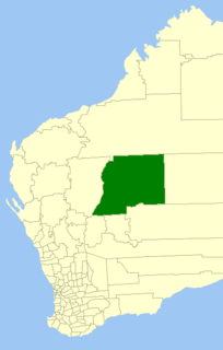
The Shire of Wiluna is a local government area in the Mid West region of Western Australia, about 950 kilometres (590 mi) northeast of the state capital, Perth. The Shire covers an area of 182,155 square kilometres (70,330 sq mi), and its seat of government is the town of Wiluna.
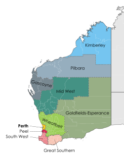
Pilbara newspapers is a selection of newspapers published in the Pilbara region of Western Australia.

Robert John Sholl was a government administrator, magistrate, explorer, journalist, entrepreneur, harbourmaster, customs official, postmaster and lay reader in Western Australia (WA), during the colonial era. Because of his multiple, simultaneous roles, which carried judicial, political, cultural and commercial power and influence, Sholl is regarded as a significant figure in the history of North-West Australia, at an early stage of its settlement by Europeans.
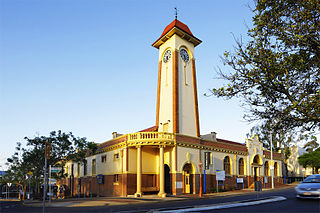
The Town of Sandgate is a former local government area of Queensland, Australia, located in northern Brisbane adjacent to Moreton Bay.
Chirritta Station, most often referred to as Chirritta or Cherratta, is a pastoral lease operating as a sheep station in Western Australia.
The Municipality of Camperdown was a local government area of Sydney, New South Wales, Australia. The municipality was proclaimed in 1862 and, with an area of 1.6 square kilometres, covered the entire suburb of Camperdown, as well as small parts of Annandale, Newtown and Stanmore. The municipality unified in February 1870 with the Municipality of Cook, which had also been established in 1862 to the north. After years of financial difficulties, the Camperdown council was formally amalgamated with the City of Sydney on 22 December 1908.

The Municipality of Waterloo was a local government area of Sydney, New South Wales, Australia. The municipality was proclaimed on 16 May 1860 and, with an area of 3.4 square kilometres, included the modern suburbs of Waterloo, Zetland and Rosebery. The suburb of Alexandria was originally included as the Western Ward of the council but seceded as a separate municipality in 1868. After several attempts to amalgamate with various neighbours in the mid-1920s, the council was amalgamated with the City of Sydney, along with most of its neighbours, with the passing of the Local Government (Areas) Act 1948, although parts of the former council area were transferred in 1967 to the City of South Sydney.
The Shire of Tableland was a local government area in the Pilbara region of Western Australia.
The Shire of Marble Bar was a local government area in the Pilbara region of Western Australia. It was established as the Bamboo Road District on 4 September 1896, and was based in the now-former town of Bamboo Creek. The first election was held in January 1897.
The Municipality of Coolgardie was a local government area in Western Australia, centred on the town of Coolgardie.
The Municipality of Nannine was a local government area in Western Australia, centred on the mining town of Nannine.
The Municipality of Broad Arrow-Paddington was a local government area in Western Australia centred on the mining towns of Broad Arrow and Paddington.
The Municipality of Broome was a local government area in Western Australia centred on the coastal town of Broome. It existed from 1904 to 1918.

Holy Trinity Anglican Church is a heritage-listed Anglican church at Hampton Street, Roebourne, Western Australia. It is both the oldest stone building and the oldest church in North West Australia. Completed in 1883, and reconstructed in 1894–95 after being destroyed in a cyclone, it was restored over about a decade in the 2010s, during which time it was again severely damaged by a cyclone.
References
- 1 2 "Municipality Boundary Amendments Register" (PDF). Western Australian Electoral Distribution Commission. Retrieved 11 January 2020.
- ↑ "LOCAL". Victorian Express . Western Australia. 24 December 1887. p. 5. Retrieved 10 February 2020– via Trove.
- ↑ "NEWS FROM ROEBOURNE". The West Australian . Western Australia. 22 December 1887. p. 2. Retrieved 10 February 2020– via Trove.
- ↑ "NEWS FROM ROEBOURNE". Western Mail . Western Australia. 24 December 1887. p. 31. Retrieved 10 February 2020– via Trove.
- ↑ "MUNICIPAL". Northern Public Opinion And Mining And Pastoral News . Western Australia. 3 August 1895. p. 3. Retrieved 10 February 2020– via Trove.
- ↑ "MUNICIPAL". Northern Public Opinion And Mining And Pastoral News . Western Australia. 26 October 1895. p. 2. Retrieved 10 February 2020– via Trove.
- ↑ "NOTES FROM COSSACK". The Daily News . Western Australia. 3 March 1888. p. 3. Retrieved 10 February 2020– via Trove.
- ↑ "GOVERNMENT GAZETTE". The Daily News . Western Australia. 17 March 1888. p. 3. Retrieved 10 February 2020– via Trove.
- ↑ "GOVERNMENT GAZETTE". The West Australian . Western Australia. 13 July 1888. p. 3. Retrieved 10 February 2020– via Trove.
- ↑ "GOVERNMENT GAZETTE". The West Australian . Western Australia. 21 June 1889. p. 3. Retrieved 10 February 2020– via Trove.
- ↑ "News". Victorian Express . Western Australia. 24 January 1891. p. 4. Retrieved 10 February 2020– via Trove.
- ↑ "COSSACK MUNICIPAL COUNCIL". Northern Public Opinion And Mining And Pastoral News . Western Australia. 23 March 1895. p. 2. Retrieved 10 February 2020– via Trove.
- ↑ "The Northern Times". Northern Times . Western Australia. 26 March 1910. p. 2. Retrieved 10 February 2020– via Trove.
- ↑ "COSSACK CAPERS". Sunday Times (Perth) . Western Australia. 30 January 1910. p. 4 (THIRD SECTION). Retrieved 10 February 2020– via Trove.