The Indian River is a river in Renfrew County and Nipissing District in Eastern and Northeastern Ontario, Canada. It is in the Saint Lawrence River drainage basin, and is a left tributary of the Muskrat River.
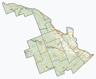
Whitewater Region is a township on the Ottawa River in Renfrew County, located within the scenic Ottawa Valley in eastern Ontario, Canada. Whitewater Region is made up of the former municipalities of Beachburg, Cobden, Ross and Westmeath, which were amalgamated into the current township on January 1, 2001.

The Seguin River is a river in Parry Sound District in central Ontario, Canada that empties into Parry Sound on Georgian Bay, Lake Huron at the town of Parry Sound. The river's name comes from the Ojibwe word ziigwan, meaning "spring".
The Moira River is a river in Hastings County in eastern Ontario, Canada. It travels from its source in the centre of the county to the Bay of Quinte at the county seat Belleville.

Lake Doré is a freshwater lake in the township of North Algona-Wilberforce, Renfrew County, Ontario, Canada, about 6 kilometres (3.7 mi) north of the community of Eganville in the neighbouring township of Bonnechere Valley.

The Skootamatta River is a river in the Lake Ontario drainage basin in Hastings and Lennox and Addington Counties in Ontario, Canada. It flows from Joeperry Lake to join the Moira River in Tweed. The river's name is thought to come from Ojibwa words meaning "burnt shoreline".
The Bayfield River is a river in Huron and Perth Counties in southwestern Ontario, Canada, that empties into Lake Huron at the community of Bayfield in the municipality of Bluewater.

The Maitland River is a river in Huron County, Perth County and Wellington County in Southwestern Ontario, Canada. The river is in the Great Lakes Basin and empties into Lake Huron at the town of Goderich. It is 150 kilometres (93 mi) long, and is named after Sir Peregrine Maitland, Lieutenant-Governor of Upper Canada from 1818 to 1828. It was formerly known as the Menesetung River.
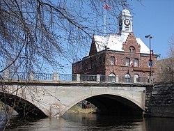
Muskrat Lake is located in the Whitewater Region of Renfrew County, in Ontario, Canada. It is approximately 16 km (9.9 mi) in length, an average of 17.9 m (59 ft) deep but 64 m (210 ft) at its deepest point, and covers an area of 1,219 ha. It is rumored to be home to a legendary lake monster that locals fondly refer to as “Mussie”. The lake currently has over 300 lakefront properties and two privately owned campgrounds surrounding its shores. The town of Cobden is the largest settlement on the lake, with a population slightly over 1,000 people.
Buttermilk Creek is a tributary of the Muskrat River in the township of Whitewater Region, Renfrew County, Ontario, Canada.
Astrolabe Lake is a lake in the township of Whitewater Region, Renfrew County, Ontario, Canada. Astrolabe Lake is where, in 1867, Edward Lee, a local farmboy, found Samuel Champlain's long lost astrolabe; a plaque now stands near the lake to commemorate this. The lake is a meeting point for the back end of both the local golf course, Oakes of Cobden, and the Logos Land waterpark. It drains via Buttermilk Creek and the Muskrat River into the Ottawa River.
The Snake River is a river in Renfrew County, Ontario, Canada.
The Clyde River is a river in Lanark County in Eastern Ontario, Canada. It is in the Saint Lawrence River drainage basin, is a left tributary of the Mississippi River, and was named after the River Clyde in Scotland.

Kemptville Creek is a stream in the municipalities of North Grenville and Augusta, in the United Counties of Leeds and Grenville, in Eastern Ontario, Canada. It is in the Ottawa River drainage basin, is a right tributary of the Rideau River, and is under the auspices of the Rideau Valley Conservation Authority.

The Montreal River is a river in Timiskaming District, Ontario, Canada. It travels 220 kilometres (137 mi) from its source at Smoothwater Lake to its mouth at Lake Timiskaming on the Ottawa River. The river is a significant source of hydroelectricity.

The Frederick House River is a river in the James Bay and Moose River drainage basins in Cochrane District in northeastern Ontario, Canada. It flows 100 kilometres (62 mi) from Night Hawk Lake in the city of Timmins to its mouth at the Abitibi River in Cochrane, Unorganized, North Part. Both the river and the associated Hudson's Bay Company Frederick House post (1785–1821) are named for Prince Frederick, Duke of York and Albany, son of George III of the United Kingdom,
Peterson Creek is a river in the Ottawa River drainage basin in Lanark Highlands, Lanark County and North Frontenac, Frontenac County in eastern Ontario, Canada. It flows 9.5 kilometres (5.9 mi) from and unnamed lake to its mouth at the South Branch Clyde River.

The Blanche River is a river in the Saint Lawrence River drainage basin in Timiskaming District in northeastern Ontario, Canada. The river is a tributary of Lake Timiskaming and its name is from the French for the colour "white".
The Matawin River is a river in Thunder Bay District in Northwestern Ontario, Canada. It is in the Great Lakes Basin and is a right tributary of the Kaministiquia River.
Jack Creek is a stream in Nipissing District in Northeastern Ontario, Canada. It is Algonquin Provincial Park, is a right tributary of the North Madawaska River, and is part of the Saint Lawrence River drainage basin.