
Mute blazes in the Giant Mountains, called also Muttich blazes (Czech : muttichovky), is a system of trail blazing used in the Czech part of the Giant Mountains. [1]
Mute blazes in the Giant Mountains, called also Muttich blazes (Czech : muttichovky), is a system of trail blazing used in the Czech part of the Giant Mountains. [1]
The system is created by the set of blazes, which are cut out of sheet metal and painted red. However, compared to classic blazing systems, they do not mark particular routes or hiking trails. Each sign corresponds to a different object in the mountains, the most frequent being the nearest mountain huts and villages with the possibility of overnighting and catering. The blazes are usually suspended on high poles, which makes them visible even when covered in snow – thus the system can be used by skiers or for winter hiking.
The system was invented and introduced in 1923. One of the initial goals was to overcome naming discrepancies between the German and Czech associations, who had been arguing about which language should be used in trail blazing on both sides. [2] The system was created and implemented by Vladislav Muttich, a Czech painter and member of the Czech skiing society. [3] Although another system was introduced after World War II, the old one proved popular and efficient and thus has been left unchanged in the Czech part of the mountain range.


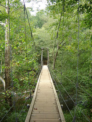
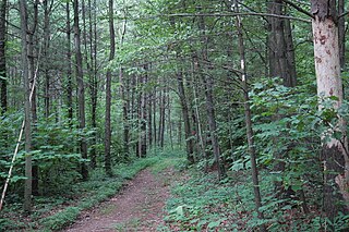
A trail, also known as a path or track, is an unpaved lane or a small paved road not intended for usage by motorized vehicles, usually passing through a natural area. In the United Kingdom and Ireland, a path or footpath is the preferred term for a pedestrian or hiking trail. The term is also applied in North America to accompanying routes along rivers, and sometimes to highways. In the US, the term was historically used for a route into or through wild territory used by explorers and migrants. In the United States, "trace" is a synonym for trail, as in Natchez Trace.

A hike is a long, vigorous walk, usually on trails or footpaths in the countryside. Walking for pleasure developed in Europe during the eighteenth century. Long hikes as part of a religious pilgrimage have existed for a much longer time. "Hiking" is the preferred term in Canada and the United States; the term "walking" is used in these regions for shorter, particularly urban walks. In the United Kingdom and the Republic of Ireland, the word "walking" describes all forms of walking, whether it is a walk in the park or backpacking in the Alps. The word hiking is also often used in the UK, along with rambling, hillwalking, and fell walking. The term bushwalking is endemic to Australia, having been adopted by the Sydney Bush Walkers Club in 1927. In New Zealand a long, vigorous walk or hike is called tramping. It is a popular activity with numerous hiking organizations worldwide, and studies suggest that all forms of walking have health benefits.
Eno River State Park is a 4,319-acre (17.48 km2) North Carolina state park in Durham and Orange Counties, North Carolina. Together with the adjoining West Point on the Eno city park, the two parks preserve over 14 miles (22.5 km) of the Eno River and surrounding lands.

Morrow Mountain State Park is a state park in Stanly County, North Carolina, U.S. Located near Albemarle, the park includes 5,881 acres (23.80 km2) within the Uwharrie Mountains.

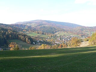
Špindlerův Mlýn is a town in Trutnov District in the Hradec Králové Region of the Czech Republic. It has about 1,200 inhabitants. It lies in the Giant Mountains and it is one of the most frequented ski resorts in the country.
Pinnacle Mountain State Park is a 2,356-acre state park located in Pulaski County, Arkansas just outside of Little Rock. The main attraction is Pinnacle Mountain, an iconic landmark surrounded by the bottomlands of the Big Maumelle and Little Maumelle rivers.

Trail blazing or way marking is the practice of marking paths in outdoor recreational areas with signs or markings that follow each other at certain, though not necessarily exactly defined, distances and mark the direction of the trail.

The Long Path is a 357-mile (575 km) long-distance hiking trail beginning in New York City, at the West 175th Street subway station near the George Washington Bridge and ending at Altamont, New York, in the Albany area. While not yet a continuous trail, relying on road walks in some areas, it nevertheless takes in many of the popular hiking attractions west of the Hudson River, such as the New Jersey Palisades, Harriman State Park, the Shawangunk Ridge and the Catskill Mountains. It offers hikers a diversity of environments to pass through, from suburbia and sea-level salt marshes along the Hudson to wilderness and boreal forest on Catskill summits 4,000 feet (1,220 m) in elevation.

Blue Knob State Park is a 6,128-acre (2,480 ha) Pennsylvania state park in Kimmel, Lincoln, and Pavia townships in Bedford County, Pennsylvania, in the United States. The average annual snowfall at the park is about 12 feet (370 cm). The park is named for Blue Knob, the second highest mountain in Pennsylvania at 3,146 feet (959 m). It is the location of Blue Knob All Seasons Resort, the ski slope in Pennsylvania with the highest elevation. Blue Knob State Park is just off Interstate 99 on Pennsylvania Route 869 west of Pavia.
Giant Mountains National Park is a National Park in the Giant Mountains in the Sudetes in southwestern Poland, along the border with the Czech Republic.

Greenwood Furnace State Park is a 423-acre (171 ha) Pennsylvania state park in Jackson Township, Huntingdon County, Pennsylvania in the United States. The park is near the historic iron making center of Greenwood Furnace. The park includes the ghost town of Greenwood that grew up around the ironworks, old roads and charcoal hearths. Greenwood Furnace State Park is adjacent to Rothrock State Forest and on the western edge of an area of Central Pennsylvania known as the Seven Mountains. The park is on Pennsylvania Route 305, 20 miles (32 km) south of State College.

Sproul State Forest is a Pennsylvania state forest in Pennsylvania Bureau of Forestry District #10. The main offices are located in Renovo, Pennsylvania in Clinton County in the United States.

The Bull of the Woods Wilderness is a wilderness area located in the Mount Hood National Forest in the northwestern Cascades of Oregon, United States. It was created in 1984 and consists of 37,607 acres (15,219 ha) including prime low-elevation old-growth forest, about a dozen lakes of at least 1-acre (4,000 m2) and many large creeks and streams. Adjacent areas, including Opal Creek Wilderness to the west, create a pristine area of nearly 84 square miles (218 km2). There are seven trails that access the wilderness area with an additional seven trails within the protection boundaries themselves. Combined the system provides 75 miles (121 km) of challenging terrain for both pedestrian and equestrian recreation. The name of the peak and thus the wilderness area comes from logging jargon in which the "bull of the woods" was the most experienced logging foreman in an operation.
Joseph E. Ibberson Conservation Area is a 783-acre (317 ha) Pennsylvania state park in Middle Paxton and Wayne Townships, Dauphin County, Pennsylvania in the United States.
or Wielka Czantoria is a mountain on the border of Poland and the Czech Republic, in the Silesian Beskids mountain range. It reaches a height of 995 metres (3,264 ft). Parts of the mountain on both sides are designated a protected area.
The Massanutten Trail is a 71-mile (114 km) National Recreation Trail located in George Washington National Forest in Central Virginia. Much of the path is steep and rugged terrain, and presents many mountain vistas. The trail traverses the Massanutten Range around its inner valley. Shenandoah National Park is to the east, and Great North Mountain is west.

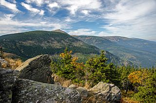
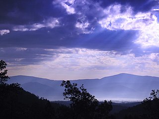
The Giant Mountains, Krkonoše, or Karkonosze, are a mountain range located in the north of the Czech Republic and the south-west of Poland, part of the Sudetes mountain system. The Czech–Polish border, which divides the historic regions of Bohemia and Silesia, runs along the main ridge. The highest peak, Sněžka, is the Czech Republic's highest natural point with an elevation of 1,603 metres (5,259 ft).

The Blue-Blazed Hiking Trail (BBHT) system, managed by the Connecticut Forest & Park Association (CFPA), and the related trail systems documented in the two-volume 19th Edition of the "Connecticut Walk Book" comprise over 800 miles of hiking trails in Connecticut.

Mieczysław Orłowicz Main Sudetes Trail is a public hiking trail in Poland running along the Sudetes. The total length of this route is 443 km and the approximate time to cover it is about 120 hours. The trail was constructed in 1947 and throughout its history has been several times modified. It is blazed red.

The Czech Hiking Markers Standard is an international system of hiking markers for tourist trails, used in more countries than any competing standard. The signs and markers can be used in both wilderness and cities. They are internationally well understandable as they grow from the same tradition in other Central European countries. Similar signs are in use in Austria, Germany, Poland and Switzerland.