The European Centre for Medium-Range Weather Forecasts (ECMWF) is an independent intergovernmental organisation supported by most of the nations of Europe. It is based at three sites: Shinfield Park, Reading, United Kingdom; Bologna, Italy; and Bonn, Germany. It operates one of the largest supercomputer complexes in Europe and the world's largest archive of numerical weather prediction data.

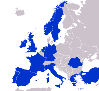
The European Organisation for the Exploitation of Meteorological Satellites (EUMETSAT) is an intergovernmental organisation created through an international convention agreed by a current total of 30 European Member States.
The Institut Français de Recherche pour l'Exploitation de la Mer or Ifremer is an oceanographic institution in Brest, France. A state-run and funded scientific organization, it is France’s national integrated marine science research institute.

The Danish Meteorological Institute is the official Danish meteorological institute, administrated by the Ministry of Climate, Energy and Utilities. It makes weather forecasts and observations for Denmark, Greenland, and the Faroe Islands.

Copernicus is the Earth observation component of the European Union Space Programme, managed by the European Commission and implemented in partnership with the EU member states, the European Space Agency (ESA), the European Organisation for the Exploitation of Meteorological Satellites (EUMETSAT), the European Centre for Medium-Range Weather Forecasts (ECMWF), the Joint Research Centre (JRC), the European Environment Agency (EEA), the European Maritime Safety Agency (EMSA), Frontex, SatCen and Mercator Océan.

The Norwegian Meteorological Institute, also known internationally as MET Norway, is Norway's national meteorological institute. It provides weather forecasts for civilian and military uses and conducts research in meteorology, oceanography and climatology. It is headquartered in Oslo and has offices and stations in other cities and places. It has around 500 full-time staff and was founded in 1866.
The European Union Space Programme is an EU funding programme established in 2021 along with its managing agency, the European Union Agency for the Space Programme, in order to implement the pre-existing European Space Policy established on 22 May 2007 when a joint and concomitant meeting at the ministerial level of the Council of the European Union and the Council of the European Space Agency, known collectively as the European Space Council, adopted a Resolution on the European Space Policy. The policy had been jointly drafted by the European Commission and the Director General of the European Space Agency. This was the first common political framework for space activities established by the European Union (EU).
The North West Shelf Operational Oceanographic System (NOOS) monitors physical, sedimentological and ecological variables for the North Sea area. NOOS is operated by partners from the nine countries bordering the extended North Sea and European North West Shelf; Belgium, Denmark, France, Germany, Ireland, Netherlands, Norway, Sweden, and United Kingdom. Working collaboratively to develop and implement ocean observing systems in the area. Near real time and recent history sea levels are available to on their web site in map, graph or table format.

Sentinel-1 is the first of the Copernicus Programme satellite constellations conducted by the European Space Agency. The mission was originally composed of a constellation of two satellites, Sentinel-1A and Sentinel-1B, which shared the same orbital plane. Two more satellites, Sentinel-1C and Sentinel-1D are in development. Sentinel-1B was retired following a power supply issue on December 23, 2021, leaving Sentinel-1A the only satellite of the constellation currently operating. Sentinel-1C is currently planned to launch in the final quarter of 2024.

Sentinel-3 is an Earth observation heavy satellite series developed by the European Space Agency as part of the Copernicus Programme. As of 2024, it consists of 2 satellites: Sentinel-3A and Sentinel-3B. After initial commissioning, each satellite was handed over to EUMETSAT for the routine operations phase of the mission. Two recurrent satellites, Sentinel-3C and Sentinel-3D, will follow in approximately 2025 and 2028 respectively to ensure continuity of the Sentinel-3 mission.

The Earth and Mission Science Division is a group of European Space Agency (ESA) staff mission scientists, contractors, research fellows, young graduates, trainees, and administrative staff working within the Climate Action, Sustainability and Science Department of the Directorate of Earth Observation Programmes. The Division is located at ESA's European Space Research and Technology Centre in Noordwijk, South Holland, The Netherlands.
The Euro-Mediterranean Center on Climate Change (CMCC) is an Italian research centre dedicated to climate and climate related research, including climate variability, its causes and consequences, carried out through numerical models ranging from Global Earth System to regional models within the Euro-Mediterranean area.

SARAL is a cooperative altimetry technology mission of Indian Space Research Organisation (ISRO) and Centre National d'Études Spatiales (CNES). SARAL performs altimetric measurements designed to study ocean circulation and sea surface elevation.
The Flanders Marine Institute provides a focal point for marine scientific research in Flanders, northern Belgium.

CORA is a global oceanographic temperature and salinity dataset produced and maintained by the French institute IFREMER. Most of those data are real-time data coming from different types of platforms such as research vessels, profilers, underwater gliders, drifting buoys, moored buoys, sea mammals and ships of opportunity.

Coriolis involves 7 institutes in operational oceanography in France decided in 2001 to joint their efforts within Coriolis in order to:
European Multidisciplinary Seafloor and water-column Observatory (EMSO) is a large-scale European distributed Research Infrastructure for ocean observation, enabling real-time interactive long term monitoring of ocean processes. EMSO allows study of the interaction between the geosphere, the biosphere, the hydrosphere, and the lithosphere; including natural hazards, climate change, and marine ecosystems. EMSO nodes have been deployed at key sites in European seas, starting from the Arctic, through the Atlantic and Mediterranean, to the Black Sea.
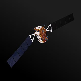
Sentinel-1A is a European radar imaging satellite launched in 2014. It is the first Sentinel-1 satellite launched as part of the European Union's Copernicus programme. The satellite carries a C-band Synthetic Aperture Radar which will provide images in all light and weather conditions. It analyzes many phenomena occurring on Earth, from detecting and tracking oil spills and mapping sea ice to monitoring movement in land surfaces and mapping changes in the way land is used.
The Copernicus Atmosphere Monitoring Service (CAMS) is a service implemented by the European Centre for Medium-Range Weather Forecasts (ECMWF), launched in November 11, 2014, that provides continuous data and information on atmospheric composition. CAMS, which is part of the Copernicus Programme, describes the current situation, forecasts the situation a few days ahead, and analyses consistently retrospective data records for recent years. This service has around 10 years of developments, and its current precursor project, MACC-III, is delivering the pre-operational Copernicus Atmosphere Service. CAMS tracks air pollution, solar energy, greenhouse gases and climate forcing globally.

The Sentinel-6 Michael Freilich (S6MF) or Sentinel-6A is a radar altimeter satellite developed in partnership between several European and American organizations. It is part of the Jason satellite series and is named after Michael Freilich. S6MF includes synthetic-aperture radar altimetry techniques to improve ocean topography measurements, in addition to rivers and lakes. The spacecraft entered service in mid 2021 and is expected to operate for 5.5 years.