
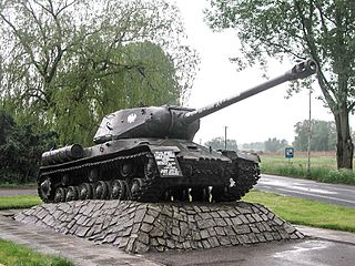
Kowalskie Błota is a village in the administrative district of Gmina Cekcyn, within Tuchola County, Kuyavian-Pomeranian Voivodeship, in north-central Poland. It lies approximately 7 kilometres (4 mi) north of Cekcyn, 10 km (6 mi) east of Tuchola, and 58 km (36 mi) north of Bydgoszcz.
Małyszyn is a village in the administrative district of Gmina Wieluń, within Wieluń County, Łódź Voivodeship, in central Poland. It lies approximately 5 kilometres (3 mi) north-east of Wieluń and 84 km (52 mi) south-west of the regional capital Łódź.
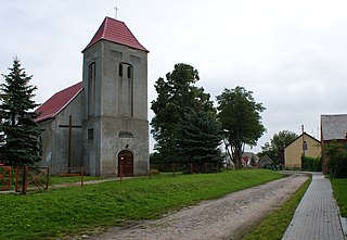
Lipy is a village in the administrative district of Gmina Chmielnik, within Kielce County, Świętokrzyskie Voivodeship, in south-central Poland.
Suchowola is a village in the administrative district of Gmina Chmielnik, within Kielce County, Świętokrzyskie Voivodeship, in south-central Poland. It lies approximately 3 kilometres (2 mi) north of Chmielnik and 30 km (19 mi) south of the regional capital Kielce.

Adamowizna is a village in the administrative district of Gmina Grodzisk Mazowiecki, within Grodzisk Mazowiecki County, Masovian Voivodeship, in east-central Poland. It lies approximately 5 kilometres (3 mi) south of Grodzisk Mazowiecki and 30 km (19 mi) south-west of Warsaw.
Łaziska is a village in the administrative district of Gmina Jakubów, within Mińsk County, Masovian Voivodeship, in east-central Poland. It lies approximately 4 kilometres (2 mi) north of Jakubów, 10 km (6 mi) north-east of Mińsk Mazowiecki, and 46 km (29 mi) east of Warsaw.
Opiłki Płoskie is a village in the administrative district of Gmina Chorzele, within Przasnysz County, Masovian Voivodeship, in east-central Poland. It lies approximately 12 kilometres (7 mi) west of Chorzele, 28 km (17 mi) north of Przasnysz, and 116 km (72 mi) north of Warsaw.
Kaliska is a village in the administrative district of Gmina Łochów, within Węgrów County, Masovian Voivodeship, in east-central Poland.
Chudolipie is a village in the administrative district of Gmina Mszczonów, within Żyrardów County, Masovian Voivodeship, in east-central Poland. It lies approximately 9 kilometres (6 mi) south-east of Mszczonów, 19 km (12 mi) south-east of Żyrardów, and 41 km (25 mi) south-west of Warsaw.
Leśne Domki is a settlement in the administrative district of Gmina Zbąszyń, within Nowy Tomyśl County, Greater Poland Voivodeship, in west-central Poland. It lies approximately 4 kilometres (2 mi) east of Zbąszyń, 15 km (9 mi) south-west of Nowy Tomyśl, and 68 km (42 mi) west of the regional capital Poznań.
Nowe Czeskie is a village in the administrative district of Gmina Zbąszyń, within Nowy Tomyśl County, Greater Poland Voivodeship, in west-central Poland.
Jęczniki Wielkie is a village in the administrative district of Gmina Człuchów, within Człuchów County, Pomeranian Voivodeship, in northern Poland. It lies approximately 5 kilometres (3 mi) south-east of Człuchów and 114 km (71 mi) south-west of the regional capital Gdańsk.
Marszewska Góra is a village in the administrative district of Gmina Przywidz, within Gdańsk County, Pomeranian Voivodeship, in northern Poland. It lies approximately 6 kilometres (4 mi) north-east of Przywidz, 18 km (11 mi) west of Pruszcz Gdański, and 23 km (14 mi) south-west of the regional capital Gdańsk.
Świetlikowo is a village in the administrative district of Gmina Tczew, within Tczew County, Pomeranian Voivodeship, in northern Poland. It lies approximately 7 kilometres (4 mi) north-west of Tczew and 26 km (16 mi) south of the regional capital Gdańsk.
Siekierki is a village in the administrative district of Gmina Cedynia, within Gryfino County West Pomeranian Voivodeship, in north-western Poland, close to the German border. It lies approximately 9 kilometres (6 mi) south of Cedynia, 52 km (32 mi) south of Gryfino, and 72 km (45 mi) south of the regional capital Szczecin.
Rogowo is a village in the administrative district of Gmina Radowo Małe, within Łobez County, West Pomeranian Voivodeship, in north-western Poland. It lies approximately 7 kilometres (4 mi) west of Radowo Małe, 17 km (11 mi) west of Łobez, and 57 km (35 mi) north-east of the regional capital Szczecin.
Darskowo is a village in the administrative district of Gmina Malechowo, within Sławno County, West Pomeranian Voivodeship, in north-western Poland. It lies approximately 8 kilometres (5 mi) south-east of Malechowo, 16 km (10 mi) south-west of Sławno, and 160 km (99 mi) north-east of the regional capital Szczecin.
Łączka is a village in the administrative district of Gmina Szczecinek, within Szczecinek County, West Pomeranian Voivodeship, in north-western Poland. It lies approximately 4 kilometres (2 mi) south-west of Szczecinek and 140 km (87 mi) east of the regional capital Szczecin.
Lipnica is a village in the administrative district of Gmina Szczecinek, within Szczecinek County, West Pomeranian Voivodeship, in north-western Poland. It lies approximately 7 kilometres (4 mi) south-west of Szczecinek and 139 km (86 mi) east of the regional capital Szczecin.

Museum of Caricature is a museum in Warsaw, Poland. The museum was established in 1978. It has a collection of over 20,000 pieces by Polish and foreign artists.


