Mützenich (Monschau)

Last updated • 3 min readFrom Wikipedia, The Free Encyclopedia
Mützenich
Mutzenich, kerk foto8 2015-04-15 16.14.jpg
Mützenich's church
Mutzenich, wappen.jpg
Location of Mützenich
Mutzenich (Monschau)
Germany adm location map.svg
Red pog.svg
Mützenich
North Rhine-Westphalia location map 01.svg
Red pog.svg
Mützenich
Coordinates: 50°34′00″N06°13′00″E / 50.56667°N 6.21667°E / 50.56667; 6.21667 Coordinates: 50°34′00″N06°13′00″E / 50.56667°N 6.21667°E / 50.56667; 6.21667
Country Germany
State North Rhine-Westphalia
Admin. region Köln
District Aachen
Town Monschau
Area
  Total9.89 km2 (3.82 sq mi)
Elevation
584 m (1,916 ft)
Population
 (2015)
  Total2,087
  Density210/km2 (550/sq mi)
Time zone UTC+01:00 (CET)
  Summer (DST) UTC+02:00 (CEST)
Postal codes
52156
Vehicle registration AC / MON
Website www.muetzenich.net
Exclaves created by the Vennbahn track, including Mutzenich Neue Exklaven durchVennbahntrasse.JPG
Exclaves created by the Vennbahn track, including Mützenich

Mützenich is a village and former municipality in the district of Aachen, North Rhine-Westphalia, Germany. It is part of the municipality of Monschau since 1972. Notably, Mützenich is a German exclave surrounded by Belgian territory due to the track bed of the former Vennbahn railway line being part of Belgium following the implementation of the Treaty of Versailles, among other small areas.

Contents

Geography

Mützenich is located on the German-Belgian border, in the region of the High Fens and below Steling mountain, at 584 m above NHN.

History

One possible derivation of the place name Mützenich is a Roman settlement Mutiniacum. In 1783, peat cutters discovered a Roman helmet and remains of a log road. The road may have been part of the military road Via Mansuerisca. A depiction of the Roman helmet forms part of the coat of arms of the former municipality. [1]

After World War II, Belgium planned to annex the German exclave created by the Vennbahn track, but decided to no longer pursue these plans in April 1949. Mützenich was a major hub for smuggling coffee from Belgium to Germany after the war. The prosecution investigated more than 100 inhabitants for smuggling. In the judicial proceedings, it turned out that nearly all the male youth of Mützenich was involved in smuggling coffee. In 1952, of 53 people indicted for smuggling, 47 were convicted (four were acquitted and the proceedings against two women were dismissed due to insignificance). [2] The local soccer club was relegated to a lower division following this for a lack of players. [3] Several people in the area were killed by gunfire from customs officers. According to official statistics, the death toll at the border in the Aachen region was 31 between 1946 and 1952. There were also two customs officers shot dead, one missing, and more than a hundred people seriously injured among the smugglers as well as the customs officers. [4]

Until 1971, Mützenich was a municipality in the district of Monschau which in turn was part of the larger governmental district ( Regierungsbezirk ) of Aachen. The district as well as the Regierungsbezirk were dissolved in 1972 and Mützenich became part of the municipality of Monschau.

Aviation pioneer Erich Offermann  [ de ] (1885–1930) raised a hill near Mützenich for flight experiments which started in 1910. The overgrown hill is now located on Belgian territory. In a 1959 publication, Belgian historian Jean de Walque mistook this hill for the commander's hill of a Roman military camp. [5]

Business

There are several guesthouses, hotels and restaurants in Mützenich, retail stores and other trades, as well as milk and meat farmers. Most of the population works outside of the village though, in the surrounding area or in Aachen.

Historic monuments

Some of Monschau's listed historic monuments are located in Mützenich, such as the Catholic church of St. Bartholomew (St. Bartholomäus in German). The church, which was originally built in Gothic revival style in 1847/1848, was enlarged with a modern annex in 1954/1955. The stained glass windows were created in 1961 by Trude Dinnendahl-Benning. [6]

Tourism

Mützenich is a destination for hiking, jogging, cycling, and cross-country skiing. Many hiking trails lead into the High Fens. From Aachen, it is an about 40 minutes drive by car to Mützenich. There are also bus lines to Mützenich.

A landmark about one kilometre north of the village is Kaiser Karls Bettstatt ("Emperor Charlemagne's resting place"), a slab of quartzite near Steling mountain and by one of the major tracks into the High Fens. According to legend, Charlemagne got lost one day while hunting and rested on this slab for one night. [7] There is also a humorous legend regarding the origin of the name of Mützenich connected to this: As he rested on the slab in cold weather, Charlemagne was offered a cap (in German, Mütze) by a servant, which the emperor then refused by saying in local dialect Mütze nich! [7] ("Cap - not!").

Related Research Articles

<span class="mw-page-title-main">Aachen</span> City in North Rhine-Westphalia, Germany

Aachen is, with around 249,000 inhabitants, the 13th-largest city in North Rhine-Westphalia, and the 28th-largest city of Germany.

<span class="mw-page-title-main">Herstal</span> Municipality in French Community, Belgium

Herstal, formerly known as Heristal, or Héristal, is a city and municipality of Wallonia located in the province of Liège, Belgium. It lies along the Meuse river. Herstal is included in the "Greater Liège" agglomeration, which counts about 600,000 inhabitants.

<span class="mw-page-title-main">Eifel</span> Low mountain range in Germany

The Eifel is a low mountain range in western Germany and eastern Belgium. It occupies parts of southwestern North Rhine-Westphalia, northwestern Rhineland-Palatinate and the southern area of the German-speaking Community of Belgium.

<span class="mw-page-title-main">Aachen Cathedral</span> Roman Catholic cathedral in Aachen, Germany

Aachen Cathedral is a Roman Catholic church in Aachen, Germany and the seat of the Roman Catholic Diocese of Aachen.

<span class="mw-page-title-main">Palatine Chapel, Aachen</span>

The Palatine Chapel in Aachen is an early medieval chapel and remaining component of Charlemagne's Palace of Aachen in what is now Germany. Although the palace itself no longer exists, the chapel was preserved and now forms the central part of Aachen Cathedral. It is Aachen's major landmark and a central monument of the Carolingian Renaissance. The chapel held the remains of Charlemagne. Later it was appropriated by the Ottonians and coronations were held there from 936 to 1531.

<span class="mw-page-title-main">Monschau</span> Resort town in North Rhine-Westphalia, Germany

Monschau is a small resort town in the Eifel region of western Germany, located in the Aachen district of North Rhine-Westphalia.

<span class="mw-page-title-main">Duchy of Limburg</span> Duchy of the Low Countries (1065–1795)

The Duchy of Limburg or Limbourg was an imperial estate of the Holy Roman Empire. Much of the area of the duchy is today located within Liège Province of Belgium, with a small portion in the municipality of Voeren, an exclave of the neighbouring Limburg Province. Its chief town was Limbourg-sur-Vesdre, in today's Liège Province.

<span class="mw-page-title-main">Erkelenz</span> Town in North Rhine-Westphalia, Germany

Erkelenz is a town in the Rhineland in western Germany that lies 15 kilometres southwest of Mönchengladbach on the northern edge of the Cologne Lowland, halfway between the Lower Rhine region and the Lower Meuse. It is a medium-sized town and the largest in the district of Heinsberg in North Rhine-Westphalia.

<span class="mw-page-title-main">Vennbahn</span> Former railway line in Northern Europe

The Vennbahn is a former railway line that was built partly across what was then German territory by the Prussian state railways. It is now entirely in Belgium, because the trackbed of the line, as well as the stations and other installations, were made provisional Belgian territory in 1919 under an article of the Treaty of Versailles.

<span class="mw-page-title-main">Breinigerberg</span> Village of Stolberg in North Rhine-Westphalia, Germany

Breinigerberg is one of 17 districts and villages belonging to the town of Stolberg (Rhineland), which is one of the major towns in the borough of Aachen. According to a census dated 31 December 2005, the village had 971 inhabitants.

<span class="mw-page-title-main">Lohnweiler</span> Municipality in Rhineland-Palatinate, Germany

Lohnweiler is an Ortsgemeinde – a municipality belonging to a Verbandsgemeinde, a kind of collective municipality – in the Kusel district in Rhineland-Palatinate, Germany. It belongs to the Verbandsgemeinde Lauterecken-Wolfstein.

After the defeat of Nazi Germany in World War II in 1945, Belgium planned to annex parts of the territory along the Belgian–German border. In addition to monetary compensations and the lending of labour forces, this was considered a way of reparations. In mid-April 1949, Belgium surprisingly waived any interest in most of the previously claimed areas.

Kornelimünster/Walheim is the southernmost Stadtbezirk (borough) of Aachen, Germany, and borders the Eifel area of North Rhine-Westphalia, as well as Belgium. It became part of Aachen in 1972, after all of the communities surrounding the city were reorganized administratively. The countryside is called Münsterländchen.

<span class="mw-page-title-main">Monschau Hedge Land</span>

The cultural landscape of the Monschau Hedge Land or Monschau Hedge Region includes the uplands of the Eifel and the villages around the town of Monschau in the Region of Aachen, covering an area of 94 km², in which historical hedge structures from the 17th century have survived in great numbers. They consist of individually made, beech hedges around houses and field hedges in the open country, laid to enclose fields and protect them from grazing cattle.

<span class="mw-page-title-main">Steling</span> Mountain on the German-Belgian border

The Steling is a mountain, 658.3 m above sea level (NN) on the High Fens plateau. The German-Belgian border runs 60 meters from the mountaintop. The closest borderpoint near the summit is also the highest point in the municipal region of Aachen.
<span class="mw-page-title-main">Aachen Forest</span>

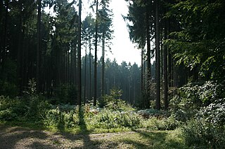
Aachen Forest lies about 3.7 km south of the city centre of Aachen and has an area of 2,357 ha. It essentially comprises the forest areas of the former free imperial city of Aachen south and west of the formerly independent municipalities of Burtscheid and Forst, as well as north and east of the Belgian border. Apart from a few small plots, it is all in municipal ownership. In July 2003, the Forest of Aachen was awarded the environmental seal of the Forest Stewardship Council (FSC) on the initiative of Greenpeace, which was extended in 2008 for another five years.

<span class="mw-page-title-main">Belgium–Germany border</span> International border

The border between the modern states of Belgium and Germany has a length of 204 km (127 mi).
<span class="mw-page-title-main">Borders of Belgium</span>

Belgium shares borders with France, Germany, Luxembourg and the Netherlands. Belgium became de facto independent from the United Kingdom of the Netherlands in 1830. Its borders were formalized between 1839 and 1843. Over the years there have been various adjustments, notably after the Treaty of Versailles (1919) when some territory was transferred to Luxembourg. There remain enclaves of Germany and the Netherlands within Belgium and enclaves of Belgium within the Netherlands.

The textile industry in Aachen has a history that dates back to the Middle Ages. The Imperial city of Aachen was the main woolen center of the Rhineland. Certain kind of woolens made there were illustrated as "Aachen fine cloth". These high-quality fine woolens have a plain weave structure using carded merino wool yarns, and a raised surface. The production of high-quality, fine cloth required fine foreign wool and skilled craftsmen and was reserved for town craftsmen. It involved regulated steps including sorting, combing, washing, spinning, fulling, dyeing, shearing, and pressing the wool. The finished products were inspected and authorized with a town trademark before being sold and exported. Fine cloth was a major export in the Middle Ages.

References

  1. "Historisches von Mützenich" (in German). Heimatverein Mützenich 1998 e.V. Retrieved 2021-02-20.
  2. Trees, Wolfgang (2002), Schmuggler, Zöllner und die Kaffeepanzer (in German), Aachen: Triangel, p. 331-332, ISBN   3-922974-06-6
  3. Trees, Wolfgang (2002), Schmuggler, Zöllner und die Kaffeepanzer (in German), Aachen: Triangel, p. 329, ISBN   3-922974-06-6
  4. Trees, Wolfgang (2002), Schmuggler, Zöllner und die Kaffeepanzer (in German), Aachen: Triangel, p. 172, ISBN   3-922974-06-6
  5. Weiß, Pejo (1996), "Der "Fliegerberg" im Venn bei Mützenich", Das Monschauer Land (in German), 24: 64–68
  6. "Monschau-Mützenich, Kath. Kirche St. Bartholomäus" (in German). Forschungsstelle Glasmalerei des 20. Jahrhunderts e.V. Retrieved 2021-02-20.
  7. 1 2 "Kaiser Karls Bettstatt: Mützenich in der Eifel". WDR (in German). 28 January 2014. Retrieved 2021-02-20.