
Gondia district is an administrative district in the state of Maharashtra in India. The district headquarter is located at Gondia. The district occupies an area of 5,234 km2 (2,021 sq mi) and has a population of 1,322,507 of which 11.95% were urban. The district is part of Nagpur Division. There are 8 Talukas in Gondia District. Gondia Airport is second airport in Vidharbha region and serves city of Gondia.

Bardez or Bardes is a taluka of the North Goa district in the Indian state of Goa.

For Sampagaon Taluka, see Bailhongal.
A tehsil is a local unit of administrative division in India and Pakistan. It is a subdistrict of the area within a district including the designated populated place that serves as its administrative centre, with possible additional towns, and usually a number of villages. The terms in India have replaced earlier terms, such as pargana (pergunnah) and thana.
Narayankhed is a town and revenue division in Sangareddy district of the Indian state of Telangana.
Ankale is a village in Hukkeri Taluk, Belgaum district in the southern state of Karnataka, India.

Karjat taluka is a taluka in Karjat subdivision of Ahmednagar district in Maharashtra state of western India.

Rahata taluka, is a taluka in Shrirampur subdivision of Ahmednagar district in Maharashtra State of India.

Parner taluka is a taluka in Ahmednagar district in the state of Maharashtra in western India.

Bhor taluka is a taluka in Haveli subdivision of Pune district of state of Maharashtra in India. There are 195 villages and 1 town in Bhor Taluka.
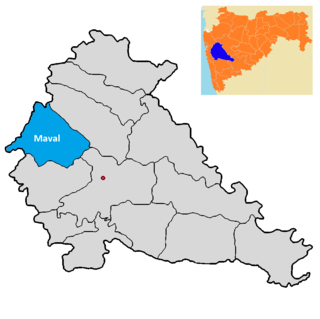
Maval taluka is a taluka in Mawal subdivision of Pune district of state of Maharashtra in India.

Purandar taluka is a taluka of Pune district of state of Maharashtra in India. There are 108 villages and 3 towns in Purandhar Taluka.
Chombhut is a village in Parner taluka in Ahmednagar district of state of Maharashtra, India.
Mhaskewadi is a village in Parner taluka in Ahmednagar district of state of Maharashtra, India.
Mandave Kd is a village in Parner taluka in Ahmednagar district of state of Maharashtra, India.
Palwe Kd is a village in Parner taluka in Ahmednagar district of state of Maharashtra, India.
Wadzire is a village in Parner taluka in Ahmednagar district of state of Maharashtra, India.

Velhe Taluka, officially renamed as, Rajgad Taluka, is a taluka in Haveli subdivision of Pune district of state of Maharashtra in India. The Taluka is entirely rural, and consists of 130 villages.
Khalapur taluka is a taluka in Raigad district of Maharashtra. The headquarters of the taluka is Khalapur village. This taluka belongs to the Karjat sub-division, and comprises 130 villages, 5 revenue circles and 25 sajas. 56 villages of this taluka come under NAINA. Khalapur toll naka is one of the busiest tolls in the state as it serves as an important transit point for goods from the Nhava Sheva port to automative and industrial belt of Pimpri-Chinchwad.

Sangareddy district, is a district located in the western region of the Indian state of Telangana. This district contains a part of the Hyderabad Metropolitan Region.Sangareddy is the district headquarters of the district. It was named after the ruler Sanga, the son of queen Shankaramba, who was the ruler of Medak during the period of Nizams. The district shares boundaries with Medak, Medchal, Vikarabad, Kamareddy and Rangareddy districts and with the state boundary of Karnataka.