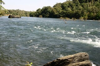
Swamimalai is a panchayat town that is a suburb near Kumbakonam in Thanjavur District in the Indian state of Tamil Nadu. It lies on the banks of river Kaveri and is the site of the fourth of the six abodes of the Hindu deity Murugan (Kartikeya).
Mandleshwar is a town and nagar panchayat in the Khargone district of the India state of Madhya Pradesh. It is on the banks of Narmada River, 8 kilometres (5.0 mi) east of Maheshwar and 99 kilometres (62 mi) south of Indore. It is a "Pavitra nagri" as termed by the government of Madhya Pradesh, as it is an ancient town. It is the education centre of Maheshwar block, the location of the district court and district jail of Khargone, and is also the political centre of Maheshwar block.
Ankola is a town municipal council and taluka in the Uttara Kannada district of the Indian state of Karnataka. The town is around 33 km (21 mi) from district headquarters Karwar.

Dandeli is a taluk in Uttara Kannada district of Karnataka, India, in the Malenadu region.
Ayyampalayam is a panchayat town in Nilakottai Taluk in Dindigul district in the state of Tamil Nadu, India. There also exists another village by the same name, in the Dindigul district in Tamil Nadu. For the Ayyampalayam in Dindigul district.
Daund is a city, municipal council, and headquarters of the Daund tehsil in the Pune district in the state of Maharashtra, India. The city of Daund is located on the Bhima River.

Kailaras is a town and a nagar panchayat in Morena district in the Indian state of Madhya Pradesh.The name of the town is related to Kailash mountain due to the Temple of God Shankar, Alopi Shankar Temple which is situated on a hill 490 meters above sea level.

Karnaprayag is a town and municipal board in the Chamoli District in the Indian state of Uttarakhand. Karnaprayag is one of the Panch Prayag of Alaknanda River, situated at the confluence of the Alaknanda and Pindar River.

Khirpai, also known as Kshirpai, is a city and a municipality in the Ghatal subdivision of the Paschim Medinipur district in the state of West Bengal, India. Earlier it was part of Hooghly. The city is situated between Ghatal and Chandrakona, near the banks of the rivers Shilabati and Kethai, and is one of the oldest municipalities in India. Khirpai is also famous for its Babarsa, a special type of sweetmeat, which is not available elsewhere.
Kumhari is located in Bhilai-3 Tehsil of Durg district in the Indian state of Chhattisgarh. Kumhari is a Nagar Palika Parishad and situated at Durg district and Raipur district border beside Kharun River. It is situated at 21°27'N 81°52' and has an average elevation of 284 meters above the sea level.
Lalganj is an important town and Nearest City, (60 kilometres Morden Old City Mehsi), and river port situated in Vaishali district, Bihar.
Pawai is a town and a nagar panchayat in the Panna district of Madhya Pradesh state in central India. It is mostly surrounded by rocky area.
Rajura is a town and municipal council district of the Indian state of Maharashtra.
Ramanujganj is a town in the Balrampur-Ramanujganj district of the Indian state of Chhattisgarh. Ramanujganj is the border town of Chhattishgarh-Jharkhand State. The nearest airports are Ranchi(250 km) and Raipur(350 km). The nearest railway stations are Garhwa(50km) and Ambikapur(110 km). District sessions court and district jail is situated here as well as district polytechnic College. A CRPF battalion is based here for training and protection of district if need arises.

Sainthia is a city and a municipality in Suri Sadar subdivision of Birbhum district in the Indian state of West Bengal. The city is known as business city of Birbhum district. The city is under the jurisdiction of Sainthia police station. Sainthia is the fourth most populous city in Birbhum district and 95th most populous city in West Bengal. The city covers an area of 10 km2 and had a population of 44,601 in 2011. Located on the banks of Mayurakshi River, Sainthia has been a major human settlement. The city is famous for Nandikeshwari Temple, one of the Shakti Peethas in Indian subcontinent.

Uthukuli is a taluk in Tirupur district in the Indian state of Tamil Nadu.
Satana is a town and a municipal council in Nashik District in the Indian state of Maharashtra. It is in the taluka of Baglan, which is sometimes called Satana, because of the city's dominance in the taluka. The name "Satana" is derived from "Śāṭyāyani" one of the minor Upanishads of the Muktika canon.
Ponmanai is a panchayat town in Kanniyakumari district in the Indian state of Tamil Nadu.
Simalwara is a census town in Dungarpur district in the Indian state of Rajasthan. It is the administrative headquarters for Simalwara Tehsil.
Aremallapur is a village in the southern state of Karnataka, India. It is located in the Ranebennur taluk of Haveri district in Karnataka.


