Nizamabad district is a district located in the north-western region of the Indian state of Telangana. The city of Nizamabad is the district headquarters. The district share boundaries with Jagtial, Sircilla, Nirmal, Kamareddy districts and with Nanded district of the state boundary of Maharashtra.

Amalapuram is a town in the Indian state of Andhra Pradesh. It is the district headquarters and the third largest town of Dr. B. R. Ambedkar Konaseema district. It is the mandal and divisional headquarters of Amalapuram mandal and Amalapuram revenue division respectively. The town is situated in the delta of konaseema.

Repalle is a town in Bapatla district of the Indian state of Andhra Pradesh. The town is one of the 12 municipalities in Bapatla district and the headquarters of Repalle mandal under the administration of Repalle revenue division. It is situated near Krishna River in the Coastal Andhra region of the state.

Mummidivaram is a town in Dr. B.R. Ambedkar Konaseema district of Andhra Pradesh, India. The Mummidivaram revenue block was formed out of the Amalapuram tehsil in July 1969. It is the second largest town in Konaseema district.
Peruru is a village located in peruru Mandal, Sri Sathya Sai district in the Indian state of Andhra Pradesh.

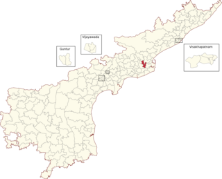
Razole is a Scheduled Caste reserved constituency in Konaseema district of Andhra Pradesh that elects representatives to the Andhra Pradesh Legislative Assembly in India. It is one of the seven assembly segments of the Amalapuram Lok Sabha constituency.

Gannavaram Assembly Constituency is a Scheduled Caste reserved constituency in Konaseema district of Andhra Pradesh that elects representatives to the Andhra Pradesh Legislative Assembly in India. It is one of the seven assembly segments of the Amalapuram Lok Sabha constituency.

Kothapeta Assembly constituency is a constituency in Konaseema district of Andhra Pradesh that elects representatives to the Andhra Pradesh Legislative Assembly in India. It is one of the seven assembly segments of the Amalapuram Lok Sabha constituency.

Mandapeta Assembly constituency is a constituency in Konaseema district of Andhra Pradesh that elects representatives to the Andhra Pradesh Legislative Assembly in India. It is one of the seven assembly segments of the Amalapuram Lok Sabha constituency.
Nagraur is a small village located in the Bahraich District of Uttar Pradesh, India. It is situated on Bahraich-Gonda highway, 7 km south-east of the main Bahraich city. Its connected to the city by rickshaw and auto-rickshaw transportation system. Nagraur is one of the Villages in Chitaura Mandal in Bahraich District, and is located 6.5 km from its Mandal Main Chitaura.
On 27 June 2014 a massive fire broke out following a blast in Gas Authority of India Limited (GAIL) 18" size underground gas Pipeline at Nagaram in East Godavari district of Andhra Pradesh, India. The accident took place near Tatipaka refinery of Oil and Natural Gas Corporation (ONGC), about 180 km from state capital Vijayawada.
National Highway 216 is a National Highway in the Indian state of Andhra Pradesh. The former highways of NH 214 and 214A were merged and renumbered as NH 216. It starts from NH 16 junction at Kattipudi and passes through Kakinada, Amalapuram, Digamarru (Palakollu), Narasapuram, Machilipatnam, Repalle, Cherukupalle, Bapatla, Chirala before it junctions NH 16 again at Ongole. Visakhapatnam–Kakinada Petro Chemical Corridor, is a proposed project along the highway.
Bhatnavilli is a village in the Amalapuram Mandal of Dr. B.R. Ambedkar Konaseema district in the State of Andhra Pradesh, India. The village is located by the national highway 216 which is now being expanded to a six lane highway. Amalapuram railway station is being proposed to be located here.
Edarapalle is a village in Amalapuram Mandal, Dr. B.R. Ambedkar Konaseema district in the state of Andhra Pradesh in India.
Immidivarappadu is a village in Amalapuram Mandal, Dr. B.R. Ambedkar Konaseema district in the state of Andhra Pradesh in India.
Indupalle is a village in Amalapuram Mandal, Dr. B.R. Ambedkar Konaseema district in the state of Andhra Pradesh in India.
Nadipudi is a village in Amalapuram Mandal, Dr. B.R. Ambedkar Konaseema district in the state of Andhra Pradesh in India.
Palagummi is a village in Amalapuram Mandal, Dr. B.R. Ambedkar Konaseema district in the state of Andhra Pradesh in India.
Sakuru is a village in Amalapuram Mandal, Dr. B.R. Ambedkar Konaseema district in the state of Andhra Pradesh in India.

Konaseema district, is one of the 26 districts in the Indian state of Andhra Pradesh. It is situated between the tributaries of the Godavari River in the Konaseema region of Coastal Andhra. It was carved out of East Godavari district on 4 April 2022 by the Government of Andhra Pradesh. Amalapuram is the district headquarters and the largest city in this district. The district shares boundaries with West Godavari, East Godavari and Kakinada districts.


